Khunjerab Pass
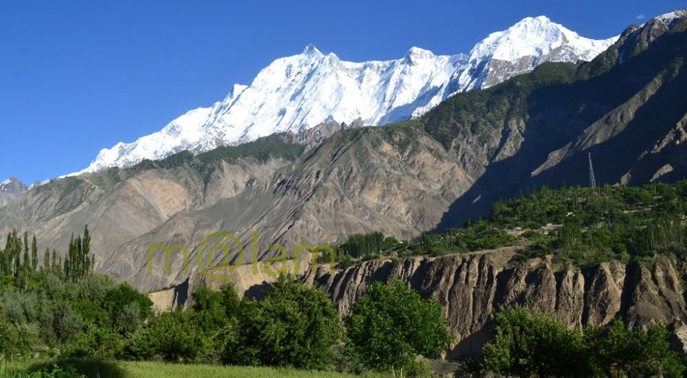
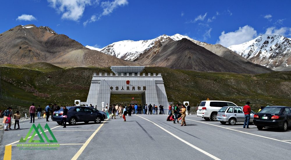
Discover the Khunjerab Pass: A High-Elevation Gateway The Khunjerab Pass, nestled at a breathtaking altitude of 4,700 meters, stands as the world’s highest paved international border crossing. It serves as a crucial junction linking the Gilgit-Baltistan region in northern Pakistan to China’s western Xinjiang province. This article delves into the beauty and significance of this remarkable pass, highlighting its construction, attractions, and access. Khunjerab Pass: A Natural Wonder Situated amidst the majestic Karakoram Mountains, the Khunjerab Pass, often referred to as Khunzerav, boasts expansive snow-capped peaks. During the summer months, this area transforms into a haven adorned with a kaleidoscope of wildflowers, creating a striking contrast against the glistening snow-clad mountains. The Khunjerab Pass offers some of the world’s most awe-inspiring scenery. The Birth of Hunza River This pass is the birthplace of the Hunza River. The snowmelt from the surrounding peaks converges to form a pristine creek that flows downward. Several of these tributaries ultimately merge to create the Hunza River, which eventually meets the Gilgit River in Gilgit. The Gilgit River continues its journey along the Karakoram Highway, eventually merging with the River Indus at the convergence of three mountain ranges before flowing onward to Thakot. Construction of the Khunjerab Pass Before the construction of the Karakoram Highway (KKH), the primary passes on the Karakoram Range were Kilik and Mintaka Passes to the north of Khunjerab. The decision to choose the Khunjerab Pass for the KKH was rooted in technical considerations. Kilik and Mintaka were deemed more vulnerable to air strikes. Consequently, Khunjerab was recommended in 1966 and realized in 1978. Attractions at Khunjerab Pass The Khunjerab Pass stands as a major tourist attraction, drawing both domestic and international visitors daily. The entire Karakoram Highway is a treasure trove of natural wonders and man-made marvels. At every turn, travelers are treated to breathtaking panoramas and opportunities for short hikes and photography. A journey along the highway to the border area promises a lifetime of unforgettable experiences. Khunjerab National Park A substantial portion of the Khunjerab Pass is enveloped by the Khunjerab National Park, established in 1979 to safeguard endangered species. Within the park’s boundaries dwell rare animals like the Marco Polo sheep and the elusive Snow Leopard. From the border area, visitors can gaze across the border into China’s Xinjiang province. Access to Khunjerab Pass Access to the Khunjerab Pass varies by location: Pakistani Side Sost Customs and Immigration Check Post: 75 km Hunza: 180 km Gilgit Airport: 280 km Islamabad (Capital City): 890 km Chinese Side Tashkurgan: 130 km Kashgar: Approximately 420 km Urumqui: 1,890 km Informative road signs provide tourists with distance-related information. It’s worth noting that traffic follows a right-hand drive on the Chinese side and a left-hand drive on the Pakistani side, making the border the transition point. Travel Tips While the Pakistani side of the highway is well-paved, the steep altitude gain near the pass can slow down your journey. Additionally, checkpoints on both sides can lead to further delays. On the Pakistani side, an entry fee is applicable to both local and international tourists. At present, the fee stands at Rs. 40 for Pakistani tourists and $8 for international tourists. It’s advisable to check for annual revisions of these fees to manage expenses, especially for larger groups. The Khunjerab Pass is open for trade and tourism from May to November. During the remaining months, it remains closed due to heavy snowfall. In November, the extreme cold and strong winds can make the visit challenging. However, under favorable weather conditions, it remains a must-visit destination. Bus Service A daily bus service operates between Sost, the last human settlement along the KKH in Pakistan, and Tashkurgan in China. Both Pakistani and Chinese buses provide transportation from their respective stations in their home countries. Travelers can also hire private cars or 4WD vehicles from Sost to Tashkurgan for drop-off and continue their journey to Kashgar using shared rides or taxis. Precautions for a Safe Journey Due to the high altitude, some tourists may experience altitude sickness, characterized by dizziness, headaches, or shortness of breath. It’s advisable to descend to lower altitudes immediately or carry altitude sickness medication in advance. During peak summer, there’s a risk of flooding due to rapid snowmelt near the pass, so a timely return is recommended. Additionally, loose gravel, especially during rainfall, can pose hazards on the highway. Whether you’re on a motorcycle or driving a car, exercise caution and avoid overconfidence. Despite renovations, the Karakoram Highway has claimed lives, particularly among tourists from lower-altitude cities. It’s essential to familiarize yourself with the entire highway before embarking on a self-drive tour. Embrace the journey and return home with cherished memories. Before You Go Pakistani tourists must carry their CNIC, while foreign tourists require a passport for identification. Foreign tourists and Pakistani nationals traveling to China must obtain a Chinese Visa (a pass for residents of Gilgit-Baltistan traveling to the nearby city of Kashgar). Buses from Sost to Tashkurgan depart in the morning between 8:00 AM and 9:00 AM, so purchasing tickets in advance is advisable. If you prefer to hire a car, private Pakistani vehicles are allowed to travel all the way to Kashgar. The fare is negotiable and not fixed.