Gilgit-Baltistan

Sheosar Lake in Deosai National Park
Gilgit-Baltistan, Lakes

Sheosar Lake

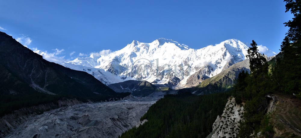
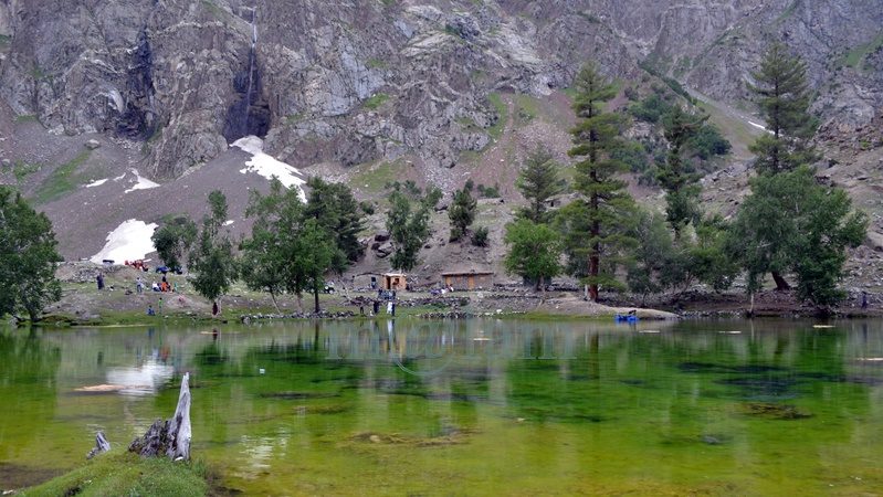
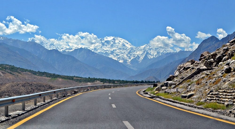
Sheosar Lake: The Hidden Gem of Deosai National Park Discover Sheosar Lake: A Himalayan Wonder Nestled within the picturesque landscape of Deosai National Park in Gilgit-Baltistan, Pakistan, Sheosar Lake stands as a testament to the awe-inspiring beauty of nature. Perched at a breathtaking elevation of 13,589 feet, it’s often referred to as the heart of Deosai and ranks among the world’s highest-altitude lakes. Throughout the year, the surroundings of Sheosar Lake transform, painting a mesmerizing canvas of nature’s vivid hues. Certainly, this pristine oasis is not only a visual treat but also a haven for rare flora and fauna. Unveiling the Local Legend The name “Sheosar” is derived from the local Shina language, where “Sheo” means blind and “Sar” means water. Hence, it’s commonly known as the “Blind Lake.” Spanning approximately 2.3 kilometers in length, 1.8 kilometers in width, and with an average depth of 40 meters (131 feet), this lake is teeming with fish, making it a vital food source for the brown bear during the winter months. A Tourist’s Paradise Sheosar Lake has become a must-visit destination, nestled on the border between the Karakoram and Himalaya mountain ranges. The lake is surrounded by gently sloping mountains that offer excellent hiking opportunities. On clear days, visitors can even catch a glimpse of Nanga Parbat, Pakistan’s second-highest peak, towering at a staggering 8,126 meters above sea level. Furthermore, the panoramic views encompass distant snow-clad mountains and expansive plains. Camping in Tranquility For adventurous souls seeking an overnight experience, designated camping sites are available on the north side of the lake. Ample parking space is provided for those wishing to pitch their own tents. However, it’s important to note that the lake’s water is not suitable for drinking. Fortunately, there’s a nearby spring that serves as a source of clean, refreshing water. Nature’s Spectacle: Sunrise and Sunset Deosai is renowned for its stunning sunrises and sunsets. On clear days, the weather remains pleasantly cool, with captivating views of the surrounding mountain peaks embracing the meadows. The lake itself becomes a natural masterpiece during the summer months, with its tranquil blue waters contrasting beautifully with the lush green grassy shores and snow-dusted mountain slopes. Photographers are in for a treat, as they can capture the essence of paradise in every frame. Seasons in Transition The climate in Deosai is as unpredictable as it is enchanting. While July and August are generally pleasant, with lush green meadows, even these months can witness unexpected snowfall. Surprisingly, Sheosar Lake undergoes a remarkable transformation in different seasons. During the summer, it showcases crystal-clear blue waters surrounded by a sea of green grass and blooming flowers. As autumn arrives, however, the grass turns a rustic brown, while winter blankets the entire region in a thick layer of snow. Embarking on the Journey Reaching Sheosar Lake in Deosai National Park is possible via two main routes: one through Astore Valley and the other through Skardu. The Astore route is relatively more accessible, with most of the road leading to the lake being paved. However, it’s advisable to use a 4WD vehicle for a trouble-free journey. The journey from Astore to the lake is a captivating experience in itself. The road winds through stunning valleys, past crystal-clear waters, lush green meadows adorned with alpine flowers, babbling streams that nourish the grasslands, glaciers, and magnificent green peaks capped with snow, offering a constant breeze of refreshing coolness. The warmth and hospitality of the local people add an extra layer of charm to this incredible journey. For those opting for the Skardu route, be prepared for a longer and more rugged journey. However, the path through the wilderness, adorned with alpine flowers and glimpses of snow-capped mountains, is a visual feast. Key stops along the way include Bara Pani and Kala Pani, both offering their own share of natural beauty before you finally arrive at Sheosar Lake. Sheosar Lake in Deosai National Park is a hidden gem waiting to be discovered by nature enthusiasts and adventure seekers. Its ever-changing beauty, from the vibrant summers to the serene winters, makes it a destination worth exploring. Whether you’re captivated by its legends, drawn to its wildlife, or simply seeking tranquility in the wilderness, Sheosar Lake promises an unforgettable experience in the heart of the Himalayas.

Fairy Meadows and Nanga Parbat
Gilgit-Baltistan

Fairy Meadows

Exploring Fairy Meadows in the Himalayas: An Epic Adventure Awaits Fairy Meadows is nestled in the majestic Himalayan range of Pakistan. It stands as a captivating highland that beckons both tourists and adventure seekers alike. Serving as a gateway to conquer nearby peaks, including the renowned 8,126-meter Nanga Parbat, known ominously as the Killer Mountain, this destination is a hidden gem waiting to be explored. Discovering the Jewel of the Himalayas Situated in the Diamar district of Gilgit-Baltistan, Pakistan, Fairy Meadows is a natural wonderland that sits at an elevation of 3,300 meters above sea level. Local residents originally named this striking highland “Joot,” and it was later christened “Fairy Meadows” by German explorers captivated by its natural splendor. In 1995, the area was officially declared a national park, preserving its pristine beauty. How to Reach This Enchanting Destination To embark on your journey to Fairy Meadows, your starting point is Raikot Bridge along the Karakoram Highway. At 4595 feet (1400 meters), Raikot Bridge is approximately 540 kilometers (336 miles) from Islamabad, the capital of Pakistan. Alternatively, for those taking a one-hour flight from Islamabad to Gilgit, Raikot Bridge can be reached in another hour and a half. However, it’s important to note that flights to Gilgit and Skardu are subject to weather conditions. The most common starting point for travelers actually is Islamabad/Rawalpindi. In fact, there are two options to travel by road. The Karakoram Highway is an all-weather road while the seasonal and scenic Naran-Gilgit road via the Babusar Pass remains open from mid-June to October.  However, there is no fixed time of the year to open and close the Naran-Gilgit road, weather is the major factor. The journey can take approximately 12-14 hours, depending on road conditions. Alternatively, the route via Naran over the Babusar Pass offers a quicker 9 to 10-hour journey. From Raikot Bridge, you’ll need to hire a local jeep to reach Tatto village, an adventurous 12-kilometer (1.5-hour) ride followed by a 5-kilometer (3-hour) uphill walk along the ravine. This journey, while challenging, is an integral part of the Fairy Meadows experience. Immersed in Natural Beauty Fairy Meadows lies in the Raikot valley, surrounded by the Raikot glacier, originating from the formidable Nanga Parbat. The lush grasslands are enveloped by an alpine forest teeming with juniper, birch, willow dwarf shrubs, and scrubs. The area is also home to brown bears and musk deer, adding to its natural allure. Embracing the Seasons The prime tourist season at Fairy Meadows spans from mid-April to mid-October. While some intrepid souls venture here during December and January for winter expeditions, it’s a rare occurrence and not for the faint of heart. Navigating the harsh winter conditions requires technical expertise and the guidance of a local expert. Where to Lay Your Head Fairy Meadows offers several accommodation options, including huts and tents, all owned and operated by local residents. Most tourists opt for affordable tents, providing a genuine experience of the area’s hospitality. However, it’s advisable to make reservations in advance, especially during peak summer months when accommodations tend to fill up quickly. Savoring Local Delights When it comes to dining at Fairy Meadows, expect slightly higher prices for food that is both organic and worth every penny. Breakfast options include desi eggs and local makhan (butter), while lunch features fresh veggies and desi chicken. You’ll also find mutton, dal, local yogurt, lassi (buttermilk), and more, all sourced locally and providing a rich, organic dining experience. Adventure Awaits Fairy Meadows offers a plethora of activities to keep you engaged. Watch locals play freestyle polo and volleyball. It is possible even to organize a cricket match or a game of Frisbee at the campsite. A half-day walk to nearby Beyal camp is a popular choice, offering a stunning view of Nanga Parbat. For those seeking a more challenging adventure, consider ascending to the viewpoint. You’ll certainly be rewarded with breathtaking vistas of the mountains, glaciers, and surrounding beauty. The bravest explorers can embark on a full-day hike to the 4,200-meter-high base camp. Undoubtedly, the base camp promises exceptional views of the landscape. Travel Tips for a Smooth Journey Before you set off on your Fairy Meadows adventure, remember these essential travel tips: Make a confirmed reservation in advance. Park your personal vehicle at the Raikot Bridge parking lot, as only local vehicles are allowed beyond this point. Pack essential medicines, fruit, cookies, and chocolates for long journeys. Don’t forget to bring sunburn cream, sunglasses, an umbrella, and a raincoat. Wear sturdy trekking shoes and carry a spare pair of socks. Ensure a supply of clean water, either bottled or boiled, as spring water may not agree with everyone. With these preparations in place, you’ll be ready to embark on a journey of a lifetime to the enchanting Fairy Meadows, where adventure, natural beauty, and unforgettable experiences await.

Naltar Valley
Gilgit-Baltistan

Naltar Valley

Unveiling the Beauty of Naltar Valley: A Hidden Gem in Gilgit-Baltistan Nestled majestically amidst towering mountains at an astonishing elevation of approximately 15,000 feet lies the picturesque Naltar Valley, a true jewel near the town of Gilgit in the Gilgit-Baltistan region of Pakistan. This idyllic highland boasts the dual distinction of being a perfect summer escape and a world-renowned winter ski resort, attracting both national and international skiing enthusiasts year after year. Enveloped in lush greenery, adorned with pine, spruce, birch, rowan, and juniper trees, and cradled by emerald hills and snow-capped peaks, Naltar Valley is not only a natural wonder but also home to the Gujjar tribe, renowned for cultivating delectable and oversized potatoes. Exploring Naltar Valley: Geography and Accessibility Located approximately 19 kilometers uphill from the Nomal Valley, which serves as a base and is situated at the mouth of the gorge, Naltar Valley is easily accessible. The Nomal Valley itself is a mere 20-kilometer drive from Gilgit via the western bank of the Hunza River and about 70 kilometers from Hunza Valley, accessible via the Karakoram Highway, passing through Rahimabad and crossing a sturdy concrete bridge over the Hunza River. To reach Upper Naltar (Naltar Bala or Ajeeni Naltar in the local Shina language) from Gilgit takes approximately 2.5 hours, while the journey from Hunza extends to around 4 hours. A Haven for Travelers: Tourist Attractions in Naltar Valley Naltar Valley is a haven for those seeking respite from the urban hustle and bustle or yearning for unadulterated serenity. Whether you plan a day trip or opt for an overnight stay, the valley offers various accommodation options, including the possibility of camping. Key attractions in the area include: 1. Skiing Naltar has firmly established itself as a premier winter sports destination, hosting international ski competitions. Due to its elevated location, Naltar receives a substantial amount of snow each year, making it perfect for skiing. The Ski Federation of Pakistan operates ski lifts, and every February, the valley becomes a magnet for national and international athletes. 2. Trekking Routes Naltar Valley serves as the starting point for two enchanting medium-level treks: one leading to the Naltar Pass (approximately 4,600 meters) towards the east, connecting to the Ishkoman Valley, and the other traversing the Daintar Pass (4,636 meters) westward to Chalt. A two-hour drive spanning approximately 47 kilometers from Gilgit along the western bank of the Hunza River brings you to Nomal Village, your gateway to these exciting treks. 3. Lakes The journey from Upper Naltar to the lakes covers about 13 kilometers of jeep-able road. However, when the road is impassable or washed away, a scenic walking trail opens up. These hikes take several hours on foot depending on the condition. This rugged jeep track runs alongside a rivulet, leading you to the captivating Bashkiri Lake – I, Bashkiri Lake – II, and Bashkiri Lake – III, nestled closely together at the gorge’s end. Locally, these lakes are known as “Chimo Bari (Fish Lake),” “Chakar Bari (Multi Ends Lake),” and “Bodolok Bari (Turbid Lake).” These lakes are ensconced within dense pine forests. Winters bring harsh conditions and sometimes pile up to 10 to 15 feet of snow. Summers attract hordes of local and international tourists and trekkers eager to explore this natural wonder. 4. Rivulet Glacial waters originating near the Wakhan Corridor’s border converge to form a rivulet that meanders through the gorge’s heart until it meets the Hunza River. This natural watercourse provides opportunities for activities like camping, cooking, and irrigation. These various enjoyable activities along its pristine banks, enhance the overall visitor experience. 5. Camping and Outdoor Activities Naltar Valley boasts numerous camping sites, making it ideal for overnight or weekend camping adventures. The valley’s safety and availability of fresh vegetables at reasonable prices ensure a comfortable and enjoyable stay. The hiking trails leading to breathtaking viewpoints along with its magnificent medium-range mountains, provide ample opportunities for exploration. Naltar is also famous for its diverse flora and fauna. The Weather in Naltar Valley Naltar Valley enjoys perpetually romantic weather. Even during the peak of summer, the lakeside at Naltar experiences frequent light showers, adding to the area’s allure. The ever-changing romantic weather, combined with the stunning natural scenery, makes a visit to Naltar Valley an unforgettable experience. Culinary Delights Light refreshments like tea and cookies are available for tourists at the lakeside. However, visitors planning to spend an entire day at Naltar are advised to make personal meal arrangements. Accessing Naltar Valley Please note that the new road to the Naltar Valley is under construction and accessible solely by 4WD Jeeps. Transport and camping arrangements for overnight in tents, are available for your convenience.

chinese graveyard in danyore
Gilgit-Baltistan, Tombs

Chinese Graveyard

Chinese Graveyard: A Memorial of Mighty Engineers and Workers The Chinese Graveyard is locally known as China Yadgar or The Memorial Park. It stands as a poignant tribute to the mighty Chinese engineers and workers. The graveyard symbolizes the ultimate sacrifice during the construction of the Karakoram Highway (KKH) in the 1960s and 1970s. It is located in Danyore, approximately 10 km from the capital city of Gilgit-Baltistan in Pakistan. The cemetery serves as the final resting place for those who played a significant role in building the 1300 km (Pakistan: 887 km & China: 413 km) long Karakoram Highway. Historic Background of Karakoram Highway The Karakoram Highway was a remarkable joint venture between Pakistani and Chinese workers and engineers. It claimed the lives of 810 Pakistanis and about 200 Chinese during its construction. It was commenced in 1959 and concluded in 1977. The highway was officially opened to the public in 1979. As the KKH was being built on the Pakistani section, the Chinese workers who lost their lives were laid to rest in what is now known as the Chinese graveyard. Establishment and Renovation The Chinese graveyard was established in the early 70s. It served as a solemn reminder of the sacrifices made during the construction of the KKH. Recognizing its significance, the Chinese government decided to renovate the cemetery, and in 2013. Its renovation was carried out through a Chinese-funded project that successfully restored its condition. The Consular of the Chinese Embassy, Mr. Zhang Lianyou, and the then Gilgit-Baltistan (G-B) Assembly Speaker, Mr. Wazir Baig, laid the foundation stone for the new cemetery on April 05, 2013. The project was completed in October of the same year. Access and Location Access to the memorial park is open and free. A  designated custodian is appointed by the Chinese government to oversee its maintenance. Upon entering the main gate, visitors are greeted with a pictographic display on both sides of the pathway. These pictures depict the arduous construction work carried out by Chinese workers and engineers on the KKH under harsh conditions. Additionally, the display showcases the medical aid provided by Chinese doctors to the local community during the highway’s construction. A series of pictures with accompanying information highlights the reconstruction of the KKH. Moreover, the pictures feature the formation of tunnels, the erection of major bridges (such as the one in Shishkat over Attabad Lake and in Danyore over Gilgit River), and the provision of emergency transportation services across Attabad Lake amidst challenging environmental conditions. The display also offers historical information about the KKH in Urdu, Chinese, and English languages, presented on an adjoining concrete structure. Design and Layout The Chinese graveyard features a thoughtful design with four equally sized quarters bordered by a footpath. Each quarter comprises three rows of graves, totaling 27 tombs per quarter, amounting to 108 tombs in all four quarters. Each grave is marked by a tombstone bearing epitaph inscriptions in Chinese characters. Notably, 16 tombs in one of the quarters remain empty, representing the workers who lost their lives under debris during massive landslides or other incidents during the highway’s construction. Maintained with utmost care, the Chinese graveyard has become not only a place of remembrance but also a significant tourist attraction. It stands as a powerful symbol of the invaluable lives lost in pursuit of the Karakoram Highway. Moreover, the cemetery serves as a testament to the enduring friendship between Pakistan and China. The friendship continues to grow stronger over time. The Chinese Graveyard, or China Yadgar, stands as a solemn memorial to the indomitable spirit of the engineers and workers who contributed to the construction of the Karakoram Highway. It serves as a reminder of the sacrifices made and a testament to the unbreakable bond between Pakistan and China. As visitors pay their respects within the serene premises of the graveyard, they can’t help but appreciate the enduring friendship that has withstood the test of time.

The Karakoram Highway
Gilgit-Baltistan, Roads & Highways, Tourism Blogs

The Karakoram Highway

Exploring the Karakoram Highway: A Journey Through History and Scenic Beauty The Karakoram Highway (KKH) stands as a testament to human determination and engineering feats. It connects China and Pakistan via the Khunjerab Pass, situated at an awe-inspiring altitude of 4,733 meters. This epic roadway is not just a trade artery but also a legendary tourist attraction. It offers a captivating blend of historic landmarks, cultural diversity, and breathtaking natural beauty. For adventure enthusiasts, embarking on a journey along the KKH is an absolute thrill. Traversing Pakistan’s Section: A Scenic Odyssey The KKH adventure begins in Hasanabdal, Punjab, Pakistan. It stretches across an impressive 887 kilometers until it reaches the Khunjerab Pass at the Pak-China border. Along this route, the highway meanders through the rugged terrain of Khyber Pakhtunkhwa (KPK). It then follows the course of the Indus River and gracefully navigates the Karakoram and Pamir Mountains. Eventually, it meets the Chinese segment at Khunjerab Pass. In China, this remarkable highway is known as the Friendship Highway. Due to the harsh conditions it was built, it is sometimes referred to as the “Eighth Wonder of the World.” Unveiling the Route: A Glimpse into the Length The total length of the Karakoram Highway spans approximately 1,300 kilometers, with 887 kilometers in Pakistan and 413 kilometers in China. While the new route doesn’t exactly replicate the ancient Silk Route, it closely follows the same region, reviving the spirit of this historic trade network. The construction of the KKH came at a significant human cost, with both Pakistani and Chinese laborers toiling relentlessly to complete each kilometer of this ambitious project. Chinese workers who lost their lives during construction are honored at the Chinese cemetery, China Yadgar, in Danyore near Gilgit. Historic Roots: A Glimpse into the Past Historically, the Karakoram Highway was a vital caravan trail, serving as one of the branches of the ancient Silk Route. Over centuries, traders, pilgrims, warriors, and common folk traversed this route, ushering in profound changes in the social, cultural, and economic aspects of the region. The Saga of Construction: Overcoming Challenges Before the Karakoram Highway was built, the northern areas, now known as Gilgit-Baltistan, attracted the interest of the Russians, Chinese, and British, owing to its strategic significance. However, access to the region was a formidable challenge. In the 1800s, the British, who were in power, aimed to bolster their authority by constructing an all-weather communication infrastructure along the Indus. Realizing this vision was no small feat. Initially, the British improved an old Srinagar foot track, transforming it into a mule track. Later, a seasonal passage was established through Chilas, crossing the Babusar Pass to connect to the Kaghan Valley. Unfortunately, this passage remained open for only about six months a year during the summer. Following the partition of the subcontinent in 1947, the Srinagar road was permanently blocked. This period saw the northern areas divided into several states under local rulers. In 1958, the Indus Valley Road (IVR) project was conceived to create an all-weather road link between Swat and Gilgit. Construction commenced in 1959 as a joint venture between the two governments. Then, in 1966, a Sino-Pak agreement transformed the IVR into the Karakoram Highway. Despite financial constraints and the outbreak of the war between Pakistan and India in 1971, China’s invaluable support enabled the project to continue. Originally planned to stretch from Thakot to the Khunjerab Pass, the entrance point was later shifted to Hasan Abdal, and the project was completed in 1979. The highway was finally opened to the public in 1986. During construction, approximately 800 Pakistanis and 200 Chinese workers lost their lives, primarily due to landslides. Unofficial estimates suggest an even higher toll. The Chinese workers were laid to rest at the Chinese Graveyard in Danyore near Gilgit. A Path to Reconstruction: Upgrading the KKH In June 2006, Pakistan’s National Highway Authority (NHA) and China Road and Bridge Corporation (CRBC) signed an MoU to upgrade the KKH, expanding its overall width from 10 to 30 meters. This expansion aimed to accommodate heavy-duty vehicles, even in extreme weather conditions. Although construction took place, the width remained largely unchanged from the original design. During the construction phase, a significant event occurred on January 4, 2010, known as the Attabad incident. A massive landslide in the Attabad valley of Hunza damaged a section of the highway, creating a 23-kilometer-long lake and disrupting travel along the Karakoram Highway. To restore the road link between Pakistan and China, the construction of tunnels along a revised 24-kilometer route began in July 2012 and was completed in September 2015. This realigned route featured five tunnels and a bridge, rejuvenating the connection between the two countries. The Geopolitical Significance: A Strategic Artery The Karakoram Highway traverses a region marked by towering mountains and geological complexities, where China, Tajikistan, Afghanistan, and Pakistan converge within a 250-kilometer radius. Due to the intricate Kashmir conflict between India and Pakistan, the KKH holds strategic and military importance for these nations, especially Pakistan and China. Beyond geopolitics, the Karakoram Highway has significantly bolstered trade and tourism between Pakistan and China. The construction of the highway resulted in uplifting the living standards of the local population. The China-Pakistan Economic Corridor (CPEC) is set to bring substantial economic gains to the region, with plans to connect the Karakoram Highway to the southern port of Gwadar in Balochistan through the Chinese-aided Gwadar-Dalbandin railway, extending to Rawalpindi. Discovering Tourist Gems: Treasures Along the KKH The Karakoram Highway has earned international acclaim as a niche adventure tourism destination. Beginning in Hasan Abdal, about 50 kilometers from Rawalpindi city, this dual-carriage asphalt ribbon departs from the dusty plains of Punjab, embarking on a journey through the lower Himalayas of Hazara district. As it heads north, it winds through numerous captivating natural and historic sites, ultimately reaching the Pakistan section’s culmination at the Khunjerab border in the upper Hunza valley. This 887-kilometer stretch of the Karakoram Highway in Pakistan is a diverse tapestry of tourist attractions. From the

Kargah Buddha
Buddhist Heritage, Buddhist Heritage of Pakistan, Gilgit-Baltistan

Kargah Buddha

Kargah Buddha: A 7th-Century Marvel Carved in Rock At the center of Gilgit-Baltistan, Pakistan, resides an extraordinary testament to ancient artistry and spirituality – the Kargah Buddha. Carved with precision into solid rock, this majestic Buddha figure from the 7th century stands an impressive 15 feet tall and 5 feet wide, perched about 150 feet above the ground. It is situated in the scenic Kargah Nullah ravine, to the west of Gilgit city. The Kargah Buddha explicitly serves as a symbol of the region’s intricate historical, cultural, and religious heritage. Gilgit: A Hub of History and Trade Gilgit is the headquarters of the Gilgit-Baltistan region of Pakistan. The magnificent city is perched at the confluence of the Gilgit River and Hunza River, near the Junction point of three great mountain ranges. Gilgit’s historical position on the Silk Route has undoubtedly bestowed upon it a legacy of cultural diversity, religious pluralism, and historical significance. The town’s role as a trade hub and cultural crossroads has undoubtedly left a lasting impact on its history. At the same time, the city stands as a testament to the dynamic interactions that shaped the course of history at this strategic crossroads of civilizations. Various phases in the history Gilgit underwent are: Silk Route Connection: As a key point on the Silk Route, Gilgit played a crucial role in the exchange of goods, ideas, and cultures between East and West. The town served as a melting pot where diverse civilizations converged, fostering a vibrant atmosphere of cultural exchange. Buddhism in Gilgit: The period from the 3rd to the 11th century marked Gilgit as a prominent center of early Buddhism. The presence of a Buddhist monastery and stupas with Sanskrit manuscripts attests to the town’s role in the spread of Buddhism. At the same time, the constant movement of religious caravans along the Silk Route contributed to the establishment and growth of Buddhism in the region. Power Struggles: The historical narrative of Gilgit is marked by power struggles among various empires and dynasties, including the Tibetan Empire, the Kashmiri Karkota Dynasty, and the Umayyad and Abbasid caliphates. These political dynamics shaped the region’s destiny and influenced its cultural landscape. Dardistan and Islamization: By the 11th century, Gilgit had evolved into the autonomous kingdom of Dardistan. The adoption of Islam during this period significantly transformed the religious and cultural fabric of the region. The process of Islamization added another layer to the diverse cultural history of Gilgit. Cultural and Religious Interactions: The Silk Route not only facilitated the trade of goods but also enabled the intermingling of cultures and religions. Gilgit served as a meeting point for people from China, Central Asia, Kashmir, Tibet, Afghanistan, Iran, and India. This interaction contributed to the cultural diversity and pluralism that characterize the region. Archaeological Discoveries: The excavation of a Buddhist monastery and stupas with Sanskrit manuscripts in 1931 showcases the rich archaeological heritage of Gilgit. These discoveries provide valuable insights into the town’s historical importance and its connections to early Buddhist communities. Tracing the Buddhist Legacy in Gilgit-Baltistan Gilgit-Baltistan has served as a meeting point for various cultures, religions, and civilizations over centuries. Before the advent of Islam in the area, the inhabitants followed Buddhism or various indigenous pagan religions. The infusion of a diverse cultural legacy and the dissemination of Buddhism in Gilgit and its neighboring areas are intricately connected to the activities along the Silk Route. Historical records indicate that traveling Buddhist caravans would often take respite in a monastery in Gilgit. The Kargah Buddha, known as Yashani in the local language, stands as a testament to this rich historical and cultural intersection. The Karakoram Highway (KKH), which predominantly follows the ancient Silk Route, offers an intriguing glimpse into the past. The KKH attests to the enduring influence of Buddhism in the region. It is adorned with over 10,000 images of Buddha, Stupas, animals, and inscriptions in more than ten languages. This cultural dominance persisted from the 1st to the 7th century A.D. The Kargah Buddha, situated in Gilgit, is an integral part of this rock art ensemble, serving as a symbol of Buddhism’s prevalence in the area. The carving of the Buddha image into the rock was an act of devotion and reverence, with religious rituals and worship conducted at this sacred site. It stands as a testament to the profound impact of Buddhism on the culture and spirituality of Gilgit-Baltistan. The Unearthed History: Kargah Buddha’s Discovery Archaeological evidence spanning across Gilgit Baltistan (GB) indicates that the region was under the influence of Buddhism from the 3rd to the 11th century AD, with Buddhists engraving sculptures, including that of Buddha, as a form of homage to Gautama Buddha. Some historians propose that the propagation of Buddhism in GB occurred during the rule of two Kashmiri monarchs, Yakha and Yakhani. The Buddha sculpture in Kargah is believed to have been crafted in memory of Yakhani by a group of monks. Over time, the term Yakhani evolved into Yashani. Despite these historical accounts, Gilgit’s folklore features numerous myths about the Buddha that challenge both archaeological and historical findings. The revelation of the Kargah Buddha took place in 1938-39, unveiling a sculpture thought to originate from the 4th century AD. Archaeologists unearthed this notable artifact during the same timeframe. The sculpture depicts Buddha with his right hand on his chest in the Abhayamudra, a fearless pose, while the left-hand hangs straight, conveying a message of peace. The image features a broad and squarish face with extended ears, a flat nose, a wide mouth, compressed lips, and hair arranged tightly in a skull-like fashion. The archaeological exploration also led to the discovery of the remains of a Buddhist monastery and three stupas, situated approximately 400 meters upriver from the Buddha. This discovery followed the revelation of the renowned Gilgit manuscripts in 1931. These manuscripts, written in Sanskrit, shed light on local rulers and revered pilgrims. Moreover, the manuscripts offer compelling evidence of a flourishing scholarly community in the region. It is worth noting

Passu Cathedral
Gilgit-Baltistan, Mountains

Passu Cones

Passu Cones: A Natural Wonder in Pakistan’s Karakoram Range Hidden in the grandeur of Pakistan’s Karakoram Mountain Range, the Passu Cones offer an unforgettable sight. These jagged, cathedral-like peaks, situated north of the serene Passu Valley and across the Hunza River, rise dramatically into the sky. Renowned for their distinctive shape, these spires have become one of the most iconic and photographed landscapes in the Gilgit-Baltistan region, showcasing the untamed beauty of Pakistan’s northern terrain. The Mystique of Passu The origins of the name “Passu” remain a mystery, but the region itself is a treasure trove of natural and cultural attractions. Visitors can explore the charming Passu Village, marvel at the icy grandeur of the Passu Glacier, admire the soaring Passu Peak, or gaze at the famed Passu Cathedral. All of these wonders are easily visible from the legendary Karakoram Highway (KKH), making the journey as memorable as the destination. Where Are the Passu Cones? The Passu Cones are located near Passu Village, approximately halfway between Gilgit and the Khunjerab Pass, the border crossing between Pakistan and China. Situated about 50 km from Karimabad and 150 km from Gilgit, they are part of the Batura Muztagh Range within the Karakoram system, one of the world’s most challenging and awe-inspiring mountain ranges. Locally known as Tupopdan, these peaks are also referred to as the Passu Cathedral or Cathedral Spires. They first captured international attention when British mountaineers scaled them in 1987, further enhancing their mystique and allure. What Makes Passu Cones Unique? The Passu Cones are celebrated for their dramatic, pyramid-like structure, which creates a stunning silhouette against the sky. Standing at an elevation of 6,106 meters (20,033 feet), they form a striking backdrop to the lush valleys and the tranquil Hunza River below. Unlike many remote peaks in the region, the Passu Cones are easily accessible from the Karakoram Highway, making them an ideal destination for travelers of all levels. Their ability to reflect light at sunrise and sunset creates a mesmerizing display of colors, from golden hues to deep shadows, captivating visitors and photographers alike. Captivating Beauty of Passu Cones The Passu Cathedral is perhaps the most recognizable feature of the Passu Valley. Soaring nearly four kilometers from its base, this pyramid-like peak is a testament to the raw power of nature. As the day begins, the first rays of sunlight illuminate the cones’ jagged edges, casting a play of light and shadow across their surface. During winter, the peaks become cloaked in snow, adding a pristine white brilliance to their already majestic presence. At sunset, the peaks glow with golden and bronze hues, offering an unforgettable visual treat for spectators. Getting to Passu Cones By Road: From Gilgit, take the Karakoram Highway toward Hunza. Public buses and private vehicles are readily available. By Road: From China, take the Karakoram Highway toward Hunza via Khunjerab Pass. Public buses and private vehicles are readily available from Tashkurghan. By Air: Fly to Gilgit from Islamabad and continue by road to the Hunza Valley. Tips for Visitors Stay hydrated and be mindful of altitude changes. Wear sturdy shoes, especially if you plan to trek. Respect the customs and traditions of the local community. Bring a camera—every moment at the Passu Cones is worth capturing. Why Visit Passu Cones? The Passu Cones epitomize the wild beauty of northern Pakistan, offering an experience that is both awe-inspiring and deeply moving. Whether you’re chasing adventure, capturing stunning photographs, or simply soaking in the serenity of nature, the Passu Cones promise memories that will last a lifetime. Best Time to Visit The ideal time to visit the Passu Cones is between April and October, when the weather is pleasant, and the natural surroundings are at their most vibrant. Spring and autumn are particularly stunning, with blooming flowers and colorful foliage. Winter brings a magical, snow-covered charm but can make road access more challenging. Nearest Attractions Passu Glacier Hussaini Suspension Bridge Borith Lake Batura Glacier Borith Lake Afsang View Point Ondra Poygah Attabad Lake Haldikish Yak Grill Rainbow Bridge Khunjerab Pass

Baltit Fort Hunza
Forts, Gilgit-Baltistan

Baltit Fort

Baltit Fort: Tibetan-Influenced Architectural Marvel Perched with a commanding view upon the moraine of Ultar Glacier, Baltit Fort stands as a testament to history. It offers a jaw-dropping vista of Hunza Valley and its intricate network of tributaries. This architectural gem, boasting over 700 years of history, was originally constructed as both a defensive stronghold and a symbol of authority by the rulers of Hunza. Today, it has transformed into a cultural center and museum. The fort is recognized globally and has secured numerous international awards. A Tale of Two States In a historical landscape where mountain kingdoms reigned supreme, Gilgit-Baltistan and Chitral were comprised of several small independent states. The Mirs, known as Thumo in Hunza and Nager, ruled their respective state. Notably, Hunza and Nagar, two major principalities separated only by the Hunza River, engaged in frequent clashes, fortifying their power with imposing strongholds. The chronicles of history reveal that the early Hunza rulers inhabited the Altit Fort, but a fierce conflict between the two sons of Mir Sultan, Shah Abbas (Shabos) and Ali Khan (Aliqan), led to their separation. Shabos, the elder son, relocated to Baltit Fort, ultimately solidifying its position as the epicenter of Hunza’s power. In the early 15th century, Ayasho II, Mir of Hunza at the time, forged a matrimonial alliance by marrying Princess Shah Khatoon from Baltistan, a region often likened to little Tibet. The princess brought with her a retinue of skilled craftsmen who orchestrated significant architectural modifications in both Altit Fort and Baltit Fort, creating a harmonious fusion of Tibetan and local architectural influences that still resonate in these structures today. The fortified village of Baltit, once known as “Agaai Koot” or the Heavenly Fort, and the nearby Altit, initially referred to as Hunokushal (derived from “Huns”), witnessed a linguistic evolution as Balti craftsmen introduced terms like “Elte” and “Delte” to denote “Here” and “There.” These linguistic nuances gave birth to the names Altit and Baltit, etching their place in history. Turbulence and Transformation The 19th century brought turmoil as the Maharaja of Kashmir launched attacks, followed by the British invasion in 1891. These incursions inflicted partial damage to the fort’s architecture and ushered in political upheaval in Hunza. In a daring move, Mir Safdar Ali Khan and Wazir Dadu, along with their families and supporters, sought political asylum in Kashghar. The British, in their pursuit of strategic control, reshaped the forts according to their defense needs. They dismantled the fortified walls and watchtowers of the old Baltit village and Baltit Fort. Additionally, they imposed their governance by appointing Mir Mohammad Nazim Khan as the ruler of the Hunza state. Subsequent alterations by Mir Mohammad Nazim Khan included demolishing several third-floor rooms and adding new ones, lending the fort a British colonial aesthetic with lime wash and colorful glass panel windows. These changes remained largely unchanged until the fort’s eventual restoration. Architectural Marvel Baltit Fort is a remarkable wooden pegged stone structure adorned with mud plaster. Its interior boasts exquisite woodcarvings that have since become a hallmark of architectural finesse. The three-story edifice perches gracefully on a moraine, affording breathtaking vistas of the valley below. The basement of the fort houses granaries and storage rooms, supported by narrow man-made terraces that safeguard its ancient foundations. Ascending to the first floor reveals the main kitchen, a winter guestroom, a spacious winter house, a private meeting room, guardrooms, and additional storage spaces, all interconnected for seamless functionality. The second floor graces visitors with living quarters, a balcony adorned with bay windows, and a magnificent open terrace, crowned by a Moghul-style wooden canopy sheltering a regal throne. This vantage point offers awe-inspiring views of the Hunza and Nagar valleys.  Moreover, the scenery of iconic  Rakaposhi, Diran Peak, Golden Peak, Ultar, and the Lady Finger is simply breathtaking. The fort’s third floor hosts a modest mosque and a guard shelter tucked away in the corner, completing the architectural splendor. Restoration and Renewal The fort was vacated by the local Mir family in 1945 and it remained abandoned for years, succumbing to decay. Concerned authorities contemplated its rehabilitation. Mir Gazanfar Ali Khan II, a descendant of the ruling Mirs of Hunza, made a momentous decision by gifting the fort to the Aga Khan Trust for Culture. This charitable organization embarked on a restoration project in 1989. Getty Grant Program (USA), the Norwegian Agency for Development Cooperation, and the French Authorities donated to the restoration project. The restoration efforts culminated in 1996, meticulously reviving the fort’s former glory. The restoration work was executed with such precision that it recaptured the fort’s bygone grandeur. The Mirs lost their power in 1974 as a result of the accession of princely states to the mainland. The Baltit Fort is serving as a museum now—a beacon of preserved culture for generations to come. Access and Appreciation Baltit Fort, nestled in Karimabad (Baltit), was once the capital of District Hunza. The fort is accessible via the Karakoram Highway (KKH), approximately 100 kilometers north of Gilgit, the capital of Northern Areas, Pakistan. The fort commands a panoramic view of the entire Hunza-Nagar region, making it easily discernible from the Karakoram Highway. Visiting Hours: Summer: 09:00 to 17:30 hrs (April 1st to Oct 30th) Winter: 09:30 to 16:00 hrs (November 1st to March 31st) Dining Amidst History In homage to the legacy of former Hunza state rulers, who hosted elaborate dinners and musical soirees at Baltit Fort, it is now possible to arrange a dinner with light music for groups of a minimum of eight guests. This unique dining experience features traditional dishes crafted from local organic produce, including dried apricots and the oil extracted from apricots, walnuts, and almonds. A Legacy of Awards Baltit Fort’s cultural significance and meticulous restoration have not gone unnoticed, earning it a cascade of prestigious awards: Grand Award to Aga Khan Cultural Services (AKCSP) in 1997 for “Restoration and Re-use of the Baltit Fort” by PATA (Pacific Asia Travel Association). British Airways Tourism for Tomorrow Global Award

Scroll to Top