Gilgit-Baltistan

Victory monument of Taj Mughal
Gilgit-Baltistan, Monuments

Victory Monument of Taj Mughal

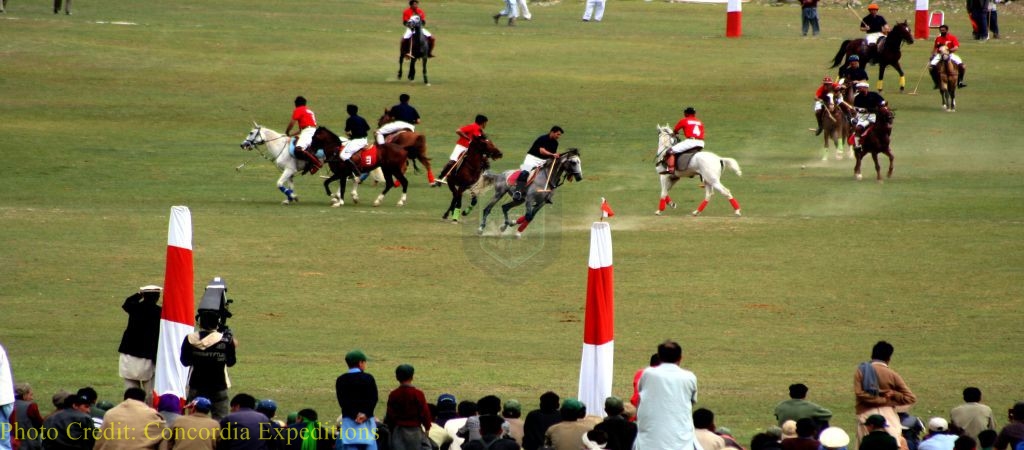
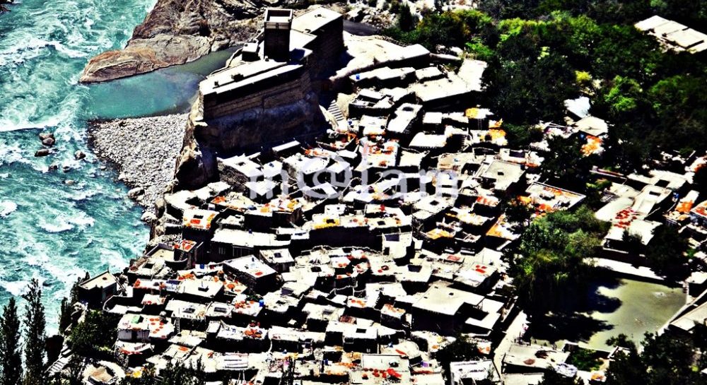
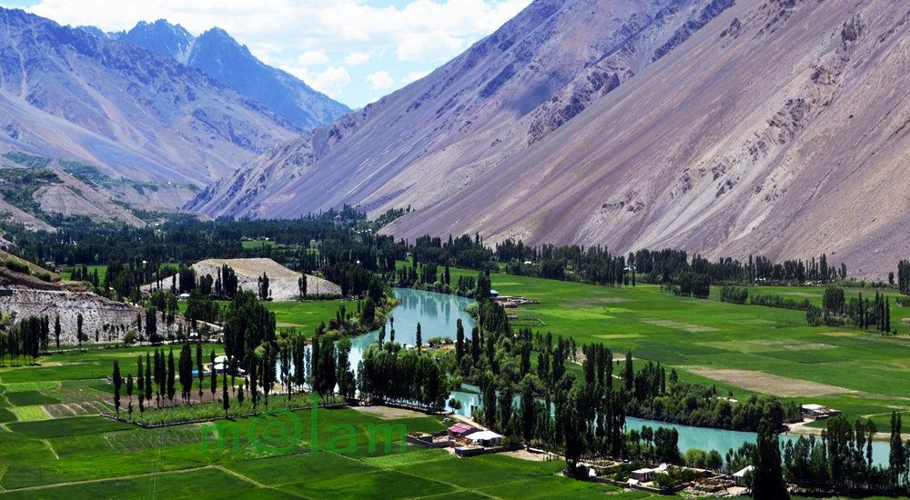
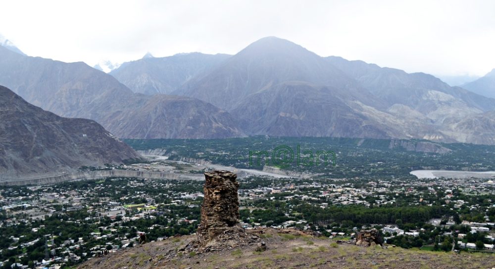
Exploring the Majestic Victory Monument of Taj Mughal Unveiling the Remarkable Tale of the 700-Year-Old Commemorative Tower in Gilgit, Pakistan Nestled gracefully upon the southern mountains of Gilgit town, Gilgit-Baltistan, Pakistan, stands the splendid Victory Monument of the Taj Mughal. Undoubtedly, the monument is a testament to history, triumph, and timeless beauty. With a history spanning over 700 years, this commemorative tower bears witness to the legacy of Taj-ud-Din Mughal. Taj-ud-Din was an Ismaili ruler from Badakhshan who graced Gilgit-Baltistan with his presence during the 13th century AD. Erected by his devoted soldiers, this monument stands tall at 21 feet and 10 inches, with a circumference of 14 feet and 4 inches, perpetuating the memory of his glorious victory. Journey to the Past: Unveiling the Monument’s Origin The Victory Monument of the Taj Mughal finds its sacred abode against the stunning backdrop of the southern mountains of Gilgit city. The Monument majestically sits about 1000 feet above Gilgit town. This awe-inspiring edifice not only oversees the enchanting villages of Gilgit and Danyore but also narrates a saga of victory and courage that continues to captivate the hearts of those who tread its path. Unveiling the Pathways: A Scenic Staircase Adventure Gone are the days of arduous treks and intricate routes. In order to promote history and tourism, access to the monument has been made easy. From the city center or the bus station, one can drive towards Serena Hotel in Jutial and follow the signboards leading to the hiking point. The monument is now reachable via a splendid flight of stairs, gracefully winding its way through rocky trails. These trails, adorned with the raw beauty of nature, create an immersive experience that heightens the anticipation of the forthcoming spectacle. As each step is taken, a sense of excitement and wonder builds, propelling us toward our destination. Cycle Track Marvel: A Gateway from Barmas to Jutial Adding to the allure of this journey is the newly constructed water channel Cycle Track, connecting Barmas to Jutial, Gilgit. One can do the monument from Barmas, the southern end of Gilgit, as well while enjoying the majestic views of Gilgit and surrounding valleys along the cycling trail. This ingeniously designed pathway presents an alternative route, one that promises a unique blend of adventure and tranquility. Unveiling the Monument’s Grandeur Architectural Resplendence: A Glimpse into the Monument’s Construction Erected upon the ridge of the Rocky Mountains, the Victory Monument stands as an embodiment of architectural finesse. Crafted meticulously with local stone and clay, this circular tower resonates with the echoes of a bygone era. Yet, the passage of time has not been without its effects, as the monument’s structural integrity slowly wanes, hinting at the ephemeral nature of existence. Temporary support has been tendered to its base, while the southern façade bears the marks of weathering, urging for a much-needed restoration. A Panoramic Tale: The Enchanting Vistas from the Monument’s Peak Gazing from the heights of the Victory Monument, one is rewarded with an awe-inspiring panorama that unfurls before the eyes. Gilgit town, stretching from Bagrot in the east to Baseen in the west, is caressed by the winding embrace of the Gilgit River. The tower, known as “Shikaari” in the local Shina language, offers an unobstructed view of the surrounding valleys, cradled by vigilant mountain sentinels. Embracing the Experience: Best Time & Route to Embark Packing Essentials: The Checklist for a Memorable Voyage The monument can be accessed at any time of the year. During peak summers, only early morning or late afternoon time is suggested to avoid heat. Preparation is the key to a fulfilling visit to the Victory Monument. As you tread upon the barren mountain terrain, remember to arm yourself with a water bottle, ensuring hydration amidst the arid landscape. Similarly, the scorching sun necessitates the application of sunburn cream, while sturdy shoes guarantee secure footing. Complete your ensemble with sunglasses, and a hat/cap, and equip yourself with a camera or cell phone to capture the moments that unfold. Embarking Beyond: Exploring Gilgit’s Treasures Beyond the resplendent Victory Monument, Gilgit extends an invitation to delve into its treasury of attractions. Venture into the embrace of ancient history as you encounter the 7th-century Karga Buddha, a silent sentinel of bygone times. In addition, Biddulph House, Hal Ga Naal, Hanzal Stupa, Gilgit Suspension Bridge, Chinar Bagh, Buddhist Rock Carvings, and the hiking track near KIU await your exploration. Each movement narrates a unique chapter in the tale of Gilgit’s legacy. Charting Your Course: Navigating to Gilgit Accessing Gilgit is a journey that intertwines with the thrill of the destination. Flights operate daily from Islamabad, weather permitting, offering a gateway to this realm of wonder. Likewise, roadways pave the way from Islamabad along the (Karakoram Highway) KKH and from Chitral via the Gilgit-Chitral road. While those journeying from Kashgar in China tread the path along the KKH—the months from May to mid-October emerge as the optimal time to embark on this odyssey. Capturing Memories: The Must-Have Essentials A pilgrimage to Gilgit demands thoughtful preparation. Ensure a water bottle accompanies you, quenching your thirst amid the landscapes. The embrace of the sun necessitates the shield of sunburn cream, while sturdy footwear guarantees steadfast steps. Moreover, bedecked with sunglasses and a hat, seize the moment with a camera or cell phone, encapsulating memories that endure. The Victory Monument of Taj Mughal stands as a living testament to a bygone era. It proudly stands as a beacon of triumph that graces the mountains of Gilgit. As you traverse the path to this historical marvel, let the vistas of Gilgit and the tales.

Shandur Polo Festival
Gilgit-Baltistan

Shandur Polo Festival

Exploring the Thrilling Shandur Polo Festival: A Unique Experience at 3734m Altitude The exhilarating Shandur Polo Festival unfolds at the awe-inspiring Shandur polo ground, nestled at a breathtaking altitude of 3734 meters. This remarkable event occurs on the border shared by the Chitral district of Khyber Pakhtunkhwa (KPK) and the Ghizer district of Gilgit-Baltistan in Pakistan. The festival takes place annually from the 7th to the 9th of July. This festival captivates thousands of enthusiastic spectators, drawing them into the world of the kings’ game – traditional freestyle Polo. A Unique Polo Experience The version of the Polo showcased during the Shandur Polo Festival is distinctive to this region. It offers an experience unparalleled anywhere else in the world. For three exhilarating days, domestic and international tourists, ardent supporters from Gilgit and Chitral, organizers, vendors, performers, Polo players, and their magnificent horses come together to create a vibrant makeshift village. The verdant Shandur Pass serves as a spectacular battleground during this festival. The World’s Highest Polo Ground The Shandur Polo Ground is renowned as the world’s highest Polo ground. It is encircled by majestic mountain peaks and graced with a serene lake in the backdrop. This breathtaking setting not only enhances the festival’s allure but also provides exciting activities for tourists. The Polo ground, situated in the heart of the pass, measures 200 meters by 56 meters, enclosed by a 60-centimeter-high stone wall. The size of the ground is in contrast to the conventional Polo field’s dimensions of 270 meters by 150 meters. This smaller size adds to the intensity of the game, making it seem crowded for the 12 players who compete at any given time. However, this limitation prevents the horses from extended gallops at such high altitudes. A Glimpse into History Polo’s roots trace back to the 6th century BC when it served as a training game for cavalry units of the king’s guards and elite troops in Persia. Originally, Polo boasted up to 100 players on each side, resembling a mini-battle. In the 6th century AD, it became Persia’s national sport and gradually spread to Arabia, Tibet, and China. Tragically, in 910, a game in China led to the death of a cherished relative of Emperor Apao Chi, prompting the gruesome beheading of all players. In South Asia, Polo arrived in the 13th century, introduced by Muslim conquerors. Over time, it evolved into a more regulated version from its wild beginnings. The contemporary Polo we witness today typically features six players on each side with a distinct lack of rigid rules. The free-style polo is epitomized by the famous saying, “The rule is that there is no rule.” However, the polo festival at Shandur makes one exception, with six players on each side engaging in an intense one-hour match, punctuated by a mere 10-minute break due to the high altitude. This breather comes alive with a traditional dance performance, and the team securing the most goals within the allotted time emerges victorious. Historical Beginnings Shandur’s first Polo match occurred in 1936. It was initiated dramatically by Major Evelyn Hey Cobb, the British political agent of the region. Cobb, a Polo enthusiast, ordered Niat Qabool Hayat Kakakhel, a prominent figure, and assistant to the governor from Ghizer district, to construct a Polo Ground in Shandur. This Polo Ground earned the name “Mas Junali,” derived from two Khuwar languages, meaning “Moony Polo Ground.” Impressed by Kakakhel’s efforts, Cobb sought to reward him However, Kakakhel declined and instead asked for trout to be stocked in local streams. Cobb agreed, importing live trout from England, which were released into the River of Ghizer. This visionary move paved the way for the Directorate of Fisheries and job opportunities in the region. Today, Gilgit-Baltistan is also renowned for Trout fishing. Preparing for Battle Players and horses from both sides arrive at Shandur weeks before the grand showdown to acclimatize to the high altitude. Preliminary matches in both Chitral and Gilgit determine the best horses and players for the final games, with local judges making their selections during test matches on home grounds. A Wild Game Safety measures take a back seat during this wild game. Players rarely wear helmets, donning colorful attire and wielding strapless mallets as they chase the ball vigorously on their horses, often without bandages to protect the steeds from harm. Winning the highly anticipated trophy is a source of immense pride for both teams, making national headlines. Supporters and tourists flock to the venue as soon as the rival teams and their horses make their grand entrance. Access Both Gilgit and Chitral districts are accessible by air and road from the capital city of Islamabad. Shandur is approximately 211 kilometers west of Gilgit via the Gilgit-Chitral road. Conversely, it is about 168 kilometers northeast of Chitral along the Shandur-Gilgit road. The journey from Gilgit treats travelers to breathtaking vistas of valleys, lakes, fruit orchards, traditional houses, terraced fields, flowing rivers, and serene springs. Similarly, the drive from Chitral offers glimpses of the Mastuj and Surlasp valleys’ lush natural beauty, the warm hospitality of the residents, and traditional houses nestled amidst stunning landscapes. Both routes are suitable for 4WD vehicles but are closed during the winter months. Activities The heart-pounding Polo matches at Shandur are complemented by an array of activities. These warm-up activities help visitors to immerse themselves in the natural and cultural beauty of the region. Adventure enthusiasts can explore the surroundings of Shandur, try their hand at stream and lake fishing, or embark on exhilarating hikes. The event also provides a fascinating glimpse into the lifestyle and cultural traditions of the people of Gilgit and Chitral. Nights come alive with musical performances and fireworks, while daytime showcases paragliding and traditional dances from Chitral and Gilgit-Baltistan. The indigenous customs and natural beauty are a visual delight for visitors. Plan Your Visit For all visitors, it is highly recommended to: Arrive at the venue at least a day before the final contest to fully savor the festival.

Altit Fort Hunza
Forts, Gilgit-Baltistan

Altit Fort

Altit Fort: A Journey Through History and Architecture In the mountain valley of Hunza, Gilgit-Baltistan, Pakistan, stands a true marvel of history and architecture, the awe-inspiring Altit Fort. The fort is perched majestically on a 1000-foot towering cliff rising sharply from the Hunza River. This 900-year-old fort has witnessed centuries of dynastic rule, and cultural transformations. The award-winning Altit Fort now stands as a testament to the rich heritage of the region. Its historic background, architectural marvels, and restoration efforts make Altit Fort a must-visit destination. Historic Background Before becoming a part of Pakistan in 1974, Gilgit-Baltistan was a patchwork of independent princely states, with the kingdom of Hunza being one of them. The local Mirs, hereditary rulers of Hunza, held sway until 1974. However, the socio-political reforms stripped them of their power during the reign of Zulfiqar Ali Bhutto. Altit Fort, which had once served as their palace, found itself in a state of disrepair. Later, the Aga Khan Foundation took over its renovation in 1990. The village of Altit, founded in the 11th century, was the oldest settlement and the capital of Hunza. It was then called Altit Khun and served as the capital of Hunza. Its name evolved from “Hunokushal” to “Burushal” as the region’s culture shifted from the Turkic Huns to Burushaski speakers, who later converted to Islam in the 15th century. The Power Struggle According to historical accounts, the rulers of Hunza first resided in the Altit Fort. The rivalry between two royal brothers, Prince Shah Abbas (Shabos) and Prince Ali Khan (Aliqan), marked a pivotal moment in the fort’s history. Shah Abbas relocated to Baltit Fort, making it the new seat of power, while Prince Ali Khan fortified Altit Fort. With the capital shifted to Baltit, Altit Fort began to lose its significance. Prince Ali Khan made Altit Fort his stronghold and launched offensives against his elder brother. Tragically, this conflict ended with Prince Ali Khan’s death. Balti Craftsmanship When Princess Shah Khatoon from Baltistan was married to Mir Ayaaho II of Hunza in the early fifteenth century, she was accompanied by craftsmen as a dowry. The Balti craftsmen carried out significant amendments to the fort with a Tibetan touch in its design. During their stay in Hunza, they used two Balti words to refer to the two forts “Elte” and “Delte” to say “here” and “there”. Later, the term Elte became Altit, and Delte was modified to Baltit as both valleys are famously known today. The fort was purposefully built by the ruling family of Hunza as a display of power, to defend Hunza from external attacks, and to safeguard the predominant feudal system. Altit Fort has undergone several ups and downs before it was abandoned. It has been dexterously renovated and serves as a tourist attraction. Currently, the fort houses a museum, a culture center, and the offices of a successful Social Enterprise. Architecture Altit Fort is a masterpiece of architectural ingenuity. Built over 800 years ago, its construction occurred in six distinct stages. The initial phase saw the construction of a two-floor building on the lower western edge, followed by a three-floor watchtower, a storage space, a mosque, grain storage on the eastern side, and the conversion of grain storage into guest rooms. Narrow corridors lead to the lower-level rooms, while the upper ones connect to the watchtower. The fort’s main entrance, facing Ultar, leads through a dimly lit corridor on the ground floor. It reveals a rectangular supporting structure with a haunting history. Legend has it that a prince who was suspected of plotting against his kingdom was buried here in a standing position. The first-floor royal kitchen boasts intricate carvings, surrounded by the lobby, a multipurpose traditional royal room, the queen’s room, and rubble stone masonry. The watchtower is strategically positioned to oversee the land. It offers a 360-degree view and was even used for executing prisoners sentenced to death. The mosque, royal throne, and guest rooms are situated to the north of the tower, while the storage space lies to the south. The royal throne, in front of the mosque, provides a panoramic view of Altit Khun. Restoration Altit Fort, once in a state of disrepair, was donated to the Aga Khan Trust for Culture Historic Cities Support Program in 2001 by Raja Amin Khan. Extensive restoration work, carried out by the Aga Khan Trust for Culture Historic Cities Support Program and the Government of Norway, transformed it into a museum. Over the years, various development projects both within and outside the fort have flourished. These include a women’s social enterprise, the restoration of Altit Valley, the Kha Basi Café serving traditional Hunza food, an apricot orchard, and a new art center cum guesthouse. Historical tours are offered daily from 9.30 am to 5.30 pm. Access and location Altit Fort is situated on the edge of Altit Valley, near the confluence of Hunza and Nagar rivers, approximately 3 km from Baltit Fort. The main entrance guides visitors through a royal garden—an apricot orchard surrounded by lush green grassland—leading to the fort entrance. The fort offers breathtaking views of Hunza and Nagar from various locations. The galleries in front of the royal guest rooms provide a stunning vista of Altit village. While those hanging from the royal chambers overlook the Hunza River and the Nagar Valley. Similarly, the watchtower atop the fort provides an unparalleled panoramic view of the Hunza and Nagar valleys, making it a photographer’s dream. Altit Fort also offers a captivating perspective from the Karakoram Highway. Awards In recognition of its cultural heritage conservation efforts, Altit Fort received the prestigious UNESCO Asia-Pacific Award in 2011. These conservation projects focused on rectifying structural defects, stabilizing walls, replacing rooftops, addressing wood decay, and improving lighting. Altit Fort stands as a living testament to the history and culture of Gilgit-Baltistan. Its architectural brilliance, rich history, and stunning location make it a must-visit destination for history enthusiasts and travelers alike. Experience the grandeur of Altit Fort and step back in time to a

Manthal Buddha Rock
Buddhist Heritage of Pakistan, Gilgit-Baltistan, Heritage Sites in Pakistan

Manthal Buddha Rock

Manthal Buddha Rock: A Glimpse into the Golden Era of Buddhism The Manthal Buddha Rock in Skardu stands as a timeless testament to the 9th-century Buddha relief carved into the natural expanse of a massive granite boulder. The rock is nestled on the outskirts of Manthal village with a commanding view of Skardu town. This site undoubtedly holds profound significance as a relic of Buddhism in the Gilgit-Baltistan province of Pakistan. As a renowned tourist attraction and an iconic archaeological treasure, it proudly offers a window into the opulent history of the region. Interestingly, the world remained unaware of the Manthal Buddha Rock until the early 20th century. Jane E. Duncan, a British traveler, documented its existence. This remarkable site is just one among several captivating and enigmatic petroglyphs awaiting discovery in the region. Historical Canvas Before the arrival of Buddhism in the 4th century, Baltistan was steeped in Shamanism. It was the monks from northern India who ventured into the region. They established monasteries during the reign of the Palolashahi kingdom. Buddhism continued to flourish even after the Tibetan conquest of the area in the second quarter of the 8th century. This period, spanning from the 8th to the 10th centuries, is often referred to as the “Golden Era of Buddhism” in the Upper Indus Valley. During this era, Buddhism held sway, leaving its indelible mark on the landscape. Carvings of Buddha adorned numerous rock surfaces throughout Gilgit-Baltistan. These migrants from Gandhara, on their journey through the mountainous terrain of Gilgit-Baltistan, etched various images. The images include stupas, depictions of Buddha, and expressions of their experiences. Some even left behind texts in the Kharoshti language on the rocks. Several notable Buddha carvings, such as the Manthal Buddha Rock in Skardu, as well as carvings of stupas and Buddhist reliefs in Shigar and Khaplu in Baltistan, Kargah Buddha and the Hanzal Stupa in Gilgit, and Haldikish rock carvings near Hunza on the Karakoram Highway, serve as remnants of the Buddhist presence during this flourishing period. During these times, the region stood as the epicenter of Buddhism, with Islam yet to make its presence felt. Though centuries have passed, and Buddhists have vanished from the region, their legacy endures through these rock carvings and petroglyphs. Regrettably, this rich heritage has been largely ignored and nearly forgotten. Transformation and Transition The 14th century witnessed a transformation in the region with the arrival of Ali Hamadani and his followers from Iran. This obviously marked the gradual decline of Buddhism, and its places of worship fell into disrepair. Therefore, the local populace embraced Islam. By the 15th century, the region had become predominantly Muslim. Artistry Etched in Stone The Manthal Buddha Rock, which stands proudly today, was once a site of great significance. It bears witness to a tradition that has long since vanished but still retains the essence of a heritage site. This triangular rock, measuring 20 feet in width and 30 feet in height, is adorned with intricate sculptures and inscriptions from the period of Buddhist reign in the region. The front face boasts a skillful carving of a meditating Buddha, surrounded by 20 Bodhisattvas and two future Buddhas standing on either side. In accordance with Buddhist tradition, the assembly of Buddhas, from the past to the future, is depicted on the Manthal Rock. The name referred to as ‘Mandal,’ from which the village’s name, Manthal, derives. At the apex of the Buddha rock, you’ll find a distinctive black coloring. The four-inch-high and wide hole directly above the meditating Buddha’s head was used as a fireplace, hence the blackened surroundings. A local myth suggests that visitors toss pebbles into this hollow space, believing that success will grant them a wish to come true. The Tibetan script on the rock, although incomplete and challenging to decipher. It remains a puzzle to even the most seasoned experts. It is also believed that there was once a platform for religious ceremonies on the eastern side of the rock. Additionally, the area behind the rock was designated for medical facilities provided by the Lamas. However, the original platform no longer exists, likely washed away by time. Access To The Manthal Buddha Rock Manthal Buddha Rock is located approximately 3 kilometers from Satpara Road, which leads to Satpara Lake in Skardu. Skardu is accessible by road from Islamabad, a journey that takes about 24 hours along the Karakoram Highway. Alternatively, one can opt to fly to Gilgit and continue the journey to Skardu by road, with the travel time expected to reduce once the ongoing Gilgit-Skardu road construction is completed, potentially taking around 3 to 4 hours instead of the current 7 hours, depending on road conditions. Entry Fee: Rs. 500 per person Nearby Tourist Attractions: Upper Kachura Lake Lower Kachura Lake Kharpocho Fort K2 Italian Museum Soq Valley Nansoq Valley Katpana DesertAlso Read: Skardu Tourist Attractions Excursions From Skardu

Phander Valley
Gilgit-Baltistan

Phander Valley

Unveiling the Enchanting Beauty of Phander Valley: A Nature Lover’s Paradise Nestled in the heart of the Ghizer District of Gilgit-Baltistan in Pakistan lies the breathtaking Phander Valley. This hidden gem is renowned for its unrivaled grandeur and sheer natural beauty. What truly sets this valley apart is, in fact, its remarkable display of diverse colors, changing with the seasons. Moreover, the tranquil deep blue rivulet gracefully meandering through the valley’s center adds to the enchantment, creating a scene straight out of a dream. Exploring Phander’s Geography Phander finds its home in the Gupis Valley of Ghizer district, within the mesmerizing Gilgit-Baltistan region. Ghizer district shares its borders with Gilgit District to the east, Hunza-Nagar to the northeast, Diamer to the south, and Chitral district of Khyber Pakhtunkhwa to the west. A Journey Through Nature’s Masterpiece As you embark on a journey through the Ghizer District towards the Shandur Pass, you’ll be greeted by a series of tiny valleys nestled along the Gilgit River. The landscape here is undoubtedly a testament to nature’s creativity, stretching from Gilgit to Lunger near Shandur. Each stretch leading up to Lunger boasts traditional houses surrounded by lush gardens, bountiful fruit orchards, and meticulously terraced fields. Attractions Along the Way The road to Phander Valley is adorned with numerous attractions that promise an enjoyable journey without the slightest hint of fatigue. As your eyes feast on the vibrant green fields, enchanting fruit orchards and gardens, pristine lakes like Khalti Lake and Phander Lake, and the sky-blue river flowing gracefully between valleys connected by suspension bridges, you’ll find yourself immersed in a unique and awe-inspiring experience. Likewise, the clear glacial waters and natural springs that dot the landscape further add to the visual delight. A Mosaic of Cultures Beyond its diverse landscape, Ghizer District boasts a rich tapestry of cultures that make it even more enticing. The residents here speak a multitude of languages, including Shina, Khuwar, Burushaski, and Wakhi, depending on the region. These diverse cultures coexist harmoniously, and the warm and welcoming locals lead simple lives, sustaining themselves primarily through agriculture. The Pinnacle of Scenic Beauty While the entire district is a visual treat, the Phander Valley stands out as a heavenly masterpiece. This bowl-shaped valley is formed by a natural barricade at its eastern end, where the PTDC Motel overlooks the breathtaking Phander Lake. Additionally, a government rest house perched on a ridge offers panoramic views of both the valley and the lake. A Nature Lover’s Paradise Phander Valley boasts a natural setting that is truly one-of-a-kind. Lush plains cover the valley’s base, separated by the calm, deep blue waters gently flowing downstream. These waters further teem with trout, a regional delicacy that every tourist should savor. Easy Access to Paradise Phander is conveniently located approximately 173 kilometers west of Gilgit town, making it easily accessible. The journey typically takes around five hours, depending on the pace. The Gilgit-Chitral road is undergoing reconstruction currently. Upon completion, the journey will be reduced to about 3 hours. For those traveling via Chitral, Phander can also be reached via the scenic Shandur Pass. Phander Valley is a testament to the splendor of nature, offering a harmonious blend of diverse landscapes, rich cultures, and serene beauty. Whether you’re an adventure seeker or a nature enthusiast, this enchanting valley promises an unforgettable experience that will leave you in awe of the natural world’s wonders.

Rush Lake or Rush Phari
Gilgit-Baltistan, Lakes

Rush Lake

Rush Lake or Rush Phari Nestled at a breathtaking altitude of 4,694 meters (15,400 ft) within the picturesque Nagar Valley of Gilgit-Baltistan, Pakistan, Rush Lake stands as a true marvel of nature. This high-altitude alpine lake, stands on a ridge in the mighty Karakorams, boasts an awe-inspiring backdrop of snow-capped mountain peaks. Rush Lake is accessible through a moderate yet challenging trek, notably called the Rush Lake Trek, along the glacier. The trek starts from Hoper village in the Nagar Valley. There are two option for the return journey – either do it the same way or by crossing the Barpu Glacier and return from the other side via Hamdar campsite. The pristine lake is more than just a geographical wonder; it’s undoubtedly an experience waiting to reveal. Pakistan’s Shining Alpine Gem Known as “Rush Phari” by the locals, the name carries a poetic significance. “Rush” signifies “shine,” and “Phari” refers to a “water reservoir” or pond. Together, “Rush Phari” paints a vivid picture of the “Shining Lake.” The nickname seems appropriate, as for a significant part of the year, the lake’s surface shines under a crystal-clear ice crust. It reflects the sun’s rays and creates a mesmerizing spectacle. Even during the pleasant summer days when the icy covering begins to melt, the lake mirrors the majestic mountain peaks. It cast the shadows of surrounding mountain peaks upon its clear waters. The grassy surroundings come alive during peak summer, adding to the lake’s allure. A Panorama of Splendor The Rush Lake experience is not limited to the lake itself; it extends to the surrounding beauty. Perched on a high-altitude ridge that stands over the junction of Barpu Glacier and Bualtar Glacier, this location offers a 360-degree vista of awe-inspiring mountain landscapes. Gaze upon the majestic Spantik (Golden Peak, 7027m), Mair Peak (6824m), Diran’s summit (7257m), and Rakaposhi (7788m) in the Nagar Region, along with Lady Finger, Ultar Peak (7388m), and the Batura series in the Hunza Valley. On clear days, one can even spot the summit of K-2 (8611 m) – the second-highest mountain on earth, along with Broad Peak and Hidden Peak from the lake’s vantage point. Adjacent to Rush Lake stands the prominent “Rush Peak,” essentially linked to the lake’s name. Rush Peak’s elevation of 5,098 meters (16,726 ft) makes it easily accessible from the lake’s vicinity. A short excursion to the peak, usually included in the trek, takes only a couple of hours from the campsite near the lake. The Rush Lake Trek The Rush Lake trek, renowned among international trekkers, commences in the charming Hoper village of the Nagar Valley, situated opposite the Hunza Valley and accessible via a well-maintained metalled road. The trek’s starting point at the eastern end of the village treats trekkers to breathtaking views of the entire route and the encircling mountains. To reach Rush Lake, follow the trekking route that runs parallel to the Hopar Glacier (Boaltar Glacier) and Miar Glacier, originating from the Miar and Phuparash peaks. Starting from Hoper Valley, the trail descends to the Hoper Glacier before leading you across Barpu Glacier, culminating at a serene pasture trail. Much of this path to Baricho Kor campsite is smooth and enchanting offering captivating views. The uphill stretch from Baricho Kor to Chidin Harai, lasting 3 to 4 hours, tests trekkers’ resolve and stamina, particularly those yet to acclimatize. Along this ascent, enjoy the scenic vistas of the glaciers and the imposing mountains of the Nagar Valley. An additional hour’s hike will bring you to the lake’s shores. Access to the Lake For international and Pakistani tourists alike, the journey to Rush Lake typically begins with a car or bus ride to Gilgit via the Karakoram Highway or Naran-Gilgit road. A 55-minute flight from Islamabad to Gilgit by PIA is an option. One can also fly to Skardu and drive to Hunza, though flight availability depends on weather conditions. From Gilgit, a 100-kilometer, 2.5-hour drive, while 250km from Skardu takes you to the Hunza Valley. Continue to drive for a 2-hour jeep ride to the Hoper Valley. There are small tourist class accommodation providers in the Hoper valley but not high end hotels. Best Time to Visit To witness Rush Lake trek in all its glory, plan your visit during the summer season, spanning from June to October. In June, patches of ice still grace the landscape, while late summer sees the flora in full bloom. The ice usually melts away in July and August, revealing the alpine vegetation along the route and around the lake, creating an enchanting spectacle of natural beauty. Essential Guidelines If you’re considering a trip to Rush Lake, thorough preparation is key to a successful and safe adventure. Here are some essential guidelines to assist in your preplanning: Personal Belongings: A personal backpack for your belongings and walking sticks Layered clothing for warmth, including a raincoat Trekking trousers or a tracksuit, along with an extra T-shirt or sweatshirt Proper trekking shoes or ankle-high joggers, a pair of flip-flops, and warm gloves and socks Sunscreen, sunglasses, and a cap A camera for capturing memories Rechargeable flashlights or torches Personal medications Towels, handkerchiefs, and shampoo or soap Optional: A sleeping tent, sleeping bag, and mattress For both international and Pakistani tourists embarking on the Rush Lake trek, it’s advisable to enlist the services of a licensed tour operator. These professionals can provide the necessary support. Services include the staff, food, equipment, tour guides, and emergency services, ensuring a safe and enjoyable journey. You May also Like: Attabad Lake Borith Lake Khalti Lake Phander Lake Blind Lake Sheosar Lake Lulusar Lake

Attabad Lake on the Karakoram Highway in Hunza
Gilgit-Baltistan, Lakes

Attabad Lake

Attabad Lake: A Gem on the Karakoram Highway In the heart of Hunza, nestled along the legendary Karakoram Highway, lies a breathtaking jewel known as Attabad Lake. This pristine oasis emerged from the aftermath of a massive landslide that struck on January 4, 2010. Although the catastrophe claimed lives and property, it also heralded a remarkable transformation in the region. Over time, Attabad Lake rose to fame and established itself as a premier tourist destination. It captivates the hearts of visitors from far and wide. Discovering Attabad Lake’s Location Attabad Lake is situated approximately 19 kilometers east of Karimabad in the enchanting Hunza region of Gilgit-Baltistan, Pakistan. Perched along the Karakoram Highway, the lifeline connecting China and Pakistan, this natural wonder is just a three-hour drive from Gilgit. The lake makes it easily accessible to travelers seeking its beauty. The Tale of Attabad’s Creation The lake’s name, “Attabad,” bears witness to the valley of the same name, which was devastated to give birth to this stunning waterbody. It was the peak of winter when a colossal portion of the valley tumbled into the Hunza River. The event tragically claimed the lives of 20 residents, hundreds of livestock, and valuable land and property. This monumental a-kilometer-thick mudslide resulted in blockage of the river flow upstream along the Hunza River. Over time, the obstructed river began to swell, forming a sprawling water reservoir. As a result, this reservoir submerged adjoining valleys upstream. Thus, it completely inundated Ayeenabad and engulfed 40% of the Shishkat Valley. Consequently, homes, shops, and hotels along the 19-kilometer stretch from Attabad to Hussani Village drowned. The consequences were dire with over 6,000 people displaced. Eventually, trade and travel along the Karakoram Highway were disrupted. At the same time, more than 25,000 residents in the Gojal region were affected severely. Spill Over In June 2010, approximately five months after the initial landslide, the Hunza River began to spill over the barrier. Swift action was taken with the assistance of the Frontier Works Organization (FWO) of the Pakistan Army to create an immediate spillway, reducing the water level. At that time, the lake stretched to a length of 21 kilometers with a depth of about 358 feet. As the waters receded, hope blossomed for the affected residents, revealing their land and property once more. This catastrophic event disrupted communication systems, leaving the region’s people stranded for several months. The local business community suffered greatly. Likewise, tourists faced significant challenges during harsh winter conditions. Particularly, navigating the treacherous currents while traveling on open ferries or on foot was not an easy task. For the region’s inhabitants, most of whom relied on selling local produce like crops, fresh fruit, and dry fruit, the disaster was twofold. Their productive land was lost, and the remaining produce couldn’t reach the market in a timely manner, resulting in substantial financial losses. Rebuilding and Development In the immediate aftermath, the National Disaster Management Authority (NDMA) provided helicopter services to address the emergency, but this solution was not sustainable. Instead, manual boats were introduced, serving the community until the Karakoram Highway connection was restored in August 2015 through the construction of five long tunnels, overcoming the solid rock obstacles. The introduction of speedboats catered to tourists, and local residents established various camping sites along the lake’s banks. Each passing year brought new developments, enhancing the experience for tourists and allowing them to make the most of their visit. Attraction: Attabad Lake Today Today, Attabad Lake stands as a favored tourist destination. It’s a 14-kilometer stretch of the Karakoram Highway that runs parallel to its shimmering waters. Travelers can revel in its multi-dimensional beauty from well-organized viewpoints along the highway, marveling at the deep blue waters framed by rugged mountains and lush valleys. The journey features a series of lengthy tunnels, picturesque bridges, and opportunities for water sports. famous ones include jet skiing, speedboats, and ferries providing every passerby with a joyous experience. Local residents have embarked on the path of recovery, rebuilding their homes and businesses. Substantial investments are pouring into new infrastructure projects, all aimed at attracting and accommodating tourists. Beyond the lake’s serenity, the surrounding vistas, including the iconic Passu Cones, offer captivating sights. Meanwhile, views of the lake from the surrounding valleys and mountains are nothing short of breathtaking. Accessible year-round via the main Karakoram Highway, Attabad Lake continues to evolve. With each passing year, new developments further enhance its allure. Consequently, it draws in more tourists than ever before. Whether you seek natural beauty, adventure, or tranquility, Attabad Lake has it all. New developments make it a must-visit destination for travelers from around the globe.

Khalti Lake
Gilgit-Baltistan, Lakes

Khalti Lake

Exploring Khalti Lake in Ghizer District: A Natural Gem Khalti Lake, nestled in the captivating embrace of the Ghizer District in Gilgit-Baltistan, is a true natural wonder waiting to be discovered. Situated at an impressive altitude of 2,217 meters above sea level, this enchanting lake derives its name from the charming village of Khalti. The Lake is a prominent attraction for travelers, offering a serene oasis partly enveloped by verdant terraced fields and a dense tree line, and partly bordered by the majestic Rocky Mountains. Ghizer District: Gateway to Adventure To reach Khalti Lake, one must embark on a journey of approximately 116 kilometers from the bustling heart of Gilgit town, which takes around 3 to 4 hours by car. The road to the lake follows a winding asphalt path that runs parallel to the meandering Ghizer River. Along this scenic route lies a breathtaking gorge that leads to the renowned Shandur Pass. While en route, travelers are treated to awe-inspiring views, making the journey itself an unforgettable part of the adventure. Moreover, Khalti Lake, along with Phander Lake and the Phunder Valley, makes it a popular day trip destination from Gilgit, making it easily accessible for tourists. Khalti Lake: Nature’s Masterpiece Khalti Lake owes its existence to the Ghizer River, which stretches near the village of Khalti. This stunning lake showcases its beauty in all four seasons, each offering a unique spectacle. In spring, Khalti village, gracing the western bank of the lake, bursts into magnificent blooms. Summers bring a sense of serenity, as the lake and its surroundings become a lush green retreat. The autumn season paints the region with vibrant colors, creating a romantic ambiance around the lake. Even in winter, when the lake’s surface is adorned with a frosty layer, it transforms into a playground for local youth to engage in cultural celebrations and games. A Treasure Trove of Freshwater Khalti Lake is not only a visual delight but also a vital source of freshwater. It is home to an abundant population of local trout, a species that can be found throughout the Ghizer River. Originally introduced near the westernmost Golaghmuli Village, these trout have multiplied and spread across the Gupis Valley, offering tourists an excellent opportunity for fishing. Water Sports and Investment Opportunities For adventure seekers, Khalti Lake offers immense potential for water sports. Throughout the year, the local community, in collaboration with the tourism department of Gilgit-Baltistan, organizes various sports activities. Additionally, there are lucrative investment prospects in water sports activities. The region still has ample room for standard boarding and lodging facilities. PTDC (Pakistan Tourism Development Corporation) has a building with limited accommodation but is currently closed. There is a growing demand for more comprehensive lodging services. Weather: When to Visit The best time to explore Ghizer District and the Lake is during the pleasant summer months, from May to October, when temperatures remain comfortable. However, it’s important to note that winters in the region can be harsh, with temperatures often dropping 10 degrees below freezing point on average. This icy chill freezes everything in and around the lake, and snowfall is a common occurrence. Khalti Lake in Ghizer District is a hidden gem that offers a perfect blend of natural beauty and adventure. Whether you are a nature enthusiast, a fishing aficionado, or a water sports enthusiast, this pristine destination has something to offer everyone. Plan your visit wisely to make the most of this captivating locale and create memories that will last a lifetime.

Deosai National Park
Gilgit-Baltistan

Deosai National Park

Exploring the Majestic Deosai National Park: Nature’s Paradise in Pakistan Deosai National Park, a hidden gem in Pakistan, claims the title of the world’s second-largest alpine plateau, spanning across an expansive 3626 sq. km. Nestled amidst four prominent mountain ranges—the Karakoram, Ladakh range (Trans-Himalaya), Zanskar range (Trans-Himalaya), and Himalaya—this breathtaking region sits at a lofty elevation of 13,600 feet above sea level. It’s a mesmerizing junction between the Skardu and Astore districts in the Gilgit-Baltistan territory. Deosai National Park is not only a natural wonder but also a thriving habitat for diverse wildlife, making it a coveted destination for both local and international travelers. Unveiling Deosai: The Land of Giants The name “Deosai” derives from two words, “Deo” and “Sai,” translating to “Land of Giants.” For ages, myths circulated about this region being haunted by giants, giving rise to its intriguing moniker. However, the locals in Baltistan affectionately refer to it as “Ghbiarsa,” meaning “Summer’s Place” because it is accessible only during the summer months. Enchanting Attractions Deosai National Park is a sanctuary of natural beauty and biodiversity, with some areas designated as restricted zones, particularly for the protection of the endangered Brown Bear. Tourists can explore specific zones, making Deosai a prime attraction that draws hordes of visitors annually. Some of the must-see attractions include: 1. Sheosar Lake: The Jewel of Deosai Sheosar Lake graces the plateau like a beauty mark, surrounded by snow-capped hills and lush green patches adorned with wildflowers. 2. Kala Pani: Camping by the Blackwater Kala Pani, or the Black Water, is a favored campsite by a stream of the same name. Despite its dark appearance from a distance, the water is crystal clear and frigid, making it an ideal spot for camping amid small green hills. 3. Bara Pani: A Mountain Stream Haven Bara Pani, the larger water stream originating from Deosai’s icy mountains, lies between Kala Pani and Ali Malik Mar Pass. It offers an idyllic campsite amid the vast expanse of the park and snow-clad peaks. 4. Ali Malik Mar Pass (Deosai Top): An Adventure Awaits Located about 30 km uphill from Skardu, Ali Malik Mar Pass promises an adventurous half-day excursion with panoramic views. It marks the end of Deosai Plains when approaching from the Astore side. 5. Shatoung Nala: The Gateway to Deosai Shatoung Nala is an uphill gorge leading to Deosai from Skardu, enveloped by snow-covered mountains. The freshwater stream flowing through it is the primary source of water for Sadpara Lake in Skardu. Deosai offers various trails to explore, but a top recommendation is walking along the jeep track encircling Sheosar Lake to savor the vast expanse of this natural wonder. For fishing enthusiasts, obtaining a valid license allows for a unique angling experience, while clear, starry nights offer a chance to witness the Milky Way galaxy in profound silence. Planning Your Deosai Adventure If you plan to spend a night in Deosai, it’s essential to carry your tents and food, as heavy rains can pose challenges. Careful planning and arrangements are a must, ensuring a comfortable and enjoyable stay amid nature’s splendor. Flora and Fauna in Abundance Established in December 1993, Deosai National Park serves as a sanctuary for rare wildlife, particularly the Himalayan brown bear, once freely roaming these mountains. Presently, the park houses approximately 20-28 brown bears, and their population is steadily increasing due to stringent conservation efforts. This national park boasts a rich diversity of wildlife, including Himalayan Ibex, Snow Leopard, Tibetan Red Fox, wolves, Ladakh Urial, and the Golden Marmot, among 18 different mammal species. Bird enthusiasts will also be delighted by the park’s 209 bird species, both resident and migratory, including the Honred Lard, Citrine Wagtail, Mountain Finch, Eastern Swift, and Craig Martin. Deosai Plateau, situated between sub-alpine and glacial regions, harbors shrubs and forbs, devoid of trees. It’s renowned for its variety of medicinal and aromatic plants, with 342 plant species from 142 genera and 36 families. Notable species include Artemisia, Aconitum, Jurinea, Rheum, Mentha, Swertia, Valeriana, Verbascum, Viola, Potentilla, Ephedra, Thymus, Saussurea, and Bunium. A Climate of Extremes Deosai remains shrouded in snow for most of the year, becoming accessible for only four to six months, typically from June to November. Its environment is characterized by extreme cold, low atmospheric pressure, and minimal oxygen and carbon dioxide levels. Travelers should be wary of arid conditions and intense solar ultraviolet radiation. The plateau experiences higher rainfall than the surrounding valleys due to its proximity to the monsoon-affected outer Himalayas. While July and August generally offer pleasant weather, snowfall is not uncommon during these months. Annual precipitation ranges from 350 to 550 mm, primarily as snow. Daily temperatures fluctuate between -20°C in winter and 12°C in July and August. Accessing Deosai’s Beauty Deosai National Park can be accessed from both the Skardu district in the north and the Astor Valley in the west. The journey takes around 9 to 10 hours from Gilgit to Skardu via Astore and Deosai or vice versa. Overnight stays in Astor or within the National Park are advisable for travelers exploring Deosai. Given the high altitude and road conditions, a 4WD vehicle is recommended for a safe and comfortable journey. In conclusion, Deosai National Park is a pristine sanctuary that beckons adventurers and nature lovers alike. With its remarkable biodiversity, stunning landscapes, and unique flora and fauna, it’s a destination that promises an unforgettable experience amidst the wonders of nature.

Rama Lake
Gilgit-Baltistan

Rama Lake

Exploring Rama Lake: A Himalayan Gem in Gilgit-Baltistan Nestled at a breathtaking altitude of 3800 meters, Rama Lake stands as an iconic jewel in the pristine Astore district of Gilgit-Baltistan, Pakistan. This high-altitude lake, perched gracefully above Rama Meadows, offers a remarkable natural spectacle. While the lake itself is awe-inspiring, the immediate surroundings have faced challenges from illegal logging, resulting in a treeless landscape. Nonetheless, Rama Meadows, situated at 3300 meters, remains a lush oasis, adorned with towering trees like pine, cedar, fir, and juniper. Unveiling the Attractions Rama Lake: A Magnificent Oasis Rama Lake takes center stage as one of the most alluring attractions, magnetizing a substantial influx of both domestic and international tourists throughout the year. This picturesque lake, nestled against the southern ridge of Nanga Parbat, offers a captivating spectacle. On a clear day, it mirrors the snow-capped majesty of Nanga Parbat, known as the “Killer Mountain” (standing tall at 8126 meters), creating a mesmerizing inverted image. A Nature Lover’s Paradise The environs of Rama Lake harbor a diverse range of flora and fauna. Here, one can encounter various medicinal plants and a fascinating array of wildlife, including the golden marmot, ibex, musk deer, snow leopard, and rock partridge. Along the trail from Rama Meadows to the lake, you’ll encounter three small lakes known as “Sarot” in the local Shina language. Explore Rama’s Beauty A Must-Visit Destination Rama Valley and Rama Lake are undisputed must-visit destinations for travelers making their way to or from Deosai. For those with limited time, the lake can be explored as a captivating day excursion from Gilgit. For a more comprehensive journey, consider an ideal itinerary that encompasses Fairy Meadows, Rama, Deosai, and Skardu, offering a week-long adventure. To elevate your experience, don’t miss the opportunity to add Gilgit and Hunza to your travel program. Weather: A Seasonal Symphony Seasonal Transformation Rama Meadow undergoes a dramatic transformation with the changing seasons. During winters, it’s blanketed in pristine snow, while in summers, it transforms into a vibrant green paradise, making Rama an idyllic camping spot. The lake, too, transitions from being frozen in winter to a refreshing oasis where you can take a dip on a warm summer day. Rama Lake presents an ideal option for a half-day hike from Rama Meadows, promising an unforgettable experience. Accessing Rama: Your Gateway to Adventure Connecting to Astore Rama is part of the rich tapestry of valleys and key tourist destinations in Astore, Gilgit-Baltistan. To reach this paradise, travelers can take advantage of the well-connected transportation network. Astore itself is conveniently linked to Gilgit, which is accessible both by air (weather permitting) and by road. The iconic Karakoram Highway (KKH) ensures a year-round road link between Islamabad/Rawalpindi and Gilgit. While in the summer, the Gilgit-Naran route via the Kaghan Valley and Babusar Pass offers a scenic drive. The Journey From Islamabad, embark on a scenic drive along the Karakoram Highway, heading towards Gilgit. After crossing Raikot Bridge, continue for approximately 20 more minutes, following the sign directing you to Fairy Meadows. Take the right turn indicated, leading you on a 45-kilometer (about 2-hour) journey to Astore Bazar. From there, it’s just another 9 kilometers of uphill driving, leading you to Rama Lake. The Lake is nestled within the embrace of Rama Meadows, where the primary campsite awaits, ready to welcome adventurers. Rama Lake in Gilgit-Baltistan is a natural wonder that beckons explorers and nature enthusiasts from far and wide. Its picturesque beauty, diverse wildlife, and easy accessibility make it a must-visit destination for those seeking an unforgettable Himalayan experience. Whether you’re planning a day trip or a week-long adventure, Rama Lake promises to leave an indelible mark on your soul.

Scroll to Top