The Karakoram Highway
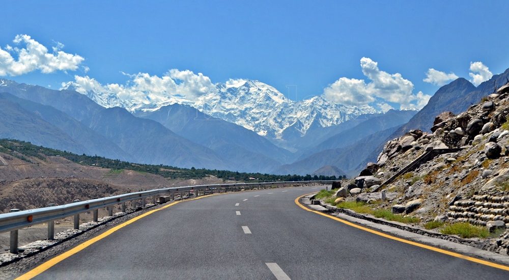
Exploring the Karakoram Highway: A Journey Through History and Scenic Beauty The Karakoram Highway (KKH) stands as a testament to human determination and engineering feats. It connects China and Pakistan via the Khunjerab Pass, situated at an awe-inspiring altitude of 4,733 meters. This epic roadway is not just a trade artery but also a legendary tourist attraction. It offers a captivating blend of historic landmarks, cultural diversity, and breathtaking natural beauty. For adventure enthusiasts, embarking on a journey along the KKH is an absolute thrill. Traversing Pakistan’s Section: A Scenic Odyssey The KKH adventure begins in Hasanabdal, Punjab, Pakistan. It stretches across an impressive 887 kilometers until it reaches the Khunjerab Pass at the Pak-China border. Along this route, the highway meanders through the rugged terrain of Khyber Pakhtunkhwa (KPK). It then follows the course of the Indus River and gracefully navigates the Karakoram and Pamir Mountains. Eventually, it meets the Chinese segment at Khunjerab Pass. In China, this remarkable highway is known as the Friendship Highway. Due to the harsh conditions it was built, it is sometimes referred to as the “Eighth Wonder of the World.” Unveiling the Route: A Glimpse into the Length The total length of the Karakoram Highway spans approximately 1,300 kilometers, with 887 kilometers in Pakistan and 413 kilometers in China. While the new route doesn’t exactly replicate the ancient Silk Route, it closely follows the same region, reviving the spirit of this historic trade network. The construction of the KKH came at a significant human cost, with both Pakistani and Chinese laborers toiling relentlessly to complete each kilometer of this ambitious project. Chinese workers who lost their lives during construction are honored at the Chinese cemetery, China Yadgar, in Danyore near Gilgit. Historic Roots: A Glimpse into the Past Historically, the Karakoram Highway was a vital caravan trail, serving as one of the branches of the ancient Silk Route. Over centuries, traders, pilgrims, warriors, and common folk traversed this route, ushering in profound changes in the social, cultural, and economic aspects of the region. The Saga of Construction: Overcoming Challenges Before the Karakoram Highway was built, the northern areas, now known as Gilgit-Baltistan, attracted the interest of the Russians, Chinese, and British, owing to its strategic significance. However, access to the region was a formidable challenge. In the 1800s, the British, who were in power, aimed to bolster their authority by constructing an all-weather communication infrastructure along the Indus. Realizing this vision was no small feat. Initially, the British improved an old Srinagar foot track, transforming it into a mule track. Later, a seasonal passage was established through Chilas, crossing the Babusar Pass to connect to the Kaghan Valley. Unfortunately, this passage remained open for only about six months a year during the summer. Following the partition of the subcontinent in 1947, the Srinagar road was permanently blocked. This period saw the northern areas divided into several states under local rulers. In 1958, the Indus Valley Road (IVR) project was conceived to create an all-weather road link between Swat and Gilgit. Construction commenced in 1959 as a joint venture between the two governments. Then, in 1966, a Sino-Pak agreement transformed the IVR into the Karakoram Highway. Despite financial constraints and the outbreak of the war between Pakistan and India in 1971, China’s invaluable support enabled the project to continue. Originally planned to stretch from Thakot to the Khunjerab Pass, the entrance point was later shifted to Hasan Abdal, and the project was completed in 1979. The highway was finally opened to the public in 1986. During construction, approximately 800 Pakistanis and 200 Chinese workers lost their lives, primarily due to landslides. Unofficial estimates suggest an even higher toll. The Chinese workers were laid to rest at the Chinese Graveyard in Danyore near Gilgit. A Path to Reconstruction: Upgrading the KKH In June 2006, Pakistan’s National Highway Authority (NHA) and China Road and Bridge Corporation (CRBC) signed an MoU to upgrade the KKH, expanding its overall width from 10 to 30 meters. This expansion aimed to accommodate heavy-duty vehicles, even in extreme weather conditions. Although construction took place, the width remained largely unchanged from the original design. During the construction phase, a significant event occurred on January 4, 2010, known as the Attabad incident. A massive landslide in the Attabad valley of Hunza damaged a section of the highway, creating a 23-kilometer-long lake and disrupting travel along the Karakoram Highway. To restore the road link between Pakistan and China, the construction of tunnels along a revised 24-kilometer route began in July 2012 and was completed in September 2015. This realigned route featured five tunnels and a bridge, rejuvenating the connection between the two countries. The Geopolitical Significance: A Strategic Artery The Karakoram Highway traverses a region marked by towering mountains and geological complexities, where China, Tajikistan, Afghanistan, and Pakistan converge within a 250-kilometer radius. Due to the intricate Kashmir conflict between India and Pakistan, the KKH holds strategic and military importance for these nations, especially Pakistan and China. Beyond geopolitics, the Karakoram Highway has significantly bolstered trade and tourism between Pakistan and China. The construction of the highway resulted in uplifting the living standards of the local population. The China-Pakistan Economic Corridor (CPEC) is set to bring substantial economic gains to the region, with plans to connect the Karakoram Highway to the southern port of Gwadar in Balochistan through the Chinese-aided Gwadar-Dalbandin railway, extending to Rawalpindi. Discovering Tourist Gems: Treasures Along the KKH The Karakoram Highway has earned international acclaim as a niche adventure tourism destination. Beginning in Hasan Abdal, about 50 kilometers from Rawalpindi city, this dual-carriage asphalt ribbon departs from the dusty plains of Punjab, embarking on a journey through the lower Himalayas of Hazara district. As it heads north, it winds through numerous captivating natural and historic sites, ultimately reaching the Pakistan section’s culmination at the Khunjerab border in the upper Hunza valley. This 887-kilometer stretch of the Karakoram Highway in Pakistan is a diverse tapestry of tourist attractions. From the