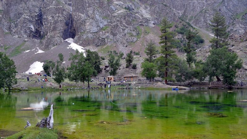
Hunza

Tentative list of UNESCO World Heritage Sites of Pakistan
Blogs, Heritage Sites in Pakistan, World Heritage Sites

Tentative List of UNESCO World Heritage Sites of Pakistan

Tentative List of UNESCO World Heritage Sites of Pakistan Pakistan boasts six UNESCO World Heritage Sites. In addition to these established sites, the country has compiled a roster of 25 potential sites called the Tentative List of UNESCO World Heritage Sites of Pakistan seeking recognition. This catalog has been formally presented to the UNESCO Committee for assessment and approval. The pre-listing process is a mandatory step for the eventual acceptance of nominations onto the esteemed World Heritage list. Punjab Province The Salt Range and Khewra Salt Mine The Salt Range, rising abruptly from the Punjab plains in Pakistan, spans 180 km and features sheer escarpments, jagged peaks, and fertile valleys. Originating 800 million years ago, it formed from the evaporation of a shallow sea and underthrusting of the Indian Plate. Named for the thickest rock salt seams globally, the range is a geological treasure with fossiliferous stratified rocks and exposed strata, attracting global geologists. The region is rich in paleontological finds, including dinosaur trackways, Cretaceous belemnites, and ancient hominid remains. The Salt Range is a historical and cultural hub with sites dating from Alexander the Great‘s era to the British colonial period. Notably, Khewra hosts one of the world’s richest salt deposits, exploited for over a millennium, continuing as a mining, research, and tourism center. Badshahi Mosque, Lahore The Badshahi Mosque and its expansive courtyard are elevated on a platform accessible from the east via a grand staircase and a traditional Mughal-style gateway. The entrance, a two-story structure, boasts intricate decorations with framed and carved paneling on all facades. Square minarets with pseudo-pavilions in red sandstone and white marble cupolas adorn the four corners. Its tall octagonal minarets are positioned at the courtyard’s corners. Additionally, smaller octagonal minarets are attached to the prayer chamber’s corners, beneath three grand marble domes. The red sandstone exterior is subtly adorned with white marble inlay lines and patterns. The interior and exterior of the prayer chamber feature unique and beautifully crafted Zanjira interlacing and floral motifs in bold relief, showcasing unparalleled beauty and craftsmanship in Mughal architecture. The gateway’s inscription indicates its construction in A.H. 1084 (1673-74 A.D.). Wazir Khan Mosque, Lahore The Wazir Khan Mosque, covering an area of 279′ x 159′, is entirely constructed using cut and dressed bricks laid in kankar lime, with minimal use of red sandstone in the gate and transept. The courtyard is split into two sections, with the upper part slightly elevated and an ablution tank in the middle. Flanking the east, north, and south sides of the courtyard are 32 small hujras of varying sizes. The prayer chamber on the west side features five compartments divided by massive piers supporting wide, four-centered arches, each topped with a dome. Small rooms are created at the northern and southern ends, and an eastern gallery leads to a spiral staircase accessing the roof. Distinctive structural elements include four corner minarets, five domes, and a transept at the entrance gate on the east. According to inscriptions, the mosque was built in A.H. Archaeological Site of Harappa The archaeological site of Harappa, extending over 150 hectares, comprises eight mounds and two cemeteries situated to the south of the dry Ravi riverbed. While much of the site is buried beneath agricultural land or the modern village of Harappa, exposed structures on mounds AB and F date back to the third millennium BC. The site’s sequence spans from the fourth to the second millennium BC, with a depth of over 13 meters. The strategic location beside the old course of the Ravi River granted inhabitants access to trade networks, aquatic resources, and water for cultivation, explaining its prolonged occupation. Harappa’s town plan during the mature Harappan period (2600-1900 BC) features self-contained walled centers on raised mounds. The site’s unique urbanization declined in the second millennium BC, and subsequent developments, including brick removal for railway ballast in the 1850s and salination from irrigation agriculture, impacted the preservation of structures. Tombs of Jahangir, Asif Khan and Akbari Sarai, Lahore The Tombs of Jahangir, Asif Khan, and Akbari Sarai, designated on December 14, 1993, showcase remarkable Mughal architecture. Jahangir’s Tomb is a single-story structure with a square plan, featuring tall octagonal corner towers and a projecting entrance bay on each side. The exterior boasts red sandstone facing with intricate marble inlay decoration. The interior displays floral frescoes, delicate inlay work (pietra dura), and vibrant marble intersia. Asif Khan’s Tomb, an octagonal structure with a high bulbous dome, stands in a vast garden. Originally adorned with rich stone inlay and bold stucco tracery inside, it featured a high bulbous double dome covered with marble veneering. Akbari Sarai, between Jahangir and Asif Khan’s, includes an open courtyard with small cells, adorned gateways, and a mosque with three splendid domes. The Sarai and the entrance gateway seem part of a unified complex from Shah Jahan’s era, sharing similar styles and elements. Hiran Minar and Tank, Sheikhupura The Hiran Minar, erected under Emperor Jahangir’s reign in 1620 AD, boasts unique architectural elements. Its facade sports 210 square perforations arranged in 14 rows, while inside, a spiral staircase with 108 steps leads to the top, adorned with 11 rectangular arched openings. Divided into six tiers, the Minar showcases lime plaster possibly embellished with floral or linear frescoes. An arched entrance graces the lowest tier. Across from it lies a rectangular tank connected by a causeway to an octagonal baradari. Each corner features square pavilions with gateways. The tank, equipped with ramps, parapet walls, and staircases, connects to the Aik rivulet via a channel. Inside the baradari, intricately decorated niches and honeycomb patterns adorn the walls. The causeway, supported by 21 pointed arched pillars, links the main baradari to an octagonal platform in the tank’s center, which served as a royal residence. Tomb of Hazrat Rukn-e-Alam, Multan The tomb of Shah Rukn-i-Alam, constructed between 1320 and 1324 AD by the Tughluq ruler Ghiyas-ud-din, was initially meant for his dynasty but later dedicated to the family of the revered Sufi saint. This

Tentative List of UNESCO World Heritage Sites of Pakistan Read Post »

, , , , , , , , , , , , , , , , , , , , , , , , , , , , , , , , , , , , , , , , , , , , ,
Gappa Valley
City Breaks, Gilgit-Baltistan, Tourists Destinations in Pakistan

Gappa Valley

Exploring the Enchanting Charms of Gappa Valley The Gappa Valley is a breathtaking meadow and an emerging tourist attraction alluring visitors from within and outside Pakistan. If you’re in search of an enchanting escape, then the Gappa is your choice. Nestled in the heart of the Nagar Valley in Gilgit-Baltistan, this hidden gem is quickly rising to prominence as a must-visit tourist destination. With its gushing glacial waters, terraced fields, expansive meadows, lush green hills, and majestic snow-covered mountain peaks in the background, this enchanting valley promises an unparalleled experience. Embracing Nature’s Beauty in Gappa Valley Gappa is a haven for nature enthusiasts, boasting pristine pine jungles, bubbling fountains, vast grasslands, and breathtaking vistas of Rakaposhi. The journey through the majestic Chalt Bala (Upper) and its pastures is an experience to memorize for a lifetime. It comes as no surprise that this valley has become a magnet for tourists seeking solace in the embrace of nature. Unveiling the Treasures of Nagar Valley Nagar Valley, home to the Gappa Valley, is a treasure trove of towering mountain peaks, crystal-clear lakes, and ancient glaciers. This region, located north of Gilgit city along the Karakoram Highway, remains a relatively undiscovered gem. The Chalt Valley marks the beginning of Nagar Valley, and Gappa is the first adventure that beckons. Gappa Valley: A Playground for All Seasons Gappa Valley’s allure knows no bounds, attracting visitors year-round. During the summer months, both local and international tourists flock to this haven to relish its serene ambiance and camping opportunities. The ideal time to visit is between June and September for the ultimate summer experience, while winter enthusiasts should plan a trip between December and February. Keep in mind that the road leading to the valley remains unpaved beyond the Chalt intersection on the Karakoram Highway, so opting for a sturdy Jeep is advisable. Discovering Hidden Treasures in Gappa Valley Gappa isn’t just a sanctuary for nature lovers; it’s a paradise for trekkers and those seeking peace alike. The region’s natural forests, pristine fountains, lush grasslands, and delectable local cuisine provide a holistic experience. Moreover, the warm and hospitable locals ensure that your visit is truly unforgettable. However, the crowning jewel of the valley is the mesmerizing view of Rakaposhi Peak, a sight that will leave an indelible mark on your memory. Outdoor Adventures Whether you’re an individual traveler or part of a family, there are plenty of spots to prepare and enjoy your own meals. Picture yourself cooking amidst the shade of towering pine trees with glacier water flowing nearby. The local shepherds extend their hospitality by offering delicious buttermilk (Lassi) and traditional flour Crepes (Giyaling). However, do remember to carry all your cooking supplies from the market. Adventure Awaits in Gappa Valley For adventure seekers, Gappa Valley offers a plethora of hiking and trekking activities. Exploring the vast expanse of the valley by hiking through its surrounding pastures and hills is an exhilarating experience. The trekking trail from Gappa Valley to Naltar Valley is a compelling reason in itself to plan a visit. Finding Your Way to Gappa Valley Gappa is accessible by 4WD. The journey to Gappa commences with a scenic drive through Chalt Bala, branching off from the main Karakoram Highway. While it was previously accessible from the District Nagar Check Post at KKH towards Chalt village, make sure to check current access points and trail conditions for an effective journey. To be precise, the road branches out from the Police check-post near the Collision Point of Continental Plates. Drive to the Chalt Valley and proceed to Gappa. While the drive is an adventure in itself, lasting approximately one and a half hours, it’s unquestionably worth the effort. As you approach Gappa Valley, the landscape transforms, welcoming you with open arms. The Gappa Valley is a paradise waiting to be discovered. Whether you’re an avid trekker, a nature enthusiast, or simply someone seeking serenity, Gappa offers an array of experiences that will undoubtedly leave you in awe. Plan your journey and unlock the enchanting charms of Gappa today.

Gappa Valley Read Post »

, , , , , , , , , ,
Kha Basi Cafe
Gilgit-Baltistan, Heritage Sites in Pakistan

Kha Basi Café

Discover the Majestic Kha Basi Café: A Taste of Tradition in Hunza Valley Nestled under the shadow of the magnificent Altit Fort, within the ancient royal garden known as “the Kha Basi,” The Kha Basi Café is a truly exceptional restaurant. This hidden gem resides on the outskirts of Altit town, in the enchanting Hunza Valley, Gilgit-Baltistan, Pakistan. The cafe is basically surrounded by beautifully maintained apricot orchards. This classic restaurant stands as a testament to the region’s rich history and cultural heritage. A Glimpse into the Royal Past The Kha Basi Café’s historical significance is unparalleled. Once a summerhouse for the royal family of Hunza, this architectural gem has gracefully weathered the passage of time. Today, it stands as a living testament to the region’s glorious past. It exudes an air of old-world charm that enchants visitors from far and wide. Reviving Tradition through Culinary Delights As you step into the Kha Basi Café, prepare to embark on a culinary adventure like no other. The menu boasts an extensive selection of delectable dishes. At the same time, it also showcases the rich flavors of traditional Hunza cuisine. Every bite is a journey through the ages, offering a glimpse into the customs and culinary practices that have been cherished for generations. A Proudly Local Experience The heart and soul of the Kha Basi Café lie in the hands of the remarkable local women who manage it with utmost dedication. Their commitment to preserving the essence of Hunza’s heritage is evident in every detail of the café. From the warm greetings to the meticulously prepared dishes, every aspect of the experience exudes genuine hospitality and pride in the local culture. A Panoramic Feast for the Senses Beyond the culinary delights, the Kha Basi Café treats visitors to an unparalleled feast for the senses. The veranda, overlooking the majestic Karakoram Highway, mountains, and lush orchard offers a visual symphony that complements the flavors on your plate. The soothing sounds of nature, the gentle breeze rustling through the trees, and the fragrant blooms all contribute to an unforgettable dining experience. Preserving Culture Through Art and Architecture Delving deeper into its commitment to preserving culture, the café invites talented young artists to showcase their skills on special occasions. Their captivating performances range from traditional music and dance to storytelling, offering guests an immersive encounter with Hunza’s artistic heritage. Moreover, the small traditional house within the café’s premises provides an enchanting opportunity for visitors to experience the harmony of traditional architecture with modern comforts. The meticulous craftsmanship and use of indigenous materials in its construction pay homage to the region’s architectural legacy. A Photographic Paradise Nature’s masterpiece, the Kha Basi orchard, is a photographer’s dream come true. Each season unfurls its own breathtaking charm, from the delicate blossoms of spring to the vibrant colors of autumn. Photographers and nature enthusiasts alike will find endless inspiration within the enchanting confines of this picturesque garden. Getting There and Contact Information For those eager to explore the wonders of the Kha Basi Café, access is straightforward. Located at the end of the streets of Altit town, the café is easily reachable from the Karakoram Highway. Visitors can contact (0581) 3457012 during business hours for bookings and further information. The Kha Basi Café is more than just a restaurant. It provides an immersive experience that transports you to a bygone era of regal splendor and cultural richness. With its delectable cuisine, warm hospitality, and awe-inspiring surroundings, this enchanting establishment is a true gem in the heart of the Hunza Valley. Whether you are a food enthusiast, a culture aficionado, a nature lover, or a seeker of tranquility, the Kha Basi Café offers a magical journey that will linger in your memories forever. Discover the essence of Hunza’s heritage and indulge in an extraordinary culinary and cultural adventure that will leave you spellbound.

Kha Basi Café Read Post »

, , , , , , , , , , , , , ,
Collision point of continental plates on the Karakoram Highway
Gilgit-Baltistan

Collision Point of Continental Plates

Exploring the Collision Point of Continental Plates near Chalt Valley In the heart of Gilgit-Baltistan, Pakistan, lies a hidden geological wonder: the collision point of continental plates. The site is located on the Karakoram Highway, just 53 kilometers north of Gilgit town. This extraordinary site has a rich history and undeniable significance. The intriguing collision of Indian and Eurasian continental plates gave birth to the majestic Himalayan mountain range and the Tibetan plateau some 50 million years ago. The Ancient Tectonic Drama: The Genesis of a Geological Marvel Over 40-50 million years ago, the Indian subcontinent was in fact an isolated landmass. It was basically separated from Asia by the vast Tethys Ocean. As tectonic forces began reshaping the Earth’s surface, India embarked on a northward journey towards Asia. This movement, which commenced around 200 million years ago, witnessed India covering a staggering 6,400 kilometers while remaining disconnected from the Asian continent. Around 50 to 40 million years ago, the pace of India’s northward drift gradually slowed to a more deliberate 4-6 centimeters per year. This deceleration marked the onset of a momentous collision between the Indian and Eurasian continental plates. The Birth of Majestic Peaks As the Indian plate eventually collided with the Eurasian plate. As a result, geological forces unfolded a remarkable transformation. The Eurasian plate crumpled and buckled above the Indian plate, eventually leading to the thickening of the continental crust. This dramatic upheaval gave rise to the towering Karakoram Mountains, proudly adorning the landscape of Gilgit-Baltistan. The crust in this region, therefore, is twice as thick as the global average, marking the cessation of volcanic activity. To this day, the Indian plate continues its northward push into the Eurasian landmass, causing these majestic mountains to ascend by about seven millimeters each year. Unlocking the Geographic Treasure Regrettably, the profound geographic significance of the collision point of continental plates remains largely unknown to the people of Gilgit-Baltistan. It remained unnoticed until recently when informative signboards were installed for the benefit of tourists and locals alike. These signboards particularly serve as educational tools, shedding light on the area’s significance. However, there is untapped potential here. The site, with its unique mountain formation, could become a prominent picnic spot, attracting visitors from far and wide. Moreover, remnants of the ancient Silk Route can still be observed on the other side, hinting at the region’s historical importance. Plans to renovate the ancient Silk Route are in the works, with the aim of promoting tourism in this captivating region. The Mystical Realm of Local Beliefs Locals have bestowed upon the collision point a name of its own, Bidru-Kha. However, mostly “Chalt Xhang” mostly signifies its threshold-like existence. This unique site is steeped in local legends and traditions. For instance, as a bride and groom pass through this point on their wedding day, locals perform sacrificial rituals involving chickens, goats, or other animals to appease the spirits. Additionally, local shamans believe that this place serves as a portal connecting three worlds: the realm of spirits or the upper world, the material human world, and the underworld of souls and the deceased. This spiritual significance adds another layer of intrigue to this already fascinating location. A Weather Oracle Beyond its geological and cultural significance, the collision point also plays a role in weather prediction. The climatic conditions above this particular point serve as a barometer for the lower parts of the Hunza Valley. An overcast sky may signal impending rain, while patches of blue amidst the clouds suggest clear skies ahead. The collision point of continental plates near Chalt Valley is a multifaceted wonder. It embodies the Earth’s tumultuous history and offers a glimpse into local traditions and legends. At the same time, this site even plays a role in forecasting the weather. As awareness of this unique site grows, it has the potential to become a must-visit destination, drawing adventurers, geology enthusiasts, and curious travelers from around the world.

Collision Point of Continental Plates Read Post »

, , , , , , , , , , , , , , , , , ,
Key Facts about Pakistan
Blogs

Pakistan

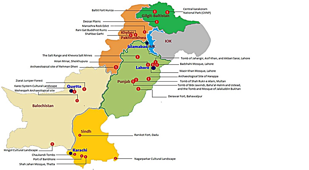
Exploring Pakistan: A Treasure Trove of Diverse Experiences Pakistan stands as an exceptional and blessed nation, graced with some of Asia’s most breathtaking landscapes. Its geography is as varied as its rich cultures, and its people are known for their warm hospitality. In the realm of discovering the roots of modern-day humanity, few places on Earth rival Pakistan. Unraveling the Tapestry of History The land that now comprises Pakistan has been a cradle of ancient civilizations and a melting pot of cultures and dynasties for centuries. From the ancient Neolithic Mehergarh civilization, dating back 9000 years, to the illustrious 5000-year-old bronze age Indus Valley Civilization, the 3000-year-old Buddhist Gandhara Civilization, the opulent Mughal Era of the 16th century, the brief Sikh rule, to over two centuries of British occupation, leading to independence in 1947, Pakistan’s history is a tapestry of unparalleled events, unlike any other sovereign state. A Glimpse of Pakistan’s Geography Officially, the country is known as the Islamic Republic of Pakistan. Most importantly, Pakistan ranks as the 6th most populous nation in South Asia. Altogether, the country houses over 224 million people from diverse cultural and ethnic backgrounds. Encompassing 881,913 square kilometers (340,509 square miles), Pakistan boasts four provinces – Sindh, Baluchistan, Punjab, and Khyber Pakhtunkhwa – and three territories – Islamabad, Kashmir, and Gilgit-Baltistan. The carefully planned capital city, Islamabad, lies at the heart of this diverse nation. Pakistan’s strategic location at the crossroads of Asia divides it into three major geographic regions: the northern highlands, the Indus River plains, and the Balochistan Plateau. Bordered by the Arabian Sea’s 1046-kilometer coastline in the south, India to the east, China to the northeast, Afghanistan to the northwest, and Iran to the southeast, Pakistan’s diverse landscape includes glaciated mountain ranges in the north (Gilgit-Baltistan), fertile alluvial plains, expansive deserts, lush forests, plateaus, jungles, diverse flora and fauna, meandering rivers, and pristine lakes. A Bounty of Tourist Attractions Pakistan is a treasure trove of tourist attractions, each region offering a unique experience. Northern Adventures The northern mountainous regions encompass parts of KPK (Chitral, Swat, and the Kaghan Valley), Azad  Kashmir, and all of Gilgit-Baltistan. Altogether, the region forms the westernmost edge of the magnificent Himalayas. This area is a haven for adventure enthusiasts offering opportunities for trekking and mountaineering. Moreover, climbing, white-water rafting, mountain and desert jeep safaris, and paragliding are other activities adventurers can take up. Gilgit-Baltistan is proud to host the world’s highest mountains and longest glaciers outside the polar regions. The region undoubtedly makes it a magnet for adventurers. This region also marks the convergence of three mighty mountain ranges – the Karakoram, the Hindukush, and the Himalaya – along with the Pamir mountain range. It was once a vital trade route of the ancient Silk Route. Now, it is embodied by the Karakoram Highway, connecting Pakistan and China at Khunjerab Pass. This highway is adorned with over 100,000 petroglyphs and rock carvings, testifying to its rich Buddhist history. The region’s towering mountains, quaint valleys, terraced fields, ancient forts showcasing architectural marvels, and a history spanning centuries beckon travelers. Central Treasures Pakistan’s central regions feature dense forests, vast deserts, and fertile lands steeped in history and culture, boasting unique landmarks. In fact, ancient sites like Moenjo-Daro & Harappa of the Indus Valley Civilization, Taxila & Takht-i-Bahi of the Gandhara Civilization, and architectural gems from the Islamic era, Mughal Empire, Sikh rule, and the British era, found in cities like Lahore, Multan, Bahawalpur, Karachi, and Peshawar, enthrall domestic and international visitors alike. Southern Charms The southern regions, Sindh and Baluchistan, boast archaeological sites, religious landmarks, and architectural heritage. At the same time, its lakes and some of the world’s most stunning golden beaches along the coastal line earned a special place in the world of tourism. The Makran Coastal Highway from Karachi to Gwadar and Jiwani is a world-famous route, dotted with exclusive tourist attractions. Pakistan proudly hosts six UNESCO World Heritage Sites, with several dozen more awaiting recognition. The Rich Tapestry of Pakistani Culture Pakistan’s major cities bear the marks of both history and modernity. Diverse ethnic groups, each with its own cultural background, inhabit different parts of these cities. Moreover, these groups practice various faiths, wear vibrant costumes, speak unique languages, savor rich cuisine, and coexist harmoniously. This diversity, combined with the legendary hospitality of the people, evidently paints a true portrait of Pakistan. Accessing Pakistan Pakistan is accessible by road from China via the Khunjerab border and remains open from April to October end.  Similarly, Pakistan is accessible from Afghanistan via the Khyber Pass in the northwest. Likewise, Pakistan is accessible from Iran via the Taftan border, and from India via the Wahga border. Similarly, Pakistan is well-connected to the world through its international airports in Islamabad, Lahore, Multan, Peshawar, Sialkot, and Karachi. Embracing the Seasons Pakistan’s distinct seasons are complemented by its stunning landscapes. It includes towering mountain ranges, expansive glaciers, crystal-clear lakes, flowing rivers, extensive highways, trekking routes, terraced fields, historical monuments, diverse cuisines, and cultural tapestry, creating an enticing destination that attracts tourists in abundance.

Pakistan Read Post »

, , , , , , , , , , , , ,
Naltar Valley
Gilgit-Baltistan

Naltar Valley

Unveiling the Beauty of Naltar Valley: A Hidden Gem in Gilgit-Baltistan Nestled majestically amidst towering mountains at an astonishing elevation of approximately 15,000 feet lies the picturesque Naltar Valley, a true jewel near the town of Gilgit in the Gilgit-Baltistan region of Pakistan. This idyllic highland boasts the dual distinction of being a perfect summer escape and a world-renowned winter ski resort, attracting both national and international skiing enthusiasts year after year. Enveloped in lush greenery, adorned with pine, spruce, birch, rowan, and juniper trees, and cradled by emerald hills and snow-capped peaks, Naltar Valley is not only a natural wonder but also home to the Gujjar tribe, renowned for cultivating delectable and oversized potatoes. Exploring Naltar Valley: Geography and Accessibility Located approximately 19 kilometers uphill from the Nomal Valley, which serves as a base and is situated at the mouth of the gorge, Naltar Valley is easily accessible. The Nomal Valley itself is a mere 20-kilometer drive from Gilgit via the western bank of the Hunza River and about 70 kilometers from Hunza Valley, accessible via the Karakoram Highway, passing through Rahimabad and crossing a sturdy concrete bridge over the Hunza River. To reach Upper Naltar (Naltar Bala or Ajeeni Naltar in the local Shina language) from Gilgit takes approximately 2.5 hours, while the journey from Hunza extends to around 4 hours. A Haven for Travelers: Tourist Attractions in Naltar Valley Naltar Valley is a haven for those seeking respite from the urban hustle and bustle or yearning for unadulterated serenity. Whether you plan a day trip or opt for an overnight stay, the valley offers various accommodation options, including the possibility of camping. Key attractions in the area include: 1. Skiing Naltar has firmly established itself as a premier winter sports destination, hosting international ski competitions. Due to its elevated location, Naltar receives a substantial amount of snow each year, making it perfect for skiing. The Ski Federation of Pakistan operates ski lifts, and every February, the valley becomes a magnet for national and international athletes. 2. Trekking Routes Naltar Valley serves as the starting point for two enchanting medium-level treks: one leading to the Naltar Pass (approximately 4,600 meters) towards the east, connecting to the Ishkoman Valley, and the other traversing the Daintar Pass (4,636 meters) westward to Chalt. A two-hour drive spanning approximately 47 kilometers from Gilgit along the western bank of the Hunza River brings you to Nomal Village, your gateway to these exciting treks. 3. Lakes The journey from Upper Naltar to the lakes covers about 13 kilometers of jeep-able road. However, when the road is impassable or washed away, a scenic walking trail opens up. These hikes take several hours on foot depending on the condition. This rugged jeep track runs alongside a rivulet, leading you to the captivating Bashkiri Lake – I, Bashkiri Lake – II, and Bashkiri Lake – III, nestled closely together at the gorge’s end. Locally, these lakes are known as “Chimo Bari (Fish Lake),” “Chakar Bari (Multi Ends Lake),” and “Bodolok Bari (Turbid Lake).” These lakes are ensconced within dense pine forests. Winters bring harsh conditions and sometimes pile up to 10 to 15 feet of snow. Summers attract hordes of local and international tourists and trekkers eager to explore this natural wonder. 4. Rivulet Glacial waters originating near the Wakhan Corridor’s border converge to form a rivulet that meanders through the gorge’s heart until it meets the Hunza River. This natural watercourse provides opportunities for activities like camping, cooking, and irrigation. These various enjoyable activities along its pristine banks, enhance the overall visitor experience. 5. Camping and Outdoor Activities Naltar Valley boasts numerous camping sites, making it ideal for overnight or weekend camping adventures. The valley’s safety and availability of fresh vegetables at reasonable prices ensure a comfortable and enjoyable stay. The hiking trails leading to breathtaking viewpoints along with its magnificent medium-range mountains, provide ample opportunities for exploration. Naltar is also famous for its diverse flora and fauna. The Weather in Naltar Valley Naltar Valley enjoys perpetually romantic weather. Even during the peak of summer, the lakeside at Naltar experiences frequent light showers, adding to the area’s allure. The ever-changing romantic weather, combined with the stunning natural scenery, makes a visit to Naltar Valley an unforgettable experience. Culinary Delights Light refreshments like tea and cookies are available for tourists at the lakeside. However, visitors planning to spend an entire day at Naltar are advised to make personal meal arrangements. Accessing Naltar Valley Please note that the new road to the Naltar Valley is under construction and accessible solely by 4WD Jeeps. Transport and camping arrangements for overnight in tents, are available for your convenience.

Naltar Valley Read Post »

, , , , , , , , , , , , , , , , , ,
The Karakoram Highway
Blogs, Gilgit-Baltistan, Roads & Highways

The Karakoram Highway

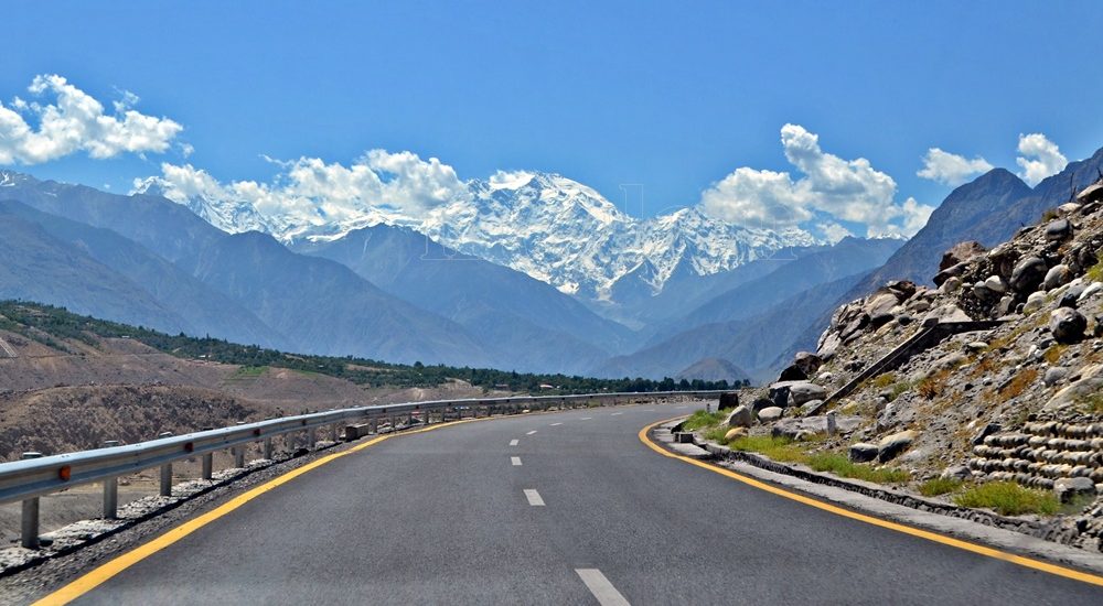
Exploring the Karakoram Highway: A Journey Through History and Scenic Beauty The Karakoram Highway (KKH) stands as a testament to human determination and engineering feats. It connects China and Pakistan via the Khunjerab Pass, situated at an awe-inspiring altitude of 4,733 meters. This epic roadway is not just a trade artery but also a legendary tourist attraction. It offers a captivating blend of historic landmarks, cultural diversity, and breathtaking natural beauty. For adventure enthusiasts, embarking on a journey along the KKH is an absolute thrill. Traversing Pakistan’s Section: A Scenic Odyssey The KKH adventure begins in Hasanabdal, Punjab, Pakistan. It stretches across an impressive 887 kilometers until it reaches the Khunjerab Pass at the Pak-China border. Along this route, the highway meanders through the rugged terrain of Khyber Pakhtunkhwa (KPK). It then follows the course of the Indus River and gracefully navigates the Karakoram and Pamir Mountains. Eventually, it meets the Chinese segment at Khunjerab Pass. In China, this remarkable highway is known as the Friendship Highway. Due to the harsh conditions it was built, it is sometimes referred to as the “Eighth Wonder of the World.” Unveiling the Route: A Glimpse into the Length The total length of the Karakoram Highway spans approximately 1,300 kilometers, with 887 kilometers in Pakistan and 413 kilometers in China. While the new route doesn’t exactly replicate the ancient Silk Route, it closely follows the same region, reviving the spirit of this historic trade network. The construction of the KKH came at a significant human cost, with both Pakistani and Chinese laborers toiling relentlessly to complete each kilometer of this ambitious project. Chinese workers who lost their lives during construction are honored at the Chinese cemetery, China Yadgar, in Danyore near Gilgit. Historic Roots: A Glimpse into the Past Historically, the Karakoram Highway was a vital caravan trail, serving as one of the branches of the ancient Silk Route. Over centuries, traders, pilgrims, warriors, and common folk traversed this route, ushering in profound changes in the social, cultural, and economic aspects of the region. The Saga of Construction: Overcoming Challenges Before the Karakoram Highway was built, the northern areas, now known as Gilgit-Baltistan, attracted the interest of the Russians, Chinese, and British, owing to its strategic significance. However, access to the region was a formidable challenge. In the 1800s, the British, who were in power, aimed to bolster their authority by constructing an all-weather communication infrastructure along the Indus. Realizing this vision was no small feat. Initially, the British improved an old Srinagar foot track, transforming it into a mule track. Later, a seasonal passage was established through Chilas, crossing the Babusar Pass to connect to the Kaghan Valley. Unfortunately, this passage remained open for only about six months a year during the summer. Following the partition of the subcontinent in 1947, the Srinagar road was permanently blocked. This period saw the northern areas divided into several states under local rulers. In 1958, the Indus Valley Road (IVR) project was conceived to create an all-weather road link between Swat and Gilgit. Construction commenced in 1959 as a joint venture between the two governments. Then, in 1966, a Sino-Pak agreement transformed the IVR into the Karakoram Highway. Despite financial constraints and the outbreak of the war between Pakistan and India in 1971, China’s invaluable support enabled the project to continue. Originally planned to stretch from Thakot to the Khunjerab Pass, the entrance point was later shifted to Hasan Abdal, and the project was completed in 1979. The highway was finally opened to the public in 1986. During construction, approximately 800 Pakistanis and 200 Chinese workers lost their lives, primarily due to landslides. Unofficial estimates suggest an even higher toll. The Chinese workers were laid to rest at the Chinese Graveyard in Danyore near Gilgit. A Path to Reconstruction: Upgrading the KKH In June 2006, Pakistan’s National Highway Authority (NHA) and China Road and Bridge Corporation (CRBC) signed an MoU to upgrade the KKH, expanding its overall width from 10 to 30 meters. This expansion aimed to accommodate heavy-duty vehicles, even in extreme weather conditions. Although construction took place, the width remained largely unchanged from the original design. During the construction phase, a significant event occurred on January 4, 2010, known as the Attabad incident. A massive landslide in the Attabad valley of Hunza damaged a section of the highway, creating a 23-kilometer-long lake and disrupting travel along the Karakoram Highway. To restore the road link between Pakistan and China, the construction of tunnels along a revised 24-kilometer route began in July 2012 and was completed in September 2015. This realigned route featured five tunnels and a bridge, rejuvenating the connection between the two countries. The Geopolitical Significance: A Strategic Artery The Karakoram Highway traverses a region marked by towering mountains and geological complexities, where China, Tajikistan, Afghanistan, and Pakistan converge within a 250-kilometer radius. Due to the intricate Kashmir conflict between India and Pakistan, the KKH holds strategic and military importance for these nations, especially Pakistan and China. Beyond geopolitics, the Karakoram Highway has significantly bolstered trade and tourism between Pakistan and China. The construction of the highway resulted in uplifting the living standards of the local population. The China-Pakistan Economic Corridor (CPEC) is set to bring substantial economic gains to the region, with plans to connect the Karakoram Highway to the southern port of Gwadar in Balochistan through the Chinese-aided Gwadar-Dalbandin railway, extending to Rawalpindi. Discovering Tourist Gems: Treasures Along the KKH The Karakoram Highway has earned international acclaim as a niche adventure tourism destination. Beginning in Hasan Abdal, about 50 kilometers from Rawalpindi city, this dual-carriage asphalt ribbon departs from the dusty plains of Punjab, embarking on a journey through the lower Himalayas of Hazara district. As it heads north, it winds through numerous captivating natural and historic sites, ultimately reaching the Pakistan section’s culmination at the Khunjerab border in the upper Hunza valley. This 887-kilometer stretch of the Karakoram Highway in Pakistan is a diverse tapestry of tourist attractions. From the

The Karakoram Highway Read Post »

, , , , , , , , , , , , , , ,
Passu Cathedral
Gilgit-Baltistan, Mountains

Passu Cones

Passu Cones: A Natural Wonder in Pakistan’s Karakoram Range Hidden in the grandeur of Pakistan’s Karakoram Mountain Range, the Passu Cones offer an unforgettable sight. These jagged, cathedral-like peaks, situated north of the serene Passu Valley and across the Hunza River, rise dramatically into the sky. Renowned for their distinctive shape, these spires have become one of the most iconic and photographed landscapes in the Gilgit-Baltistan region, showcasing the untamed beauty of Pakistan’s northern terrain. The Mystique of Passu The origins of the name “Passu” remain a mystery, but the region itself is a treasure trove of natural and cultural attractions. Visitors can explore the charming Passu Village, marvel at the icy grandeur of the Passu Glacier, admire the soaring Passu Peak, or gaze at the famed Passu Cathedral. All of these wonders are easily visible from the legendary Karakoram Highway (KKH), making the journey as memorable as the destination. Where Are the Passu Cones? The Passu Cones are located near Passu Village, approximately halfway between Gilgit and the Khunjerab Pass, the border crossing between Pakistan and China. Situated about 50 km from Karimabad and 150 km from Gilgit, they are part of the Batura Muztagh Range within the Karakoram system, one of the world’s most challenging and awe-inspiring mountain ranges. Locally known as Tupopdan, these peaks are also referred to as the Passu Cathedral or Cathedral Spires. They first captured international attention when British mountaineers scaled them in 1987, further enhancing their mystique and allure. What Makes Passu Cones Unique? The Passu Cones are celebrated for their dramatic, pyramid-like structure, which creates a stunning silhouette against the sky. Standing at an elevation of 6,106 meters (20,033 feet), they form a striking backdrop to the lush valleys and the tranquil Hunza River below. Unlike many remote peaks in the region, the Passu Cones are easily accessible from the Karakoram Highway, making them an ideal destination for travelers of all levels. Their ability to reflect light at sunrise and sunset creates a mesmerizing display of colors, from golden hues to deep shadows, captivating visitors and photographers alike. Captivating Beauty of Passu Cones The Passu Cathedral is perhaps the most recognizable feature of the Passu Valley. Soaring nearly four kilometers from its base, this pyramid-like peak is a testament to the raw power of nature. As the day begins, the first rays of sunlight illuminate the cones’ jagged edges, casting a play of light and shadow across their surface. During winter, the peaks become cloaked in snow, adding a pristine white brilliance to their already majestic presence. At sunset, the peaks glow with golden and bronze hues, offering an unforgettable visual treat for spectators. Getting to Passu Cones By Road: From Gilgit, take the Karakoram Highway toward Hunza. Public buses and private vehicles are readily available. By Road: From China, take the Karakoram Highway toward Hunza via Khunjerab Pass. Public buses and private vehicles are readily available from Tashkurghan. By Air: Fly to Gilgit from Islamabad and continue by road to the Hunza Valley. Tips for Visitors Stay hydrated and be mindful of altitude changes. Wear sturdy shoes, especially if you plan to trek. Respect the customs and traditions of the local community. Bring a camera—every moment at the Passu Cones is worth capturing. Why Visit Passu Cones? The Passu Cones epitomize the wild beauty of northern Pakistan, offering an experience that is both awe-inspiring and deeply moving. Whether you’re chasing adventure, capturing stunning photographs, or simply soaking in the serenity of nature, the Passu Cones promise memories that will last a lifetime. Best Time to Visit The ideal time to visit the Passu Cones is between April and October, when the weather is pleasant, and the natural surroundings are at their most vibrant. Spring and autumn are particularly stunning, with blooming flowers and colorful foliage. Winter brings a magical, snow-covered charm but can make road access more challenging. Nearest Attractions Passu Glacier Hussaini Suspension Bridge Borith Lake Batura Glacier Borith Lake Afsang View Point Ondra Poygah Attabad Lake Haldikish Yak Grill Rainbow Bridge Khunjerab Pass

Passu Cones Read Post »

, , , , , , , , , , , , , , , ,
Scroll to Top