Tourist attractions in Gilgit-Baltistan

Phander Lake
Gilgit-Baltistan, Lakes, Tourists Destinations in Pakistan

Phander Lake

Exploring Phander Lake: A Jewel in Gilgit-Baltistan’s Crown The Phunder Lake is located in the Phunder Valley of Ghizer District in Gilgit-Baltistan, Pakistan. The lake sits at an impressive altitude of 11,500 feet (3,505 meters) above sea level. The Phunder Lake graces the enchanting Phander Valley in the Ghizer district of Gilgit-Baltistan, Pakistan. This captivating lake not only serves as a vital freshwater reservoir but also hosts thriving populations of trout. Thanks to its primary source, the Ghizer River which is abundant in Trout Fish. Situated on the picturesque Gilgit-Chitral Road, Phunder Lake is a pivotal gateway to the Chitral district. The lake also falls on the way to Shandur Pass, where the illustrious Shandur Polo Festival unfolds annually. Nango Chatt: The Local Gem Known to the locals as Nango Chatt, Phander Lake is an embodiment of tranquility and natural grandeur. Its crystal-clear waters, plunging to an astounding depth of 44 meters. The lake is teemed with lush aquatic flora and plants even visible even from a distance. The lake’s periphery boasts a stunning border of poplar trees, enhancing its overall charm. Snuggled amidst imposing mountains and verdant valleys, Phander Lake finds itself nestled between two imposing ridges. The entire scenery offers a breathtaking panorama of the valley and the lake itself. One end of the lake is enclosed, while the other serves as the primary inlet, continuously replenishing the lake’s pristine waters from the river. A Seasonal Spectacle Phander Lake transforms into a canvas of ever-changing beauty throughout the year, making it a magnet for nature enthusiasts and thrill-seekers alike. On the western ridge, you’ll discover a government rest house, while the eastern ridge is home to a modest cluster of PTDC Motels, both providing unrivaled vistas of the lake and the cascading valleys below. The narrow western ridge, separating the valley from the lake, offers sweeping views of the entire expanse. A Haven for Explorers Phander Valley is a treasure trove for day-trippers and overnight adventurers. Beyond the scenic landscapes, the local cuisine steals the spotlight, with its delectable trout fish, organic vegetables, and a variety of fruits that tantalize the taste buds. Accessible from Both Ends Phander Lake enjoys a strategic location at the crossroads between Gilgit and Chitral, making it easily accessible from either direction. From Gilgit, the journey spans approximately 173 kilometers, with a travel time of around 5 hours, promising a scenic drive through this mesmerizing region. Renovation of Gilgit-Chitral Road is in progress. The completion of the project will ultimately reduce the travel time from 5 hours to about 3 hours.

Phander Lake Read Post »

, , , , , , ,
Rakaposhi View Point from the Karakoram Highway
Gilgit-Baltistan

Rakaposhi View Point

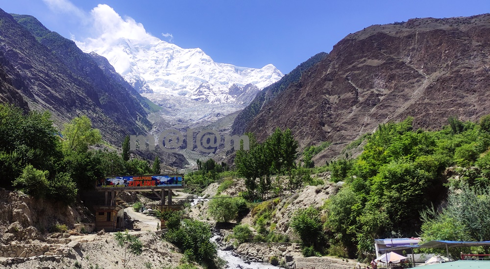
Rakaposhi View Point -A Close Encounter With The Shining Wall The Rakaposhi View Point undoubtedly stands as a testament to the unparalleled beauty of nature. The view point is situated in Ghulmet village, on the main Karakoram Highway, within the enchanting Nagar Valley. This extraordinary viewpoint offers an up-close and personal encounter with the awe-inspiring Rakaposhi mountain. Karakoram Highway: A Tapestry of Marvels The Karakoram Highway is much more than a mere asphalt artery connecting Pakistan and China through the Khunjerab Pass. It’s a highway especially adorned with a treasure trove of tourist attractions. The highway boasts natural wonders, archaeological marvels, cultural heritage, and architectural splendors. It beckons travelers to pause and immerse themselves in its allure. Rakaposhi View Point, nestled along this route, stands out as a prime exemplar of pristine natural beauty. An Oasis Amidst the Journey When traversing the road between Gilgit and Hunza, seasoned travelers always include a mandatory stop at Rakaposhi View Point. The shadow of Rakaposhi is the 27th highest peak globally, soaring at an elevation of 7,788 meters. Here one can find solace and delight in the lap of unparalelled natural grandeur. Moreover, the locale offers small terraces thoughtfully designed along the glacier-fed stream, inviting tourists to relish moments of relaxation, savor delicious meals, and capture stunning vistas. Summer Serenity: Immersing in Nature’s Bliss During the summer season, tourists revel in the joy of sitting by the stream, dipping their feet into the refreshing glacier water. Furthermore, this site is ideal for capturing the picturesque surroundings through their lenses. The symphony of flowing water, the verdant embrace of nature, and the grandeur of Rakaposhi provide an unforgettable experience. Evolution of Rakaposhi View Point The journey of Rakaposhi View Point from obscurity to acclaim has been nothing short of remarkable. The gradual surge in tourist footfall led to its growing prominence, which in turn catalyzed infrastructure development in the vicinity. The site boasts a plethora of attractions including the glacier nestled in greenery and the meandering stream driving a gentle breeze. In its nascent stage, Rakaposhi View Point was no more than a humble gift shop and a local eatery, primarily serving the needs of nearby travelers. Over time, local entrepreneurs embraced the opportunity, resulting in the establishment of gift shops, handicraft stores, convenience shops, restaurants, campsites, and even upscale tourist accommodations. A new road has been constructed, providing closer access to the glacier emanating from Rakaposhi, and work is underway to develop additional tourist attractions. The future holds the promise of turning this site into a premier tourist destination. Culinary Delights and More For travelers journeying between Gilgit and Hunza, Rakaposhi View Point stands as an ideal spot for a leisurely and sumptuous breakfast or an open-air lunch with breathtaking views. Not to be missed is the local specialty, “Chap-Shuro,” a unique kind of local pizza. The menu offers an array of fresh local cuisine at budget-friendly prices. Here, you can always count on delectable food coupled with personalized service. Rakaposhi View Point is not just a stopping point on your journey; it’s an invitation to immerse yourself in nature’s grandeur and indulge in local delights. Visit and be captivated by the magic of Rakaposhi and the wonders that surround it.

Rakaposhi View Point Read Post »

, , , , , , , , , , , , ,
Victory monument of Taj Mughal
Gilgit-Baltistan, Monuments

Victory Monument of Taj Mughal

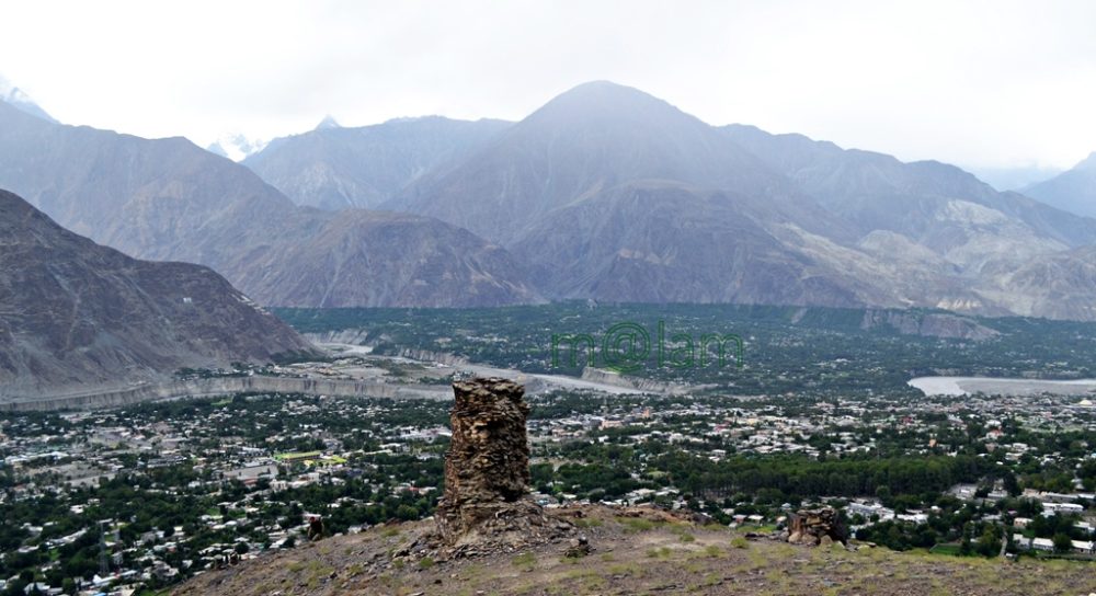
Exploring the Majestic Victory Monument of Taj Mughal Unveiling the Remarkable Tale of the 700-Year-Old Commemorative Tower in Gilgit, Pakistan Nestled gracefully upon the southern mountains of Gilgit town, Gilgit-Baltistan, Pakistan, stands the splendid Victory Monument of the Taj Mughal. Undoubtedly, the monument is a testament to history, triumph, and timeless beauty. With a history spanning over 700 years, this commemorative tower bears witness to the legacy of Taj-ud-Din Mughal. Taj-ud-Din was an Ismaili ruler from Badakhshan who graced Gilgit-Baltistan with his presence during the 13th century AD. Erected by his devoted soldiers, this monument stands tall at 21 feet and 10 inches, with a circumference of 14 feet and 4 inches, perpetuating the memory of his glorious victory. Journey to the Past: Unveiling the Monument’s Origin The Victory Monument of the Taj Mughal finds its sacred abode against the stunning backdrop of the southern mountains of Gilgit city. The Monument majestically sits about 1000 feet above Gilgit town. This awe-inspiring edifice not only oversees the enchanting villages of Gilgit and Danyore but also narrates a saga of victory and courage that continues to captivate the hearts of those who tread its path. Unveiling the Pathways: A Scenic Staircase Adventure Gone are the days of arduous treks and intricate routes. In order to promote history and tourism, access to the monument has been made easy. From the city center or the bus station, one can drive towards Serena Hotel in Jutial and follow the signboards leading to the hiking point. The monument is now reachable via a splendid flight of stairs, gracefully winding its way through rocky trails. These trails, adorned with the raw beauty of nature, create an immersive experience that heightens the anticipation of the forthcoming spectacle. As each step is taken, a sense of excitement and wonder builds, propelling us toward our destination. Cycle Track Marvel: A Gateway from Barmas to Jutial Adding to the allure of this journey is the newly constructed water channel Cycle Track, connecting Barmas to Jutial, Gilgit. One can do the monument from Barmas, the southern end of Gilgit, as well while enjoying the majestic views of Gilgit and surrounding valleys along the cycling trail. This ingeniously designed pathway presents an alternative route, one that promises a unique blend of adventure and tranquility. Unveiling the Monument’s Grandeur Architectural Resplendence: A Glimpse into the Monument’s Construction Erected upon the ridge of the Rocky Mountains, the Victory Monument stands as an embodiment of architectural finesse. Crafted meticulously with local stone and clay, this circular tower resonates with the echoes of a bygone era. Yet, the passage of time has not been without its effects, as the monument’s structural integrity slowly wanes, hinting at the ephemeral nature of existence. Temporary support has been tendered to its base, while the southern façade bears the marks of weathering, urging for a much-needed restoration. A Panoramic Tale: The Enchanting Vistas from the Monument’s Peak Gazing from the heights of the Victory Monument, one is rewarded with an awe-inspiring panorama that unfurls before the eyes. Gilgit town, stretching from Bagrot in the east to Baseen in the west, is caressed by the winding embrace of the Gilgit River. The tower, known as “Shikaari” in the local Shina language, offers an unobstructed view of the surrounding valleys, cradled by vigilant mountain sentinels. Embracing the Experience: Best Time & Route to Embark Packing Essentials: The Checklist for a Memorable Voyage The monument can be accessed at any time of the year. During peak summers, only early morning or late afternoon time is suggested to avoid heat. Preparation is the key to a fulfilling visit to the Victory Monument. As you tread upon the barren mountain terrain, remember to arm yourself with a water bottle, ensuring hydration amidst the arid landscape. Similarly, the scorching sun necessitates the application of sunburn cream, while sturdy shoes guarantee secure footing. Complete your ensemble with sunglasses, and a hat/cap, and equip yourself with a camera or cell phone to capture the moments that unfold. Embarking Beyond: Exploring Gilgit’s Treasures Beyond the resplendent Victory Monument, Gilgit extends an invitation to delve into its treasury of attractions. Venture into the embrace of ancient history as you encounter the 7th-century Karga Buddha, a silent sentinel of bygone times. In addition, Biddulph House, Hal Ga Naal, Hanzal Stupa, Gilgit Suspension Bridge, Chinar Bagh, Buddhist Rock Carvings, and the hiking track near KIU await your exploration. Each movement narrates a unique chapter in the tale of Gilgit’s legacy. Charting Your Course: Navigating to Gilgit Accessing Gilgit is a journey that intertwines with the thrill of the destination. Flights operate daily from Islamabad, weather permitting, offering a gateway to this realm of wonder. Likewise, roadways pave the way from Islamabad along the (Karakoram Highway) KKH and from Chitral via the Gilgit-Chitral road. While those journeying from Kashgar in China tread the path along the KKH—the months from May to mid-October emerge as the optimal time to embark on this odyssey. Capturing Memories: The Must-Have Essentials A pilgrimage to Gilgit demands thoughtful preparation. Ensure a water bottle accompanies you, quenching your thirst amid the landscapes. The embrace of the sun necessitates the shield of sunburn cream, while sturdy footwear guarantees steadfast steps. Moreover, bedecked with sunglasses and a hat, seize the moment with a camera or cell phone, encapsulating memories that endure. The Victory Monument of Taj Mughal stands as a living testament to a bygone era. It proudly stands as a beacon of triumph that graces the mountains of Gilgit. As you traverse the path to this historical marvel, let the vistas of Gilgit and the tales.

Victory Monument of Taj Mughal Read Post »

, , , , , , , , , , , ,
Phander Valley
Gilgit-Baltistan

Phander Valley

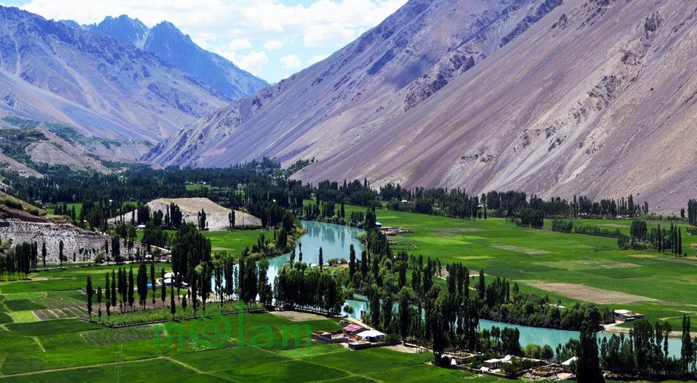
Unveiling the Enchanting Beauty of Phander Valley: A Nature Lover’s Paradise Nestled in the heart of the Ghizer District of Gilgit-Baltistan in Pakistan lies the breathtaking Phander Valley. This hidden gem is renowned for its unrivaled grandeur and sheer natural beauty. What truly sets this valley apart is, in fact, its remarkable display of diverse colors, changing with the seasons. Moreover, the tranquil deep blue rivulet gracefully meandering through the valley’s center adds to the enchantment, creating a scene straight out of a dream. Exploring Phander’s Geography Phander finds its home in the Gupis Valley of Ghizer district, within the mesmerizing Gilgit-Baltistan region. Ghizer district shares its borders with Gilgit District to the east, Hunza-Nagar to the northeast, Diamer to the south, and Chitral district of Khyber Pakhtunkhwa to the west. A Journey Through Nature’s Masterpiece As you embark on a journey through the Ghizer District towards the Shandur Pass, you’ll be greeted by a series of tiny valleys nestled along the Gilgit River. The landscape here is undoubtedly a testament to nature’s creativity, stretching from Gilgit to Lunger near Shandur. Each stretch leading up to Lunger boasts traditional houses surrounded by lush gardens, bountiful fruit orchards, and meticulously terraced fields. Attractions Along the Way The road to Phander Valley is adorned with numerous attractions that promise an enjoyable journey without the slightest hint of fatigue. As your eyes feast on the vibrant green fields, enchanting fruit orchards and gardens, pristine lakes like Khalti Lake and Phander Lake, and the sky-blue river flowing gracefully between valleys connected by suspension bridges, you’ll find yourself immersed in a unique and awe-inspiring experience. Likewise, the clear glacial waters and natural springs that dot the landscape further add to the visual delight. A Mosaic of Cultures Beyond its diverse landscape, Ghizer District boasts a rich tapestry of cultures that make it even more enticing. The residents here speak a multitude of languages, including Shina, Khuwar, Burushaski, and Wakhi, depending on the region. These diverse cultures coexist harmoniously, and the warm and welcoming locals lead simple lives, sustaining themselves primarily through agriculture. The Pinnacle of Scenic Beauty While the entire district is a visual treat, the Phander Valley stands out as a heavenly masterpiece. This bowl-shaped valley is formed by a natural barricade at its eastern end, where the PTDC Motel overlooks the breathtaking Phander Lake. Additionally, a government rest house perched on a ridge offers panoramic views of both the valley and the lake. A Nature Lover’s Paradise Phander Valley boasts a natural setting that is truly one-of-a-kind. Lush plains cover the valley’s base, separated by the calm, deep blue waters gently flowing downstream. These waters further teem with trout, a regional delicacy that every tourist should savor. Easy Access to Paradise Phander is conveniently located approximately 173 kilometers west of Gilgit town, making it easily accessible. The journey typically takes around five hours, depending on the pace. The Gilgit-Chitral road is undergoing reconstruction currently. Upon completion, the journey will be reduced to about 3 hours. For those traveling via Chitral, Phander can also be reached via the scenic Shandur Pass. Phander Valley is a testament to the splendor of nature, offering a harmonious blend of diverse landscapes, rich cultures, and serene beauty. Whether you’re an adventure seeker or a nature enthusiast, this enchanting valley promises an unforgettable experience that will leave you in awe of the natural world’s wonders.

Phander Valley Read Post »

, , , , , , , , , , , , ,
Khalti Lake
Gilgit-Baltistan, Lakes

Khalti Lake

Exploring Khalti Lake in Ghizer District: A Natural Gem Khalti Lake, nestled in the captivating embrace of the Ghizer District in Gilgit-Baltistan, is a true natural wonder waiting to be discovered. Situated at an impressive altitude of 2,217 meters above sea level, this enchanting lake derives its name from the charming village of Khalti. The Lake is a prominent attraction for travelers, offering a serene oasis partly enveloped by verdant terraced fields and a dense tree line, and partly bordered by the majestic Rocky Mountains. Ghizer District: Gateway to Adventure To reach Khalti Lake, one must embark on a journey of approximately 116 kilometers from the bustling heart of Gilgit town, which takes around 3 to 4 hours by car. The road to the lake follows a winding asphalt path that runs parallel to the meandering Ghizer River. Along this scenic route lies a breathtaking gorge that leads to the renowned Shandur Pass. While en route, travelers are treated to awe-inspiring views, making the journey itself an unforgettable part of the adventure. Moreover, Khalti Lake, along with Phander Lake and the Phunder Valley, makes it a popular day trip destination from Gilgit, making it easily accessible for tourists. Khalti Lake: Nature’s Masterpiece Khalti Lake owes its existence to the Ghizer River, which stretches near the village of Khalti. This stunning lake showcases its beauty in all four seasons, each offering a unique spectacle. In spring, Khalti village, gracing the western bank of the lake, bursts into magnificent blooms. Summers bring a sense of serenity, as the lake and its surroundings become a lush green retreat. The autumn season paints the region with vibrant colors, creating a romantic ambiance around the lake. Even in winter, when the lake’s surface is adorned with a frosty layer, it transforms into a playground for local youth to engage in cultural celebrations and games. A Treasure Trove of Freshwater Khalti Lake is not only a visual delight but also a vital source of freshwater. It is home to an abundant population of local trout, a species that can be found throughout the Ghizer River. Originally introduced near the westernmost Golaghmuli Village, these trout have multiplied and spread across the Gupis Valley, offering tourists an excellent opportunity for fishing. Water Sports and Investment Opportunities For adventure seekers, Khalti Lake offers immense potential for water sports. Throughout the year, the local community, in collaboration with the tourism department of Gilgit-Baltistan, organizes various sports activities. Additionally, there are lucrative investment prospects in water sports activities. The region still has ample room for standard boarding and lodging facilities. PTDC (Pakistan Tourism Development Corporation) has a building with limited accommodation but is currently closed. There is a growing demand for more comprehensive lodging services. Weather: When to Visit The best time to explore Ghizer District and the Lake is during the pleasant summer months, from May to October, when temperatures remain comfortable. However, it’s important to note that winters in the region can be harsh, with temperatures often dropping 10 degrees below freezing point on average. This icy chill freezes everything in and around the lake, and snowfall is a common occurrence. Khalti Lake in Ghizer District is a hidden gem that offers a perfect blend of natural beauty and adventure. Whether you are a nature enthusiast, a fishing aficionado, or a water sports enthusiast, this pristine destination has something to offer everyone. Plan your visit wisely to make the most of this captivating locale and create memories that will last a lifetime.

Khalti Lake Read Post »

, , , , ,
Rama Lake
Gilgit-Baltistan

Rama Lake

Exploring Rama Lake: A Himalayan Gem in Gilgit-Baltistan Nestled at a breathtaking altitude of 3800 meters, Rama Lake stands as an iconic jewel in the pristine Astore district of Gilgit-Baltistan, Pakistan. This high-altitude lake, perched gracefully above Rama Meadows, offers a remarkable natural spectacle. While the lake itself is awe-inspiring, the immediate surroundings have faced challenges from illegal logging, resulting in a treeless landscape. Nonetheless, Rama Meadows, situated at 3300 meters, remains a lush oasis, adorned with towering trees like pine, cedar, fir, and juniper. Unveiling the Attractions Rama Lake: A Magnificent Oasis Rama Lake takes center stage as one of the most alluring attractions, magnetizing a substantial influx of both domestic and international tourists throughout the year. This picturesque lake, nestled against the southern ridge of Nanga Parbat, offers a captivating spectacle. On a clear day, it mirrors the snow-capped majesty of Nanga Parbat, known as the “Killer Mountain” (standing tall at 8126 meters), creating a mesmerizing inverted image. A Nature Lover’s Paradise The environs of Rama Lake harbor a diverse range of flora and fauna. Here, one can encounter various medicinal plants and a fascinating array of wildlife, including the golden marmot, ibex, musk deer, snow leopard, and rock partridge. Along the trail from Rama Meadows to the lake, you’ll encounter three small lakes known as “Sarot” in the local Shina language. Explore Rama’s Beauty A Must-Visit Destination Rama Valley and Rama Lake are undisputed must-visit destinations for travelers making their way to or from Deosai. For those with limited time, the lake can be explored as a captivating day excursion from Gilgit. For a more comprehensive journey, consider an ideal itinerary that encompasses Fairy Meadows, Rama, Deosai, and Skardu, offering a week-long adventure. To elevate your experience, don’t miss the opportunity to add Gilgit and Hunza to your travel program. Weather: A Seasonal Symphony Seasonal Transformation Rama Meadow undergoes a dramatic transformation with the changing seasons. During winters, it’s blanketed in pristine snow, while in summers, it transforms into a vibrant green paradise, making Rama an idyllic camping spot. The lake, too, transitions from being frozen in winter to a refreshing oasis where you can take a dip on a warm summer day. Rama Lake presents an ideal option for a half-day hike from Rama Meadows, promising an unforgettable experience. Accessing Rama: Your Gateway to Adventure Connecting to Astore Rama is part of the rich tapestry of valleys and key tourist destinations in Astore, Gilgit-Baltistan. To reach this paradise, travelers can take advantage of the well-connected transportation network. Astore itself is conveniently linked to Gilgit, which is accessible both by air (weather permitting) and by road. The iconic Karakoram Highway (KKH) ensures a year-round road link between Islamabad/Rawalpindi and Gilgit. While in the summer, the Gilgit-Naran route via the Kaghan Valley and Babusar Pass offers a scenic drive. The Journey From Islamabad, embark on a scenic drive along the Karakoram Highway, heading towards Gilgit. After crossing Raikot Bridge, continue for approximately 20 more minutes, following the sign directing you to Fairy Meadows. Take the right turn indicated, leading you on a 45-kilometer (about 2-hour) journey to Astore Bazar. From there, it’s just another 9 kilometers of uphill driving, leading you to Rama Lake. The Lake is nestled within the embrace of Rama Meadows, where the primary campsite awaits, ready to welcome adventurers. Rama Lake in Gilgit-Baltistan is a natural wonder that beckons explorers and nature enthusiasts from far and wide. Its picturesque beauty, diverse wildlife, and easy accessibility make it a must-visit destination for those seeking an unforgettable Himalayan experience. Whether you’re planning a day trip or a week-long adventure, Rama Lake promises to leave an indelible mark on your soul.

Rama Lake Read Post »

, , , , , , , ,
Sheosar Lake in Deosai National Park
Gilgit-Baltistan, Lakes

Sheosar Lake

Sheosar Lake: The Hidden Gem of Deosai National Park Discover Sheosar Lake: A Himalayan Wonder Nestled within the picturesque landscape of Deosai National Park in Gilgit-Baltistan, Pakistan, Sheosar Lake stands as a testament to the awe-inspiring beauty of nature. Perched at a breathtaking elevation of 13,589 feet, it’s often referred to as the heart of Deosai and ranks among the world’s highest-altitude lakes. Throughout the year, the surroundings of Sheosar Lake transform, painting a mesmerizing canvas of nature’s vivid hues. Certainly, this pristine oasis is not only a visual treat but also a haven for rare flora and fauna. Unveiling the Local Legend The name “Sheosar” is derived from the local Shina language, where “Sheo” means blind and “Sar” means water. Hence, it’s commonly known as the “Blind Lake.” Spanning approximately 2.3 kilometers in length, 1.8 kilometers in width, and with an average depth of 40 meters (131 feet), this lake is teeming with fish, making it a vital food source for the brown bear during the winter months. A Tourist’s Paradise Sheosar Lake has become a must-visit destination, nestled on the border between the Karakoram and Himalaya mountain ranges. The lake is surrounded by gently sloping mountains that offer excellent hiking opportunities. On clear days, visitors can even catch a glimpse of Nanga Parbat, Pakistan’s second-highest peak, towering at a staggering 8,126 meters above sea level. Furthermore, the panoramic views encompass distant snow-clad mountains and expansive plains. Camping in Tranquility For adventurous souls seeking an overnight experience, designated camping sites are available on the north side of the lake. Ample parking space is provided for those wishing to pitch their own tents. However, it’s important to note that the lake’s water is not suitable for drinking. Fortunately, there’s a nearby spring that serves as a source of clean, refreshing water. Nature’s Spectacle: Sunrise and Sunset Deosai is renowned for its stunning sunrises and sunsets. On clear days, the weather remains pleasantly cool, with captivating views of the surrounding mountain peaks embracing the meadows. The lake itself becomes a natural masterpiece during the summer months, with its tranquil blue waters contrasting beautifully with the lush green grassy shores and snow-dusted mountain slopes. Photographers are in for a treat, as they can capture the essence of paradise in every frame. Seasons in Transition The climate in Deosai is as unpredictable as it is enchanting. While July and August are generally pleasant, with lush green meadows, even these months can witness unexpected snowfall. Surprisingly, Sheosar Lake undergoes a remarkable transformation in different seasons. During the summer, it showcases crystal-clear blue waters surrounded by a sea of green grass and blooming flowers. As autumn arrives, however, the grass turns a rustic brown, while winter blankets the entire region in a thick layer of snow. Embarking on the Journey Reaching Sheosar Lake in Deosai National Park is possible via two main routes: one through Astore Valley and the other through Skardu. The Astore route is relatively more accessible, with most of the road leading to the lake being paved. However, it’s advisable to use a 4WD vehicle for a trouble-free journey. The journey from Astore to the lake is a captivating experience in itself. The road winds through stunning valleys, past crystal-clear waters, lush green meadows adorned with alpine flowers, babbling streams that nourish the grasslands, glaciers, and magnificent green peaks capped with snow, offering a constant breeze of refreshing coolness. The warmth and hospitality of the local people add an extra layer of charm to this incredible journey. For those opting for the Skardu route, be prepared for a longer and more rugged journey. However, the path through the wilderness, adorned with alpine flowers and glimpses of snow-capped mountains, is a visual feast. Key stops along the way include Bara Pani and Kala Pani, both offering their own share of natural beauty before you finally arrive at Sheosar Lake. Sheosar Lake in Deosai National Park is a hidden gem waiting to be discovered by nature enthusiasts and adventure seekers. Its ever-changing beauty, from the vibrant summers to the serene winters, makes it a destination worth exploring. Whether you’re captivated by its legends, drawn to its wildlife, or simply seeking tranquility in the wilderness, Sheosar Lake promises an unforgettable experience in the heart of the Himalayas.

Sheosar Lake Read Post »

, , , , , , , , , , , , , , , , ,
chinese graveyard in danyore
Gilgit-Baltistan, Tombs

Chinese Graveyard

Chinese Graveyard: A Memorial of Mighty Engineers and Workers The Chinese Graveyard is locally known as China Yadgar or The Memorial Park. It stands as a poignant tribute to the mighty Chinese engineers and workers. The graveyard symbolizes the ultimate sacrifice during the construction of the Karakoram Highway (KKH) in the 1960s and 1970s. It is located in Danyore, approximately 10 km from the capital city of Gilgit-Baltistan in Pakistan. The cemetery serves as the final resting place for those who played a significant role in building the 1300 km (Pakistan: 887 km & China: 413 km) long Karakoram Highway. Historic Background of Karakoram Highway The Karakoram Highway was a remarkable joint venture between Pakistani and Chinese workers and engineers. It claimed the lives of 810 Pakistanis and about 200 Chinese during its construction. It was commenced in 1959 and concluded in 1977. The highway was officially opened to the public in 1979. As the KKH was being built on the Pakistani section, the Chinese workers who lost their lives were laid to rest in what is now known as the Chinese graveyard. Establishment and Renovation The Chinese graveyard was established in the early 70s. It served as a solemn reminder of the sacrifices made during the construction of the KKH. Recognizing its significance, the Chinese government decided to renovate the cemetery, and in 2013. Its renovation was carried out through a Chinese-funded project that successfully restored its condition. The Consular of the Chinese Embassy, Mr. Zhang Lianyou, and the then Gilgit-Baltistan (G-B) Assembly Speaker, Mr. Wazir Baig, laid the foundation stone for the new cemetery on April 05, 2013. The project was completed in October of the same year. Access and Location Access to the memorial park is open and free. A  designated custodian is appointed by the Chinese government to oversee its maintenance. Upon entering the main gate, visitors are greeted with a pictographic display on both sides of the pathway. These pictures depict the arduous construction work carried out by Chinese workers and engineers on the KKH under harsh conditions. Additionally, the display showcases the medical aid provided by Chinese doctors to the local community during the highway’s construction. A series of pictures with accompanying information highlights the reconstruction of the KKH. Moreover, the pictures feature the formation of tunnels, the erection of major bridges (such as the one in Shishkat over Attabad Lake and in Danyore over Gilgit River), and the provision of emergency transportation services across Attabad Lake amidst challenging environmental conditions. The display also offers historical information about the KKH in Urdu, Chinese, and English languages, presented on an adjoining concrete structure. Design and Layout The Chinese graveyard features a thoughtful design with four equally sized quarters bordered by a footpath. Each quarter comprises three rows of graves, totaling 27 tombs per quarter, amounting to 108 tombs in all four quarters. Each grave is marked by a tombstone bearing epitaph inscriptions in Chinese characters. Notably, 16 tombs in one of the quarters remain empty, representing the workers who lost their lives under debris during massive landslides or other incidents during the highway’s construction. Maintained with utmost care, the Chinese graveyard has become not only a place of remembrance but also a significant tourist attraction. It stands as a powerful symbol of the invaluable lives lost in pursuit of the Karakoram Highway. Moreover, the cemetery serves as a testament to the enduring friendship between Pakistan and China. The friendship continues to grow stronger over time. The Chinese Graveyard, or China Yadgar, stands as a solemn memorial to the indomitable spirit of the engineers and workers who contributed to the construction of the Karakoram Highway. It serves as a reminder of the sacrifices made and a testament to the unbreakable bond between Pakistan and China. As visitors pay their respects within the serene premises of the graveyard, they can’t help but appreciate the enduring friendship that has withstood the test of time.

Chinese Graveyard Read Post »

, , , , , , , , ,
Kargah Buddha
Buddhist Heritage, Buddhist Heritage of Pakistan, Gilgit-Baltistan

Kargah Buddha

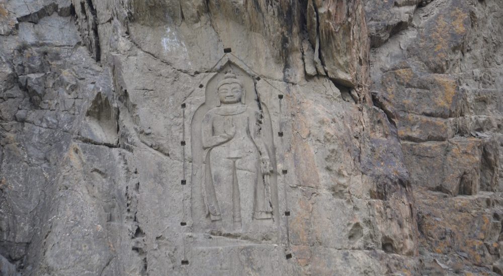
Kargah Buddha: A 7th-Century Marvel Carved in Rock At the center of Gilgit-Baltistan, Pakistan, resides an extraordinary testament to ancient artistry and spirituality – the Kargah Buddha. Carved with precision into solid rock, this majestic Buddha figure from the 7th century stands an impressive 15 feet tall and 5 feet wide, perched about 150 feet above the ground. It is situated in the scenic Kargah Nullah ravine, to the west of Gilgit city. The Kargah Buddha explicitly serves as a symbol of the region’s intricate historical, cultural, and religious heritage. Gilgit: A Hub of History and Trade Gilgit is the headquarters of the Gilgit-Baltistan region of Pakistan. The magnificent city is perched at the confluence of the Gilgit River and Hunza River, near the Junction point of three great mountain ranges. Gilgit’s historical position on the Silk Route has undoubtedly bestowed upon it a legacy of cultural diversity, religious pluralism, and historical significance. The town’s role as a trade hub and cultural crossroads has undoubtedly left a lasting impact on its history. At the same time, the city stands as a testament to the dynamic interactions that shaped the course of history at this strategic crossroads of civilizations. Various phases in the history Gilgit underwent are: Silk Route Connection: As a key point on the Silk Route, Gilgit played a crucial role in the exchange of goods, ideas, and cultures between East and West. The town served as a melting pot where diverse civilizations converged, fostering a vibrant atmosphere of cultural exchange. Buddhism in Gilgit: The period from the 3rd to the 11th century marked Gilgit as a prominent center of early Buddhism. The presence of a Buddhist monastery and stupas with Sanskrit manuscripts attests to the town’s role in the spread of Buddhism. At the same time, the constant movement of religious caravans along the Silk Route contributed to the establishment and growth of Buddhism in the region. Power Struggles: The historical narrative of Gilgit is marked by power struggles among various empires and dynasties, including the Tibetan Empire, the Kashmiri Karkota Dynasty, and the Umayyad and Abbasid caliphates. These political dynamics shaped the region’s destiny and influenced its cultural landscape. Dardistan and Islamization: By the 11th century, Gilgit had evolved into the autonomous kingdom of Dardistan. The adoption of Islam during this period significantly transformed the religious and cultural fabric of the region. The process of Islamization added another layer to the diverse cultural history of Gilgit. Cultural and Religious Interactions: The Silk Route not only facilitated the trade of goods but also enabled the intermingling of cultures and religions. Gilgit served as a meeting point for people from China, Central Asia, Kashmir, Tibet, Afghanistan, Iran, and India. This interaction contributed to the cultural diversity and pluralism that characterize the region. Archaeological Discoveries: The excavation of a Buddhist monastery and stupas with Sanskrit manuscripts in 1931 showcases the rich archaeological heritage of Gilgit. These discoveries provide valuable insights into the town’s historical importance and its connections to early Buddhist communities. Tracing the Buddhist Legacy in Gilgit-Baltistan Gilgit-Baltistan has served as a meeting point for various cultures, religions, and civilizations over centuries. Before the advent of Islam in the area, the inhabitants followed Buddhism or various indigenous pagan religions. The infusion of a diverse cultural legacy and the dissemination of Buddhism in Gilgit and its neighboring areas are intricately connected to the activities along the Silk Route. Historical records indicate that traveling Buddhist caravans would often take respite in a monastery in Gilgit. The Kargah Buddha, known as Yashani in the local language, stands as a testament to this rich historical and cultural intersection. The Karakoram Highway (KKH), which predominantly follows the ancient Silk Route, offers an intriguing glimpse into the past. The KKH attests to the enduring influence of Buddhism in the region. It is adorned with over 10,000 images of Buddha, Stupas, animals, and inscriptions in more than ten languages. This cultural dominance persisted from the 1st to the 7th century A.D. The Kargah Buddha, situated in Gilgit, is an integral part of this rock art ensemble, serving as a symbol of Buddhism’s prevalence in the area. The carving of the Buddha image into the rock was an act of devotion and reverence, with religious rituals and worship conducted at this sacred site. It stands as a testament to the profound impact of Buddhism on the culture and spirituality of Gilgit-Baltistan. The Unearthed History: Kargah Buddha’s Discovery Archaeological evidence spanning across Gilgit Baltistan (GB) indicates that the region was under the influence of Buddhism from the 3rd to the 11th century AD, with Buddhists engraving sculptures, including that of Buddha, as a form of homage to Gautama Buddha. Some historians propose that the propagation of Buddhism in GB occurred during the rule of two Kashmiri monarchs, Yakha and Yakhani. The Buddha sculpture in Kargah is believed to have been crafted in memory of Yakhani by a group of monks. Over time, the term Yakhani evolved into Yashani. Despite these historical accounts, Gilgit’s folklore features numerous myths about the Buddha that challenge both archaeological and historical findings. The revelation of the Kargah Buddha took place in 1938-39, unveiling a sculpture thought to originate from the 4th century AD. Archaeologists unearthed this notable artifact during the same timeframe. The sculpture depicts Buddha with his right hand on his chest in the Abhayamudra, a fearless pose, while the left-hand hangs straight, conveying a message of peace. The image features a broad and squarish face with extended ears, a flat nose, a wide mouth, compressed lips, and hair arranged tightly in a skull-like fashion. The archaeological exploration also led to the discovery of the remains of a Buddhist monastery and three stupas, situated approximately 400 meters upriver from the Buddha. This discovery followed the revelation of the renowned Gilgit manuscripts in 1931. These manuscripts, written in Sanskrit, shed light on local rulers and revered pilgrims. Moreover, the manuscripts offer compelling evidence of a flourishing scholarly community in the region. It is worth noting

Kargah Buddha Read Post »

, , , , , , , , , , , , , , , , ,
Passu Cathedral
Gilgit-Baltistan, Mountains

Passu Cones

Passu Cones: A Natural Wonder in Pakistan’s Karakoram Range Hidden in the grandeur of Pakistan’s Karakoram Mountain Range, the Passu Cones offer an unforgettable sight. These jagged, cathedral-like peaks, situated north of the serene Passu Valley and across the Hunza River, rise dramatically into the sky. Renowned for their distinctive shape, these spires have become one of the most iconic and photographed landscapes in the Gilgit-Baltistan region, showcasing the untamed beauty of Pakistan’s northern terrain. The Mystique of Passu The origins of the name “Passu” remain a mystery, but the region itself is a treasure trove of natural and cultural attractions. Visitors can explore the charming Passu Village, marvel at the icy grandeur of the Passu Glacier, admire the soaring Passu Peak, or gaze at the famed Passu Cathedral. All of these wonders are easily visible from the legendary Karakoram Highway (KKH), making the journey as memorable as the destination. Where Are the Passu Cones? The Passu Cones are located near Passu Village, approximately halfway between Gilgit and the Khunjerab Pass, the border crossing between Pakistan and China. Situated about 50 km from Karimabad and 150 km from Gilgit, they are part of the Batura Muztagh Range within the Karakoram system, one of the world’s most challenging and awe-inspiring mountain ranges. Locally known as Tupopdan, these peaks are also referred to as the Passu Cathedral or Cathedral Spires. They first captured international attention when British mountaineers scaled them in 1987, further enhancing their mystique and allure. What Makes Passu Cones Unique? The Passu Cones are celebrated for their dramatic, pyramid-like structure, which creates a stunning silhouette against the sky. Standing at an elevation of 6,106 meters (20,033 feet), they form a striking backdrop to the lush valleys and the tranquil Hunza River below. Unlike many remote peaks in the region, the Passu Cones are easily accessible from the Karakoram Highway, making them an ideal destination for travelers of all levels. Their ability to reflect light at sunrise and sunset creates a mesmerizing display of colors, from golden hues to deep shadows, captivating visitors and photographers alike. Captivating Beauty of Passu Cones The Passu Cathedral is perhaps the most recognizable feature of the Passu Valley. Soaring nearly four kilometers from its base, this pyramid-like peak is a testament to the raw power of nature. As the day begins, the first rays of sunlight illuminate the cones’ jagged edges, casting a play of light and shadow across their surface. During winter, the peaks become cloaked in snow, adding a pristine white brilliance to their already majestic presence. At sunset, the peaks glow with golden and bronze hues, offering an unforgettable visual treat for spectators. Getting to Passu Cones By Road: From Gilgit, take the Karakoram Highway toward Hunza. Public buses and private vehicles are readily available. By Road: From China, take the Karakoram Highway toward Hunza via Khunjerab Pass. Public buses and private vehicles are readily available from Tashkurghan. By Air: Fly to Gilgit from Islamabad and continue by road to the Hunza Valley. Tips for Visitors Stay hydrated and be mindful of altitude changes. Wear sturdy shoes, especially if you plan to trek. Respect the customs and traditions of the local community. Bring a camera—every moment at the Passu Cones is worth capturing. Why Visit Passu Cones? The Passu Cones epitomize the wild beauty of northern Pakistan, offering an experience that is both awe-inspiring and deeply moving. Whether you’re chasing adventure, capturing stunning photographs, or simply soaking in the serenity of nature, the Passu Cones promise memories that will last a lifetime. Best Time to Visit The ideal time to visit the Passu Cones is between April and October, when the weather is pleasant, and the natural surroundings are at their most vibrant. Spring and autumn are particularly stunning, with blooming flowers and colorful foliage. Winter brings a magical, snow-covered charm but can make road access more challenging. Nearest Attractions Passu Glacier Hussaini Suspension Bridge Borith Lake Batura Glacier Borith Lake Afsang View Point Ondra Poygah Attabad Lake Haldikish Yak Grill Rainbow Bridge Khunjerab Pass

Passu Cones Read Post »

, , , , , , , , , , , , , , , ,
Scroll to Top