Author name: admin

Islamabad Tourist Attractions
City Breaks, Islamabad

Islamabad Tourist Attractions

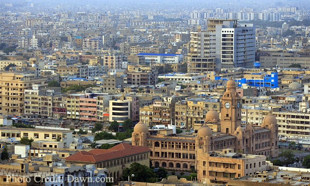
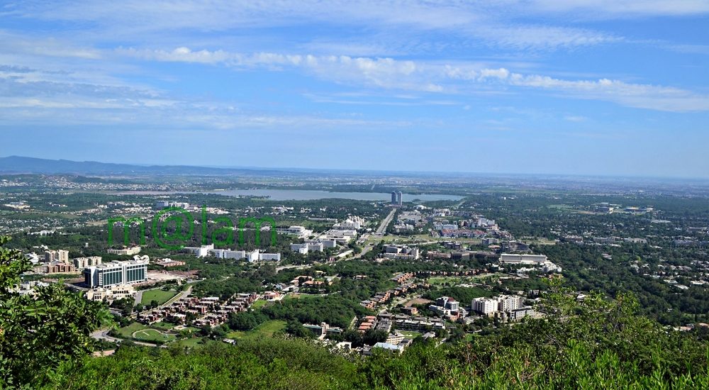
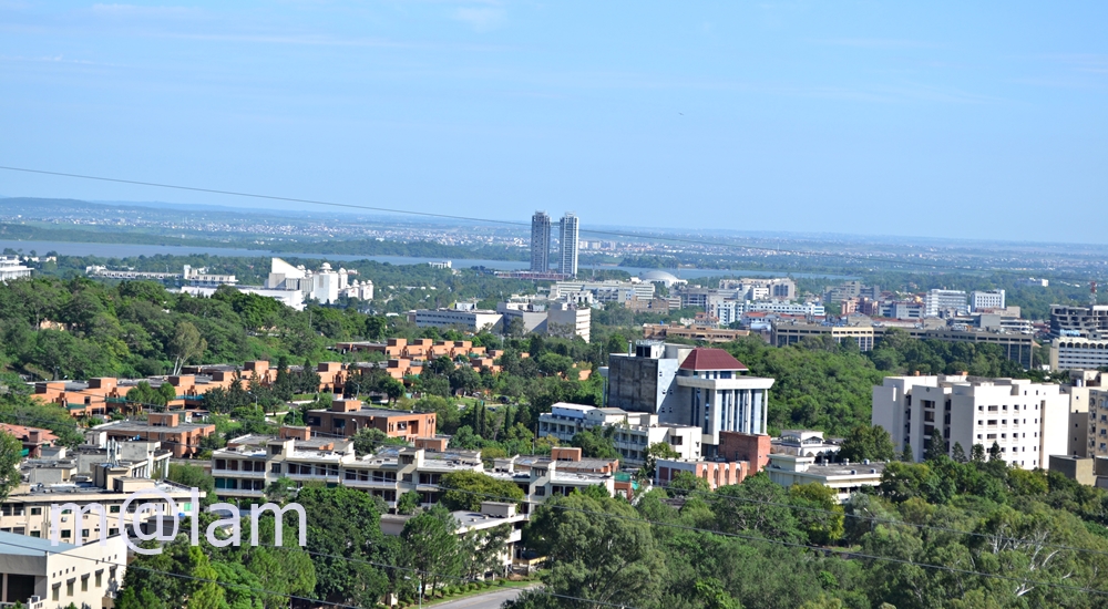
Must-See Islamabad Tourist Attractions Islamabad’s Tourist Attractions include major tourist spots found within the territory of the capital city. Surrounded by the lush greenery of the Margalla Hills, an extension of the majestic Himalayan Mountain ranges; Islamabad offers a scenic backdrop that changes with the seasons, showcasing a spectrum of natural colors. Islamabad, the capital city of Pakistan, stands out among global capitals for its unique proximity to nature. Few other capitals enjoy such a harmonious connection with the natural environment. Renowned for its breathtaking beauty, Islamabad also boasts a rich historical heritage dating back to the Stone Age. Evidence of ancient human settlements, including relics and human skulls found along the banks of the Soan River, attests to its long history. Below are the details of Islamabad Tourist Attractions. HISTORIC AND CULTURAL MONUMENTS  Shah Faisal Mosque Named after King Faisal bin Abdul Aziz of Saudi Arabia, the Shah Faisal Mosque is the largest mosque in South Asia and 6th largest in the world, located in the foothills of Margalla Hills. It was completed in 1986 at a hefty cost of USD 120 million. Bearing a contemporary design, inspired by a desert Beduine tent-shaped structure with four 80m high minarets in corners, the mosque was designed by the Turkish Architect Vedat Delokay. The interior of the Faisal Mosque is simple and elegant, with white marble walls and floors, and large chandeliers hanging from the ceiling. The prayer hall is surrounded by arched colonnades and is free from any decorative distractions, allowing worshipers to focus on prayer and reflection. The mosque can accommodate over 100,000 worshipers at a time and is open to visitors of all faiths and is a symbol of the unity and diversity of Pakistan. There is no entry fee as such but to deposit shoes it costs a minor fee. Pakistan Monument The Pakistan Monument is a popular tourist attraction and a symbol of national pride for Pakistanis. Constructed in 2004, the Pakistan National Monument in Islamabad is a heritage site and symbol of national progress built to commemorate the struggle for independence and the formation of Pakistan. The design of the Pakistan Monument is inspired by the Islamic architecture of the Mughal era. The four petals represent the four provinces (Balochistan, North West Frontier Province, Punjab, and Sindh), while the three sandwiched smaller petals represent the three territories (Gilgit-Baltistan, Azad Kashmir, and the Federal Capital Islamabad). The petals are made of granite and marble and are adorned with intricate Islamic calligraphy and patterns. The aerial views of petals represent a crescent and the central star together represents the Pakistan flag. It is illuminated at night and provides a stunning view of Islamabad and its surrounding areas. Shah Allah Ditta Caves Shah Allah Ditta Caves are situated to the west of Islamabad, about 15 km from Golra interchange, in a centuries-old village called Shah Allah Ditta (also known as Sadhu ka Bagh). The more than seven hundred-year-old village was named after a Mughal period Darvesh. The caves, however, are believed to have been a meditation spot for Buddhist monks in the 4th century BC. There are only two caves on both sides of the spring which contain traces of human existence from ancient times. Hindu families lived in Shah Allah Ditta before the partition and the caves were used for their daily worship. There is a pathway right next to the village that is said to have been used as a route from Kabul to the Taxila by Alexander the Great and Sher Shah Suri while Mughal rulers and emperors often passed through while traveling from Afghanistan to the Hindustan. Saidpur Model Village Saidpur, a 500-year-old village nestled in the Margalla hills’ foothills, boasts a rich historical legacy and draws numerous visitors. Named after Said Khan, son of Sultan Sarang, the Gakhar chief of the Pothohar region in Babur’s Mughal era, it serves as a captivating microcosm of diverse cultures coexisting harmoniously. Within its confines lie a Hindu temple, Sikh Gurdwara, and Sufi tomb, offering a unique tapestry of spiritual traditions. Originally converted into a Hindu place of worship by Mughal commander Raja Man Singh, the village has undergone restoration, transforming into a cultural hotspot and heritage site. Its terraced mud houses, showcasing traditional architecture, handicrafts, and local cuisine, provide insight into Pakistani rural life. Notable landmarks include the 16th-century Rama Mandir, dedicated to Lord Rama, and a 20th-century Gurdwara serving educational purposes. Additionally, a photo gallery depicts the village’s early lifestyle, predating Islamabad’s emergence as the capital. PARKS IN ISLAMABAD Rose & Jasmine Garden The Rose and Jasmine Garden is a picturesque public garden managed by the Capital Development Authority. Situated within the recreational zone of Shakarparian Hills, it lies adjacent to the Islamabad sports complex and Aabpara market, along the Srinagar Highway. Covering an area of 20,360 square meters, the garden boasts a diverse collection of nearly 250 varieties of roses and a dozen types of jasmine. Visitors to the nearby Pakistan Monument and Shakarparian often include a stop at this enchanting garden in their itinerary. The garden offers key amenities such as a parking area, seating areas, a walking and cycling track, and a cafeteria (Dhaba) for the convenience of the public. Japanese Childern Park Japanese Park is a children’s playground situated at the base of Margalla Hills, adjacent to Margalla Road near the F6 sector, close to Islamabad Zoo. Spanning approximately 10 acres, this park is equipped with modern amenities and is a popular destination for children and families alike. Established on 30 December 1985, it stands as a unique gift from Japan to the children of Pakistan. The park features vibrant nurseries with colorful flowers and various play areas for children, including swings, climbing nets, jumping castles, trampolines, zip lines, bouncing cushions, and slides. It offers a plethora of entertaining activities for kids to enjoy. Cherry blossom trees adorn the park, lending it an authentic Japanese ambiance. Additionally, there is a small refreshment area within the park offering snacks and beverages for

Hidden Treasures of Lahore
City Breaks, Punjab

Hidden Treasures of Lahore

Lahore is the second largest city and the cultural hub of Pakistan. The city has a charming longstanding history and is entirely rich in tourist attractions, mostly of historic and cultural significance. However, sadly, only a few conventional landmarks out of a cluster are known to the general public and tourists. The “Hidden Treasures of Lahore” have not yet been unearthed properly.  The wealth of attraction that is still hiding behind deserves to be known to the public and tourists which certainly will add to the historic significance of Lahore.  Wazir Khan Baradari The Wazir Khan Baradari (12-door pavilion) is sited between the Punjab Public Library (PPL), the National College of Arts (NCA), and the Lahore Museum and is accessible from the PPL road. It was named after Hakim Ilumddin titled ‘Wazir Khan’, a benefactor of numerous impressive buildings across Lahore including the splendid Wazir Khan’s Mosque and Wazir Khan’s Hammam ( also known as Shahi Hammam), in the Walled City. The Baradari is surrounded by a fine garden with a large number of palm trees. The two-story pavilion has been incorporated into the grounds of the Punjab Public Library in 1860 and serves as a reading room. During the 19th and early 20th centuries, Wazir Khan Baradari was used as a museum and as the Settlement and Telegraph Office under British rule. Maryam Zamani or Begum Shahi Mosque or Barood Khana Wali Masjid Maryam Zamani was one of the queens of Emperor Akbar, mother of Jahangir, and sister of Bhagwan Das. She built a mosque near Masti Gate of the Walled City in 1614 AD and is believed Lahore’s earliest surviving example of the Mughal era mosque that influenced the construction of the larger Wazir Khan Mosque. Thus it was named after the queen Maryam Zamani who was actually born Rajkumari Hira Kunwari, a Rajput princess, the daughter of Raja Bihari Mal of Jaipur (the then Amber). The mosque has a beautifully adorned prayer hall with a remarkable central dome adorned by muqarnas and painted frescos. The Mosque is close to the Akbari gate entrance and was once used as a gunpowder factory by Ranjit Singh thereby called Barood Khana Wali Masjid. However, it was restored in 1850 under the British.  Ali Mardan Khan’s Tomb Ali Mardan Khan was originally a noble at the court of Shah Tahmasp, a Safavid king. After surrendering Iranian Qandahar to Emperor Shah Jahan in 1638, he joined the Mughal court and rose to great heights rapidly and became Governor of Kashmir, Lahore, and Kabul. He was also granted the title of Amir al-Umara (Lord of Lords) in 1639 and became a commander of 7,000 troops as well was appointed viceroy of Punjab from Kabul to Delhi. Besides being a commanding figure, Ali Mardan Khan was also a renowned engineer who coined the idea of the construction of a canal from the river Ravi for the supply of water to the Shalimar Gardens, as well as for the irrigation and cultivation of surrounding areas. His tomb is a massive brick construction work standing on an octagonal podium. The structure of the tomb is also octagonal with a bulbous dome and kiosks on angular points. The tomb once stood in the center of a luxuriant garden and the extent of which could be seen by its double-story gateway. The imposing tomb is accessible by a 300 m-long walkway through the narrow streets of the Railway Carriage Workshop. Saru Wala Maqbara or Cypress Tomb The tomb of Sharf-un-Nisa Begam is popularly known as ‘Saru Wala’ Maqbara. Saru is the Urdu term used for Cypress and because of images of cypress trees used on its walls, it is thus called Cypress tomb. Sharf-un-Nisa Begam was a sister of Nawab Zakariya Khan, governor of Lahore province during the reign of Emperor Mohammad Shah Rangeela. Before her death, the Begum would read the holy Quran on daily basis on the first floor of the Chamber and then would deposit the holy book and the jeweled sword, descending by means of a portable wooden stair. After her death, she was buried in the same chamber along with a copy of the holy Quran and her jeweled sword. The unusual tower-like tomb is 16 feet above the ground and was made inaccessible by blocking up all openings in 1745. It is located near the north of Dai Anga’s tomb in the Begumpura neighborhood of Lahore. The structure of the tomb is unique in itself for its unusual shape and decoration of the cypress motif as a jewel of Mughal architecture. Dai Anga’s Tomb Dai Anga, the wet nurse of Mughal Emperor Shah Jahan and his daughter (Princess Sultan Begum), was the name given to Zeb-un-Nisa (1671 AD). She was the wife of a Mughal noble Murad Khan, magistrate of Biknar under Jahangir. Her splendid mausoleum lies near the Gulabi Bagh gateway in Begampura, outside the Walled City. The rectangular-shaped mausoleum with eight rooms encircling the perimeter of a central chamber lies on a raised plinth. A dome with frescoes is directly above the central empty chamber as the actual tomb of Dai Anga lies below in the basement just next to her daughter, Sultana Begum. The interior of the tomb is richly decorated with carved inscriptions from the holy Quran while the exterior with rich Kashi Kari or Qashani tilework but lost much of its charm.  Dai Anga Mosque The real name of Dai Anga was Zaib-u-Nisa, the wife of Mughal noble Murad Khan. She was the wet nurse of Shah Jahan and his daughter and remained a powerful figure in the Mughal dynasty. Several charming monuments associated with her name are still surviving in Lahore. Dai Anga Mosque was constructed in 1635 AD and is located near Lahore Railway station. Small in size yet rich in decor, the Dai Anga Mosque is embellished with multicolored mosaic on floral themes and remained in excellent condition since Dai Anga donated a substantial endowment to ensure its maintenance even after her death.

Tourist attractions in Karachi
City Breaks, Sindh

Karachi Tourist Attractions

Karachi, known as the “City of Lights,” stands as the largest city on the Arabian coast, serving as a prominent industrial and marine port in Pakistan. The city’s plethora of tourist attractions reflects its vastness, offering a wide array of activities for visitors. Karachi’s major tourist highlights encompass cultural, architectural, and archaeological heritage, alongside an abundance of top-notch food outlets, entertainment centers, and numerous educational institutions. The city’s diverse offerings make it a compelling destination for a varied and enriching travel experience. Major AttractionsQuaid-i-Azam’s Mausoleum (Mazar-e-Quaid) Quaid e Azam mausoleum Perched gracefully atop a 54 square meters platform, providing a commanding view, the Quaid-e-Azam’s Mausoleum stands at the heart of Karachi and serves as the final resting place for Muhammad Ali Jinnah, the father of the nation and founder of Pakistan. Reflecting a fusion of traditional and modern Islamic architecture, the mausoleum draws inspiration from the Samanid Mausoleum in Uzbekistan. Within its walls, the mausoleum accommodates the graves of Mohtarma Fatima Jinnah, sister of Muhammad Ali Jinnah, and Pakistan’s first Prime Minister, Liaquat Ali Khan, in its basement. This monumental structure, built by Pakistani architect Yahya Merchant from 1958 to 1968, features an exterior adorned with white marble and an interior embellished with a four-tiered Chinese crystal chandelier, complemented by an Iranian silver railing. This architectural marvel not only commemorates a significant historical figure but also stands as a testament to the artistic blend of cultures and influences. Wazir Mansion The Wazir Mansion holds historical significance as the birthplace of Pakistan’s founder, Quaid-e-Azam Muhammad Ali Jinnah. This protected national monument, a three-story building located in Kharadar, Karachi, draws thousands of devoted Pakistanis who come to pay homage to their founding leader. Presently, the ground floor of the mansion serves as a museum, offering a glimpse into the life and times of Jinnah, while the upper floors showcase his personal belongings. Following partition, the house was acquired by a landlord who later named it Wazir Mansion. In the 1970s, the government of Pakistan purchased the property and designated it as a heritage site. The Wazir Mansion stands as a cherished landmark, preserving the historical legacy of Pakistan’s founder for generations to come. Mohatta Palace Constructed in 1925 by Marwari businessman Shivratan Chandraratan Mohatta, the Mohatta Palace served as his summer residence, spanning an area of approximately 18,500 square feet. Demonstrating distinctive features of Rajasthani architecture, the palace was crafted using pink Jodhpur stone and local yellow stone from Gizri. The terrace of the Palace was dedicated to the Hindu God, Lord Shiva. Mohatta could enjoy the palace only until the partition, after which he left for India. Post Pakistan’s independence, the palace was subsequently occupied by two sisters of Quaid-e-Azam Muhammad Ali Jinnah, Fatima Jinnah, and Shireen Jinnah, until 1980. Following Shireen Jinnah’s passing, the palace transformed into a museum. Presently, the Mohatta Palace serves as an art gallery and museum, with the premises utilized for hosting exhibitions. The rich history and architectural elegance of the palace make it a notable cultural and artistic venue in Karachi. Frere Hall Built in 1865, Frere Hall stands as a testament to the era of British rule in the subcontinent, exuding architectural charm and surrounded by verdant gardens. The well-preserved structure, designed by Henry Saint Clair Wilkins, now serves as a library and art gallery. Nestled in the Saddar district, known for its picturesque colonial architecture, the hall was erected in honor of Sir Henry Bartle Edward Frere, the commissioner of Sind (1851-1859), who played a pivotal role in promoting economic development in Karachi. Constructed with Karachi limestone, the yellowish tower comprises two floors housing a hall, an orchestral gallery, and the Liaquat Municipal Library on the ground floor. Sindh High Court Erected between 1923 and 1929, the Sindh High Court building in Saddar stands as an iconic colonial structure, showcasing exquisite Renaissance architecture. Constructed with the reddish-tinged Jodhpur sandstone, the building is adorned with cupolas, balconies, and towering Roman-style columns. The inauguration ceremony was officiated by His Excellency Sir Frederick Hugh Sykes, the Governor of Bombay. This architectural gem, crafted with meticulous detail, is among the few well-preserved heritage buildings in Karachi. Visitors are welcome to explore the Sindh High Court from 8:30 AM to 5:00 PM, Monday to Saturday, without the need for tickets or special permission. Karachi Metropolitan Development Corporation Building (KMC) Situated on M. A. Jinnah Road, the Karachi Metropolitan Corporation (KMC) is a historic building with a foundation stone laid in 1927, construction completed in 1930, and inauguration in 1932. Karachi boasts numerous architecturally captivating structures from the British Raj era, many of which now house public offices, making them less accessible for sightseeing. Among these remarkable buildings is the Karachi Metropolitan Development Corporation Building, constructed in 1935 to commemorate George V‘s Silver Jubilee. Characterized by pointed Oriental cupolas at its four corners, the building features a prominent clock tower also domed in the same distinctive style. Three Swords Monument (Teen Talwar) Commonly known as Teen Talwar, Three Swords stands as one of the oldest monuments in Clifton, Karachi. Commissioned by Pakistan’s former President and Prime Minister, Zulfikar Ali Bhutto, and constructed by the renowned Pakistani architect Mr. Mistri in the early 1970s, the swords symbolize Jinnah’s principles of Unity, Faith, and Discipline. Originally erected on Clifton Road in Karachi, it quickly became a prominent landmark. Hindu Gymkhana (National Academy of Performing Arts)  Located on Sarwar Shaheed Road in Sadar, Karachi, the Hindu Gymkhana serves as a significant tourist attraction. Established in 1925 during the colonial era, this building was originally conceived as a club for the Hindu elite class, occupying a leased area of approximately 47,000 square yards with a lease set to expire in 2020. In 1984, the Gymkhana faced imminent demolition due to its deteriorating condition but was fortunately preserved by the Heritage Foundation of Pakistan. The architectural style of the Hindu Gymkhana is a fusion of both Mughal and Hindu influences. Notably, within its premises, the Gymkhana houses the National Academy of Performing Arts—an

Tourist Attractions in Lahore
City Breaks, Punjab

Lahore Tourist Attractions

Lahore is the second largest city and cultural hub of Pakistan, also known as Pakistan’s cultural capital. It is the provincial capital of Punjab, enormously blessed with architectural and cultural heritage. Tourist attractions in Lahore are spread in abundance and the city also has the honor of holding the largest number of important educational institutions. Founded in the legendary times, Lahore – also known as the city of gardens – has an array of diverse attractions for visitors. The lively city has been a center of architectural excellence for over a thousand years. The Mughal architecture, the Sikh legacy, the colonial Gothic buildings lined up along the Mall road existing since the British Raj, and the palatial mansions and trendy shopping malls in the suburbs make Lahore a city of choice. Shalimar Garden Lahore has several eye-catching gardens and it was therefore called the city of gardens. The Shalimar Garden, a unique collage of nature and architecture, was accomplished in 1641-42 AD under the supervision of Khalilluah Khan, a noble of Shah Jahan’s court. The construction of the garden was influenced by regions like Central Asia, Persia, Kashmir, Punjab, and Dehli Sultanate and reflects the affinity of Shah Jahan for nature and architecture. The Shalimar Garden was incorporated as one of the UNESCO World Heritage Sites of Pakistan in 1981. The 16 hectares (658 meters north to south and 258 meters east to west) rectangle garden by crenelated walls of red sandstone is arranged in three terraces descending from south to north with each terrace given a special name. The garden is located close to Baghbanpura on the GT road 5km northeast of the city centre. The site of the garden belonged to the Arian Mian Family and Shah Jahan rewarded them with the Mian title for their services and contribution to the Mughal Empire. Minar-e-Pakistan The 60-meter-high Minar-e-Pakistan is a national monument built to commemorate the day when the Pakistan resolution was passed on March 23, 1940. The memorial tower is located next to the Badshahi Mosque in Iqbal Park originally known as Minto Park. Minar-e-Pakistan was designed by a Turkish architect, Murat Khan, and the construction work was completed in 8 years from 1960-68. This is the historic site where Nehru and the Indian National Congress declared the independence of the subcontinent from Britain in 1929. Generous funding of Rs. 500,000 was generated by the then governor of West Pakistan, Akhtar Hussain, for the construction. It was opened to the public on October 31, 1968. Chau Burji Chau Burji is a local term for the monument with four minarets. The monument has a historical significance and is located on the Multan road in Lahore. Historically the tower has been an entry point to a Mughal garden associated with Zeb un Nisa, the daughter of Mughal emperor Aurangzeb Alamgir. The garden does not exist anymore but the monument is standing by the Metro Bus Track. It was built in the year 1646 CE with a typical Mughal-style construction. With the passage of time, apathy of authorities, and due to weather conditions the monument lost most of the inscriptions on it yet Ayat-ul-Kursi (Quranic verses) on the upper-most part of the structure and the two couplets written in Persian above the arch could still be legible. Comprehensive conservation of this monument was carried out in 2018 before its fall. Daata Darbar Daata Darbar is the largest Sufi shrine in South Asia. It was built to house the remains of a Muslim mystic and a revered saint Abdul Hassan Al Hujwiri also popularly known as Data Ganj Bakhsh, he is said to have lived on the site in the 11th century. The shrine was built by the Ghaznavi king Sultan Zakiruddin Ibrahim later in the 11th yet subsequent expansions were made since then and Hajvary Mosque was part of it. The shrine is located near the Bhati Gate in Lahore’s Walled City and is visited by more than 30,000 visitors on a daily basis. People of all faiths are welcome to visit the shrine. Lahore Railway Station Lahore Railway Station was the first purpose-built British imperial building, a representative of typical grand British architecture in the subcontinent during the British Raj. It was built in 1857 following the Indian Mutiny and was intentionally designed to function both as a station and as a fort for the safety and accommodation of employees. Its construction was entirely of brick masonry. The architect, William Brunton who called it the “best in the world”, was confident that the building could survive even full-scale howitzer fire. Lahore High Court Known as a place where legal history is made, the Lahore High Court has much to see for tourists. The architectural marvel that the building holds is beyond imagination. Its elegant look owing to the unique architectural design places it among the top-rated tourist attractions of Lahore. General Post Office The General Post Office (GPO) Lahore is a public building located at the end (T turn) of Mall Road near Anarkali. It was designed by eminent architect Sir Ganga Ram and was built around 1887 to celebrate the Golden Jubilee of Queen Victoria. Although not as attractive as other colonial buildings to plan a special visit yet for photographers, particularly those who are into architecture, it is a must-see facility. Its structure is a unique European-style building with the Mughal touch. It has three towers on the front with a central taller one having a domed top and four huge clocks on all four sides. It was renovated in 1970 and declared a heritage site. GPO Lahore handles about 20,000 pieces of mail per day. University of Punjab Informally called “Punjab University”, the University of Punjab is the oldest and largest public research university located in the downtown area of Lahore. The University of Punjab was established on 14 October 1882. It is the fourth major university established by the British Government in the subcontinent. Like other facilities erected during the British Raj, the Punjab University

Walled city of Lahore
City Breaks, Punjab

Walled City of Lahore

The one square kilometer densely populated walled city in the heart of Lahore houses a variety of architectural treasures and was once accessible by 13 gates. The Walled City of Lahore is also known as the Old City of Lahore and was established around 1000 CE. Most of the monuments housed in the city belong to the Mughal era, notably the lavishly decorated Wazir Khan Mosque, the massive Badshahi Mosque, and the Shahi Hammam. Gates of Walled City of Lahore The Walled City of Lahore was covered by a 9-meter high brick wall and accessible by 13 gates, made of wood and iron, with their unique names. These gates were constructed during the reign of Emperor Akbar (1584-98). The Raushnai Gate, or the Gate of Lights, is located between the royal mosque and the citadels. The Kashmiri Gate is called so because of its direction towards Kashmir. The Masti Gate, actually the Masjidi Gate refers to a mosque The Khizri or the Shranwala Gate was named after Khizr Elias, the patron saint. The Yakki Gate, originally the Zaki Gate, was a name derived from the name of a martyred saint while defending the city The Delhi Gate is called so because of its opening to the highway to Delhi. The Akbari Gate was named after the Mughal Emperor Muhammad Jala-ud-din Akbar who rebuilt the town and fort. The Mochi Gate was actually called Moti Gate to refer to Pearl named after Moti Ram, an officer of Akbar who resided here at that time. The Shah Almi Gate was named after the son and successor of Aurangzeb, Mohomed Mo’azzam Shah Alam Bahadur Shah who died on the 28th of February 1712 in Lahore. The Lahori Gate, also known as Lohari Gate, has been named after the city of Lahore. The Mori Gate was the smallest of all and was used as an outlet for the refused and sweepings of the city. The Bhatti Gate was named after the Bhatis, an ancient Rajput tribe that lived in these quarters. The Taxali Gate, named after the Taxal or Royal Mint During the reign of Ranjit Singh (1799 to 1849), the damaged walls were rebuilt in 1812. All of these marvelous gates continued to exist until the 19th century. Some damaged gates were rebuilt using simple structures, except for Delhi Gate and Lahori Gate. Currently, only 6 of these gates exist including Roshnae, Delhi, Shairanwala, Bhati, Kashmiri, and Lahori. Below is the detail of the hidden architectural treasure inside the Walled City Of Lahore Badshahi Mosque Badshahi Mosque Lahore The crown jewel of Lahore, the Badshahi Mosque, was a symbol of power in the Mughal Empire. It has been the largest mosque in the world for 313 years (1673 to 1986). The grand mosque was used more as a military base by the armies of Ranjit Singh and the British troops than as a religious structure. It is now the second largest in Pakistan and South Asia and 5th largest in the world with a capacity for more than 150,000 worshippers on its grounds.  Lahore Fort Lahore FortThe Lahore Fort or Shahi Qila is a citadel spreading over an area greater than 20 hectares located at the northern end of Lahore’s Walled City. It has 21 notable monuments, some of which date as far back as the era of Emperor Akbar. The Fort was almost entirely rebuilt in the 17th century when the Mughal Empire enjoyed the height of its reign. According to records, it was said to be a mud-brick fort in the 11th century but the foundation of the modern Lahore Fort was laid in 1566 during the reign of Emperor Akbar. The fort featured both Islamic and Hindu motifs in its architectural design. However subsequent amendments were carried out with the passage of time by the subsequent Mughal Emperors.  However, the facility was turned into the residence of Ranjit Singh, founder of the Sikh Empire, after the fall of the Mughal Empire and later passed on to the British who made some major changes in its design as per their own need. The fort was inscribed as a UNESCO World Heritage Site in 1981 for its “outstanding repertoire” of Mughal monuments dating from the era when the empire was at its artistic and aesthetic zenith.  Fort Road Food Street The Fort Road Food Street is a prominent yet mystifying street clustered with a great variety of food outlets where food enthusiasts of all colors and creeds gather for a taste of their choice, mostly made inside multi-story heritage buildings and served either along the street or on rooftops. These rooftops are surrounded by significant landmarks that provide magnificent views of the buildings clustered surrounding the old city. Food Street is also the best place to enjoy the dramatic sunset.  It is also a prominent tourist attraction located between Fort Road and Roshni Gate of the Walled City of Lahore. Historically the street was once taboo being a part of the renowned red light area of Lahore.  Wazir Khan Mosque Wazir Khan MosqueThe Mughal architecture in the subcontinent has been archetypal and has had no matching landmarks to date.  The Wazir Khan Mosque in Lahore is such a unique and vivid illustration of Mughal architecture. It is also a testimony of their affinity to finesse, frescos and dexterity. It has been described as “a mole on the cheek of Lahore”. Golden Mosque The Golden Mosque, locally known as the “Sunehri Masjid” or the Talai Mosque is a late Mughal architecture-era mosque in the Kashmiri Bazar of the famous Walled City (Old City) of Lahore. The mosque was built in 1753 by Nawab Syed Bhikari Khan, son of Raushan-ud-Daula Turrabaz Khan, deputy governor of Lahore during the reign of Muhammad Shah. It was the time when the Mughal Empire was in decline. The mosque was built on an 11-foot high plinth in a congested street accessible by 16 stairs opening to a small courtyard measuring 65 x 43 feet that further leads to the

Danyore Suspension Bridge view from KIU premises
Gilgit-Baltistan, Monuments

Danyore Suspension Bridge

Danyore Suspension Bridge: A Gateway to Gilgit’s History In the heart of Gilgit-Baltistan, Pakistan, lies a hidden gem called the Danyore Suspension Bridge. The bridge not only stands as a testament to engineering prowess but also weaves a tale of resilience and connectivity. The Danyore Suspension Bridge, a venerable structure, boasts a rich history that has etched its name in the annals of Gilgit’s development. Bridging the Gap Gilgit’s Historical Connection Before the Karakoram Highway breathed life into this region in 1978, Gilgit-Baltistan remained an isolated territory, isolated from the rest of the country. Poor infrastructure compounded the hardships of its residents. Gilgit, the bustling administrative hub, magnetized people from far and wide for various reasons. People had to travel to Gilgit for education, employment, trade, healthcare, or other pursuits. However, those residing to the south of Gilgit Town, separated by the Hunza River, faced daunting challenges in reaching the town. Prior to the introduction of the local raft (Jaalo) in 1945, the journey to Gilgit involved a lengthy detour. It would consume nearly an entire day—a stark contrast to the mere 15 to 20 minutes it takes today. Pioneering Vision The pressing need for a bridge became apparent. The residents of Danyore and the southern regions rallied together to generate a substantial fund of Rs. 20,000 in the late 1950s. The initial attempt to construct a suspension bridge ended in tragedy. The Hunza River, in its capricious nature, washed it away due to its close proximity to the riverbed. Undaunted, the community selected a higher location for a new bridge. Each household contributed both funds and construction wood, culminating in the successful completion of the present-day suspension bridge in 1960. A Lifeline for Generations For over half a century, the Danyore Suspension Bridge has been a reliable conduit for travelers to Gilgit, mitigating the hardships faced by frequent commuters. Unlike the local raft, which operated only during daylight hours, the bridge provided round-the-clock, hassle-free passage, significantly enhancing the quality of life for residents. The Art of Construction Masterful Craftsmanship The bridge’s construction was overseen by Ahmed Ali, popularly known as “Thikedar Bereno,” a celebrated builder and self-taught engineer from Hunza, renowned for his exceptional construction skills, particularly in bridge projects throughout Gilgit-Baltistan. Work on the Danyore Suspension Bridge commenced in 1957 and concluded in 1960. The primary tasks included erecting the bridge over the Hunza River and excavating a single-lane curved tunnel to the south, connecting to Danyore—a remarkable feat accomplished by local laborers without sophisticated engineering equipment. A Spectacle to Behold Situated nearly 2 km upstream from the confluence of the Hunza River and the Gilgit River, the bridge was initially designed for mini-vehicle use until the construction of an alternative concrete bridge. The western end of the suspension bridge leads to the KIU campus, providing access to Gilgit town, while the eastern end connects to a single-lane tunnel on the Danyore side, joining the Karakoram Highway. The bridge’s location, length, and design render it one of the world’s most spectacular bridges. Crossing the bridge and navigating the tunnel requires technical finesse, putting local drivers’ skills and nerves to the test. A Transition into the Present Regrettably, the Danyore Suspension Bridge has been closed to conventional transportation due to safety concerns, now exclusively accessible to pedestrians and motorcyclists. A nearby concrete bridge has been constructed to accommodate all types of traffic. Attraction Reimagined In 2018, the Danyore Suspension Bridge underwent a transformative renovation. The approach roads on both ends of the bridge have been revitalized and adorned, transforming it into a tourist hotspot. On the Gilgit side, a significant Buddhist rock carving site awaits exploration, adding to the bridge’s allure. The nearby Chinese Graveyard, situated on the KKH, beckons as a must-visit tourist attraction. Both elevated vantage points offer spectacular views of the bridge, which stands gracefully in its lower setting. Walking across the bridge or simply gazing at its majesty promises an unforgettable experience for every visitor. The Danyore Suspension Bridge stands not only as a structural marvel but also as a testament to human determination. Its rich history, remarkable construction, and current appeal as a tourist destination make it a cherished part of Gilgit’s heritage. As travelers and tourists flock to this iconic site, they become a part of the ongoing legacy that this bridge represents.

Islamabad Capital City
Islamabad

Islamabad Capital City

Islamabad – The Capital City of Pakistan Islamabad is the modern capital city of Pakistan. It is nestled in the north of the Potohar Plateau, at the foothill of the Margalla Hills. At an elevation of 507 meters above sea level, this vibrant city is strategically located in the heart of Pakistan. Moreover, the city is equipped with all types of facilities including recreational points, cycling tracks, hiking tracks, shopping malls, restaurants, parks, museums, and exhibition centers. Geographically Peshawar is 185 km (115 mi) to the east, Lahore is 295 km (183 mi) to the north and northeast, Muzaffarabad is 120 km (75 mi) to the south and southwest, and Srinagar, the capital of Indian Kashmir, is 300 km (190 mi) to the west and southwest. Historical Significance of Islamabad Islamabad undoubtedly boasts a rich history. Evidence shows ancient human settlements dating back to the Stone Age. Even some artifacts date as far back as 100,000 to 500,000 years. Moreover, excavations along the banks of the Soan River have revealed relics and human skulls from around 5000 BC. Additionally, the region has historically served as a crossroads between Punjab and Khyber Pakhtunkhwa, with the Margalla Pass acting as a gateway. The emergence of Islamabad as the Capital City After the partition of the subcontinent in 1947, Karachi became the initial capital of Pakistan. However, it was soon realized that Karachi’s location on one end of the country made it vulnerable to attacks from the Arabian Sea. Therefore, the need for a centrally located capital city with a moderate climate and easy accessibility from all parts of the country became evident. In 1958, the commission responsible for selecting the capital city chose the area that would become Islamabad. The selection was made by considering its proximity to the army headquarters in Rawalpindi and the disputed territory of Kashmir in the north. Development and Layout The construction of Islamabad as a forward capital began in 1960. Planned by a Greek firm of architects called Konstantinos Apostolos Doxiadis, the city follows a grid scheme and is triangular, with its apex facing the Margalla Hills. The capital territory is further divided into eight zones. Each zone is particularly designated for specific purposes like administrative, commercial, educational, industrial, and diplomatic activities. Moreover, The residential areas, rural zones, and green spaces provide a harmonious living environment. The city’s layout is well-organized, with lettered sectors from A to I, each further divided into four numbered sub-sectors. Therefore, clear demarcation makes navigation easy and allows for convenient addressing. Climate and Environment Islamabad experiences a unique climate characterized by hot summers with a monsoon season and mild winters. Three artificial reservoirs, including Rawal Lake, Simli Dam, and Khanpur Dam, regulate the city’s micro-climate. For instance, summers, from May to July, are the hottest months, with temperatures averaging around 40 degrees Celsius. Likewise, the monsoon season, spanning July through September, brings heavy rainfall and thunderstorms. Notable was July 1995 recorded the highest monthly rainfall of 743.3 millimeters (29.26 in). Winters, from October to March, vary in temperature depending on the location, with the lowest recorded temperature of -6 degrees Celsius occurring on January 17, 1967. Things to Do in Islamabad Islamabad offers a plethora of exciting activities for visitors and locals alike. Some popular Tourist Attractions in Islamabad to be explored include: Hiking Trails The city offers a network of specially designed hiking trails. Major hiking trails are Trail 1, Trail 2, Trail 3, Trail 4, Trail 5, and Trail 6, besides Saidpur Trail and Bari Imam Trail, catering to outdoor enthusiasts. Museums and Tourist Places History lovers and culture enthusiasts can explore the various museums and tourist attractions within Islamabad. Fishing in Rawal Lake Fishing enthusiasts can enjoy their favorite pastime in the picturesque setting of Rawal Lake. Paragliding on the Margalla Hills Thrill-seekers can experience the exhilaration of paragliding while taking in breathtaking views from the Margalla Hills. Cycling Designated cycling routes across Islamabad provide an excellent opportunity for cyclists to explore the city’s scenic beauty. Day Excursions from Islamabad Visitors can venture to nearby attractions in the nearest destinations in Punjab, KPK, and Kashmir as memorable day excursions from Islamabad. Shopping Delights Islamabad’s well-planned layout includes central shopping malls in each sector. The city offers a wide range of local and international brands at reasonable prices. The popular markets, such as F6 Markaz (Supermarket), F7 Markaz (Jinnah Super Market), F8 Markaz (Ayub Market), G6 Markaz (Melody Park), and G9 Markaz (Karachi Company), each have their distinct charm and shopping options. Culinary Adventures The city of Islamabad boasts a diverse culinary scene, catering to various tastes and preferences. From star hotel restaurants to international chains and local food joints, visitors can savor Chinese, Thai, Italian, and local cuisines, among others. How to Reach Islamabad By Air Islamabad can be reached via the Benazir Bhutto International Airport (IATA: ISB). Flights arriving from numerous international destinations include Dubai, Qatar, Abu Dhabi, London, Thailand, Sri Lanka, and China. By Bus Well-established local transport companies, such as Skyways, Faisal Movers, Niazi Express, and Daewoo Sammi, offer international standard long-haul bus services. Moreover, direct travel is available from major cities in Pakistan, including Karachi, Multan, Bahawalpur, Faisalabad, Lahore, and Peshawar. Additionally, these companies have arrangements made to transport passengers to offices within the twin cities. By Train Rawalpindi is well-connected by train to major cities, making it possible to reach Islamabad by train. Islamabad, with its rich history, well-planned layout, and diverse offerings, obviously stands as a testament to Pakistan’s progress and development. From its fascinating historical sites to its modern amenities and attractions, Islamabad invites visitors to explore its beauty and charm. Whether one seeks adventure, cultural experiences, or simply wants to enjoy a relaxing time in a dynamic city, Islamabad has something to offer for everyone.

Khunjarab Pass
Gilgit-Baltistan, Passes

Khunjerab Pass

Discover the Khunjerab Pass: A High-Elevation Gateway The Khunjerab Pass, nestled at a breathtaking altitude of 4,700 meters, stands as the world’s highest paved international border crossing. It serves as a crucial junction linking the Gilgit-Baltistan region in northern Pakistan to China’s western Xinjiang province. This article delves into the beauty and significance of this remarkable pass, highlighting its construction, attractions, and access. Khunjerab Pass: A Natural Wonder Situated amidst the majestic Karakoram Mountains, the Khunjerab Pass, often referred to as Khunzerav, boasts expansive snow-capped peaks. During the summer months, this area transforms into a haven adorned with a kaleidoscope of wildflowers, creating a striking contrast against the glistening snow-clad mountains. The Khunjerab Pass offers some of the world’s most awe-inspiring scenery. The Birth of Hunza River This pass is the birthplace of the Hunza River. The snowmelt from the surrounding peaks converges to form a pristine creek that flows downward. Several of these tributaries ultimately merge to create the Hunza River, which eventually meets the Gilgit River in Gilgit. The Gilgit River continues its journey along the Karakoram Highway, eventually merging with the River Indus at the convergence of three mountain ranges before flowing onward to Thakot. Construction of the Khunjerab Pass Before the construction of the Karakoram Highway (KKH), the primary passes on the Karakoram Range were Kilik and Mintaka Passes to the north of Khunjerab. The decision to choose the Khunjerab Pass for the KKH was rooted in technical considerations. Kilik and Mintaka were deemed more vulnerable to air strikes. Consequently, Khunjerab was recommended in 1966 and realized in 1978. Attractions at Khunjerab Pass The Khunjerab Pass stands as a major tourist attraction, drawing both domestic and international visitors daily. The entire Karakoram Highway is a treasure trove of natural wonders and man-made marvels. At every turn, travelers are treated to breathtaking panoramas and opportunities for short hikes and photography. A journey along the highway to the border area promises a lifetime of unforgettable experiences. Khunjerab National Park A substantial portion of the Khunjerab Pass is enveloped by the Khunjerab National Park, established in 1979 to safeguard endangered species. Within the park’s boundaries dwell rare animals like the Marco Polo sheep and the elusive Snow Leopard. From the border area, visitors can gaze across the border into China’s Xinjiang province. Access to Khunjerab Pass Access to the Khunjerab Pass varies by location: Pakistani Side Sost Customs and Immigration Check Post: 75 km Hunza: 180 km Gilgit Airport: 280 km Islamabad (Capital City): 890 km Chinese Side Tashkurgan: 130 km Kashgar: Approximately 420 km Urumqui: 1,890 km Informative road signs provide tourists with distance-related information. It’s worth noting that traffic follows a right-hand drive on the Chinese side and a left-hand drive on the Pakistani side, making the border the transition point. Travel Tips While the Pakistani side of the highway is well-paved, the steep altitude gain near the pass can slow down your journey. Additionally, checkpoints on both sides can lead to further delays. On the Pakistani side, an entry fee is applicable to both local and international tourists. At present, the fee stands at Rs. 40 for Pakistani tourists and $8 for international tourists. It’s advisable to check for annual revisions of these fees to manage expenses, especially for larger groups. The Khunjerab Pass is open for trade and tourism from May to November. During the remaining months, it remains closed due to heavy snowfall. In November, the extreme cold and strong winds can make the visit challenging. However, under favorable weather conditions, it remains a must-visit destination. Bus Service A daily bus service operates between Sost, the last human settlement along the KKH in Pakistan, and Tashkurgan in China. Both Pakistani and Chinese buses provide transportation from their respective stations in their home countries. Travelers can also hire private cars or 4WD vehicles from Sost to Tashkurgan for drop-off and continue their journey to Kashgar using shared rides or taxis. Precautions for a Safe Journey Due to the high altitude, some tourists may experience altitude sickness, characterized by dizziness, headaches, or shortness of breath. It’s advisable to descend to lower altitudes immediately or carry altitude sickness medication in advance. During peak summer, there’s a risk of flooding due to rapid snowmelt near the pass, so a timely return is recommended. Additionally, loose gravel, especially during rainfall, can pose hazards on the highway. Whether you’re on a motorcycle or driving a car, exercise caution and avoid overconfidence. Despite renovations, the Karakoram Highway has claimed lives, particularly among tourists from lower-altitude cities. It’s essential to familiarize yourself with the entire highway before embarking on a self-drive tour. Embrace the journey and return home with cherished memories. Before You Go Pakistani tourists must carry their CNIC, while foreign tourists require a passport for identification. Foreign tourists and Pakistani nationals traveling to China must obtain a Chinese Visa (a pass for residents of Gilgit-Baltistan traveling to the nearby city of Kashgar). Buses from Sost to Tashkurgan depart in the morning between 8:00 AM and 9:00 AM, so purchasing tickets in advance is advisable. If you prefer to hire a car, private Pakistani vehicles are allowed to travel all the way to Kashgar. The fare is negotiable and not fixed.

Here the great mountain ranges of the Karakoram, Hindukush, and Himalaya converge
Gilgit-Baltistan

Junction Point of Three Mountain Ranges

Unlocking the Secrets of the “Junction Point” of Three Majestic Mountain Ranges If you’re a true adventurer and nature enthusiast, there’s a hidden gem near Jaglot, just 40 kilometers southeast of Gilgit, Pakistan, that you absolutely must explore. It’s the awe-inspiring convergence of three of the world’s most famous mountain ranges: the Karakoram (known for its black gravel), the Himalaya (home of perpetual snow), and the Hindukush (aptly named the “killer of Hindus”). This unique location is often referred to as the “Junction Point of the world’s three great mountain ranges.” What’s more, this exceptional site also marks the meeting of the Gilgit and Indus Rivers, and the starting point of the Skardu road branching off from the Karakoram Highway (KKH). Geographic Significance: Where Worlds Collide The Junction Point isn’t just significant locally; it holds a unique place on the global stage. Pakistan is the only country where these three renowned mountain ranges converge, each boasting its highest peaks. Nanga Parbat, K-2, and Terich Mir are the standout peaks in the Himalayas, Karakoram, and Hindukush, respectively. These three ranges are considered sub-ranges of the mighty Himalayas, known as the trans-Himalayas. Standing at this point allows you to easily discern the direction of each mountain range. The Himalayan range lies to the south and east of the Indus River. The Karakoram range extends northeast from the Gilgit River, while to the west of the Gilgit and Indus Rivers, you’ll find the Hindu-Kush range. Exploring the Mountain Ranges: A Journey to Remember Karakoram Range: A World of Wonders The Karakoram Range, spanning approximately 500 kilometers, straddles the borders of Pakistan, India, and China. Within a radius of just 160 kilometers, it boasts the highest concentration of peaks soaring above 5,500 meters, numbering over 100. The crowning jewel of this range is K-2, the second-highest peak in the world, standing tall at 8,611 meters. The Karakoram is home to some of the planet’s longest glaciers, including Siachen, Batura, Baltoro, Biafo, Hisper, Gondogoro, and Chogolisa, making it one of the most heavily glaciated regions outside the Polar Regions. Himalayan Range: Nanga Parbat and Beyond The Himalayan range features Pakistan’s second-highest peak, Nanga Parbat, standing at an imposing 8,126 meters. Known as the “killer mountain” due to its formidable reputation, Nanga Parbat dominates the Astor District. The Great Himalayan Range stretches across 2,400 kilometers, encompassing Pakistan, Nepal, and India. Mount Everest, the world’s highest peak at 8,848 meters, calls Nepal home within this range. Hindu Kush Range: A Journey into History The Hindu Kush Range, spanning nearly 9,600 kilometers, is a land of its own wonders. While it primarily hosts smaller peaks, most standing below 7,500 meters, it covers the peaks of the Ghizer, Yasin, and Ishkoman valleys in Pakistan. The range reaches its zenith with Terich Mir, standing proudly at 7,708 meters in the district of Khyber Pakhtunkhwa. The Hindu Kush stretches from the Pamirs to Iran, offering a fascinating journey through history and geography. A Tourist’s Paradise: Unveiling the Junction Point A visit to this captivating site is a must for any traveler. It provides not only an educational experience but also a breathtaking panorama of the entire region, from the confluence of the Gilgit and Indus Rivers to the meeting of the three mighty mountain ranges. Local folklore weaves tales of the Junction Point being the residence of Jinns and fairies. Legend has it that these supernatural beings frequented the confluence of the rivers, using the waters for drinking and bathing. The Site: Your Gateway to Adventure An elevated platform, accessible by stairs, stands proudly on the edge of the Karakoram Highway. It offers a 360-degree view of the region and provides detailed information about the mountain coordinates. Adequate parking facilities are available for vehicles, and informative signboards offer essential information about the site. Regrettably, many, both within the country and from abroad, remain unaware of the significance of this captivating land. While some domestic tourists, particularly those traveling by public transport or passing by during odd hours or in the darkness, miss this gem, international tourists often include it as a vital stop on their itinerary. Best Time to Embark on Your Adventure The Karakoram Highway remains open year-round, allowing you to visit or pass by this unique site at any time of the year. However, the ideal time to explore Gilgit-Baltistan is from March to November, as the region’s winters can be harsh and freezing. Don’t miss the chance to stand at the crossroads of three remarkable mountain ranges, where nature’s grandeur knows no bounds. Visit Junction Point of Three Mountain Ranges, and let the magic of Pakistan’s unparalleled geography and history captivate your senses.

Rakaposhi
Gilgit-Baltistan, Mountains

Rakaposhi

Unveiling the Magnificence of Rakaposhi: Pakistan’s Spectacular Mountain Rakaposhi is a renowned mountain peak nestled in the majestic Karakoram mountain range of Pakistan. It proudly graces the Nagar valley of Gilgit-Baltistan, flanked by the enchanting landscapes of Bagrot and Danyore. Standing tall as the 27th highest peak globally and holding the prestigious rank of being the 12th highest in Pakistan, Rakaposhi derives its name from the local vernacular, translating to “Snow Covered.” Locally, it is affectionately referred to as Bilchhar Dumani, signifying “Mother of Mist” or “Mother of Clouds.” A Breathtaking Encounter The journey to Rakaposhi’s awe-inspiring presence begins when one embarks on the Karakoram Highway (KKH) from Gilgit to Hunza. Opposite Kino Kutto, a rocky mountain aptly named in the local Shina language as “Black Knee” due to its shape, you are granted the first and most splendid glimpse of this majestic peak. While this spot is often referred to as the “Rakaposhi viewpoint,” the pinnacle of views lies in Ghulmet. Here, you are treated to a broader and more stunning panorama of Rakaposhi. The picturesque Jaffarabad village serves as a backdrop, marking your entry into the magical realm of the Hunza Valley. A Scenic Journey The scenic vistas of Rakaposhi continue to unfold as you journey along the Karakoram Highway, tracing your way through the Hunza Valley. However, if you opt to travel from the opposite side of the Hunza River, specifically through the lower Hunza or Shinaki valleys (including Khizr Abad, Hussainabad, Mayun, and Khanabad), you’ll be treated to captivating facets of Rakaposhi. The mountain reveals itself in all its glory, offering a different perspective on this natural wonder. To reach the Ghulmet viewpoint, situated approximately 5 km short of the main viewpoint, you can rejoin the Karakoram Highway. Ghulmet village, home to the famous viewpoint, lies roughly 75 km from Gilgit and is a favored vacation destination for travelers seeking Rakaposhi’s grandeur. An Unparalleled Ascent One of Rakaposhi’s most remarkable features is its astounding elevation gain of 5900 meters over a mere 11.2 kilometers of horizontal distance from the Hunza-Nagar River. It stands as the sole mountain peak worldwide that ascends directly from fertile cultivated fields. Rakaposhi’s distinction arises not merely from its rank but from the sheer magnificence it embodies. A Triumph in History The first successful ascent of Rakaposhi was achieved in 1958 by Mike Banks and Tom Patey, who undertook the challenging Southwest Spur/Ridge route. Their conquest, while awe-inspiring, came at the cost of minor frostbite. Tragically, another climber slipped and lost their life during the descent on that fateful night. A Sanctuary of Biodiversity The people of Nagar have dedicated the extended Rakaposhi Mountain region as a national park. It’s indeed a noble initiative inaugurated by the Minister for Northern Areas. This sanctuary is home to several endangered species. These include Marco Polo sheep, Snow Leopards, wolves, and a diverse array of wildlife. Rakaposhi’s natural beauty not only captivates the eye but also safeguards the precious biodiversity thriving within its vicinity. Rakaposhi stands not only as a symbol of natural wonder but also as a testament to human triumph and conservation efforts. Its allure continues to draw adventurers, nature enthusiasts, and conservationists. Additionally, this majestic mountain offers a profound connection with the splendor of the Karakoram mountain range. Besides, it boasts a rich tapestry of Pakistan’s natural heritage.

Scroll to Top