Gilgit-Baltistan

Danyore Rock inscriptions
Gilgit-Baltistan

Danyore Rock Inscriptions

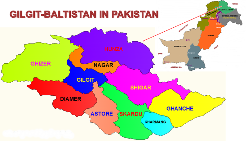
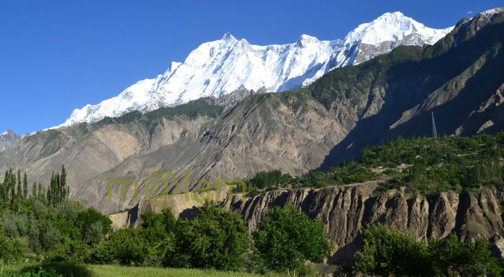
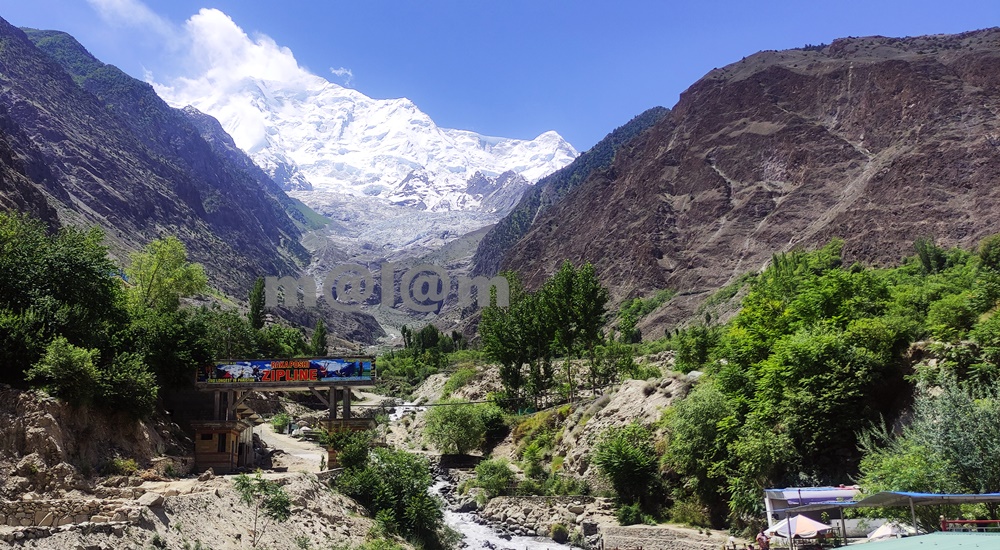
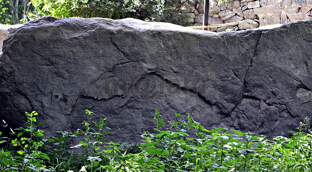
Danyore Rock Inscriptions: A Journey through Time The boulder bearing the Danyore Rock Inscriptions nestles amidst the breathtaking landscapes of Danyore. It is just a stone’s throw away from Gilgit city in Gilgit-Baltistan, Pakistan. These ancient engravings provide a captivating glimpse into the 7th and 8th centuries. However, despite its historical significance, this hidden gem remains shrouded in obscurity. It was known primarily to a select few involved in the fields of archaeology and tourism. Danyore: Where History Meets Natural Beauty Danyore is situated along the iconic Karakoram Highway leading to Hunza, south of Gilgit. It boasts a scenic setting nestled between the Gilgit River and the Hunza River. While the journey from Gilgit to Danyore is a mere 10-minute drive, locating the exact site of the Danyore Rock Inscriptions can prove to be a challenge. Additionally, the signage on the KKH guiding visitors has vanished. Moreover, the boulder itself is tucked away on a narrow street within the premises of a private residence. Surprisingly, the current occupants of the house are unaware of the historical significance concealed within their walls. The Enigmatic Inscriptions This colossal rock measures an impressive 13 x 7 feet. It proudly bears the names of Tibetan monarchs who once held sway over Gilgit during the 7th and 8th centuries. These names are meticulously inscribed in a five-line Sanskrit script, utilizing the late Brahmi script. Dr. Ahmed Hasan Dani, a renowned Pakistani archaeologist, posits that Prince Kumaramatya, a scion of the lineage mentioned in the Hatun inscription of the Ghizer Valley, likely commissioned these inscriptions. The inscriptions bestow royal titles upon Jayamangala Vikramaditya Nandi of the Vikramaditya family, crowning him as Patola Shahi Shahanushahi and Parama-Bhattaraka. Unraveling the Purpose Dr. Dani’s research suggests that the Danyore Rock Inscriptions may have served as a commemoration of a local ruler’s triumph. It may possibly signify the defeat of a Tibetan incursion in the upper Indus Valley. It is also documented that the Kingdom of Great and Little Bolor came under Tibetan suzerainty around A.D. 725.  Unfortunately, the ravages of time have taken a toll on the rock, causing the inscriptions to fade significantly. Nevertheless, it remains a poignant testament to the historical prominence of Sanskrit in the region and a priceless artifact that demands preservation. A Portal to Ancient Gilgit-Baltistan The Danyore Rock Inscriptions open a mesmerizing gateway into the ancient history and cultural heritage of Gilgit-Baltistan. As we stand in awe of these ancient carvings, it becomes evident that this land was once a vibrant center of civilization. It marks the influence of Tibetan rulers and the prevalence of Sanskrit as a dominant language. Basically, safeguarding these inscriptions and promoting awareness of their significance are vital steps in preserving the region’s historical legacy for generations to come. In the tranquility of Danyore, the Danyore Rock Inscriptions silently bear witness to a bygone era. Concealed within the heart of this town, these age-old engravings transport us through time, illuminating the rich history and cultural tapestry of Gilgit-Baltistan. Let us acknowledge the paramount importance of these inscriptions and unite in their conservation, ensuring that the legacy of our forebears endures for countless years ahead. FAQs (Frequently Asked Questions)What are the Danyore Rock Inscriptions? The Danyore Rock Inscriptions are ancient carvings on a large boulder located in Danyore, Gilgit-Baltistan, Pakistan. These inscriptions date back to the 7th and 8th centuries A.D. and bear the names of Tibetan kings who ruled Gilgit during that era. Where exactly are the Danyore Rock Inscriptions located? The Danyore Rock Inscriptions are situated on the premises of a private house in Danyore, across Gilgit City. The town of Danyore is easily accessible from Gilgit, and the rock can be found off the main Karakoram Highway, leading through a narrow street to the private house. What language are the inscriptions written in? The inscriptions on the rock are written in Sanskrit, using the late Brahmi script. Moreover, the five-line inscription reveals the names of Tibetan rulers and confers royal titles upon them. Why are the Danyore Rock Inscriptions significant? These inscriptions provide valuable insights into the ancient history of the region, particularly the rule of Tibetan kings in Gilgit during the 7th and 8th centuries. They offer evidence of Sanskrit’s presence in the area and commemorate the achievements or conquests of the rulers. What efforts are being made to preserve the Danyore Rock Inscriptions? Due to the limited knowledge of the inscriptions’ significance, preservation efforts have been minimal. However, raising awareness about their historical importance is a need of the time. It is possible through collaboration with local authorities and heritage organizations to ensure the conservation of this valuable archaeological site. Remember, the Danyore Rock Inscriptions are a fragile piece of history, and it is our responsibility to protect and cherish them for future generations to appreciate.

Phander Lake
Gilgit-Baltistan, Lakes, Tourists Destinations in Pakistan

Phander Lake

Exploring Phander Lake: A Jewel in Gilgit-Baltistan’s Crown The Phunder Lake is located in the Phunder Valley of Ghizer District in Gilgit-Baltistan, Pakistan. The lake sits at an impressive altitude of 11,500 feet (3,505 meters) above sea level. The Phunder Lake graces the enchanting Phander Valley in the Ghizer district of Gilgit-Baltistan, Pakistan. This captivating lake not only serves as a vital freshwater reservoir but also hosts thriving populations of trout. Thanks to its primary source, the Ghizer River which is abundant in Trout Fish. Situated on the picturesque Gilgit-Chitral Road, Phunder Lake is a pivotal gateway to the Chitral district. The lake also falls on the way to Shandur Pass, where the illustrious Shandur Polo Festival unfolds annually. Nango Chatt: The Local Gem Known to the locals as Nango Chatt, Phander Lake is an embodiment of tranquility and natural grandeur. Its crystal-clear waters, plunging to an astounding depth of 44 meters. The lake is teemed with lush aquatic flora and plants even visible even from a distance. The lake’s periphery boasts a stunning border of poplar trees, enhancing its overall charm. Snuggled amidst imposing mountains and verdant valleys, Phander Lake finds itself nestled between two imposing ridges. The entire scenery offers a breathtaking panorama of the valley and the lake itself. One end of the lake is enclosed, while the other serves as the primary inlet, continuously replenishing the lake’s pristine waters from the river. A Seasonal Spectacle Phander Lake transforms into a canvas of ever-changing beauty throughout the year, making it a magnet for nature enthusiasts and thrill-seekers alike. On the western ridge, you’ll discover a government rest house, while the eastern ridge is home to a modest cluster of PTDC Motels, both providing unrivaled vistas of the lake and the cascading valleys below. The narrow western ridge, separating the valley from the lake, offers sweeping views of the entire expanse. A Haven for Explorers Phander Valley is a treasure trove for day-trippers and overnight adventurers. Beyond the scenic landscapes, the local cuisine steals the spotlight, with its delectable trout fish, organic vegetables, and a variety of fruits that tantalize the taste buds. Accessible from Both Ends Phander Lake enjoys a strategic location at the crossroads between Gilgit and Chitral, making it easily accessible from either direction. From Gilgit, the journey spans approximately 173 kilometers, with a travel time of around 5 hours, promising a scenic drive through this mesmerizing region. Renovation of Gilgit-Chitral Road is in progress. The completion of the project will ultimately reduce the travel time from 5 hours to about 3 hours.

Excursions from Skardu
Gilgit-Baltistan

Gilgit-Baltistan

Gilgit-Baltistan: Nature’s Paradise and Cultural Diversity Gilgit-Baltistan, nestled in the northernmost reaches of the world, boasts some of the planet’s loftiest peaks and most extensive glaciers outside the Polar Regions. In addition to its awe-inspiring natural beauty and impressive man-made landmarks, this region is home to over 1.7 million people making a rich tapestry of ethnic groups, each proudly preserving its own culture and language. It has earned worldwide recognition as a top tourist destination and was historically referred to as the Northern Areas of Pakistan. Geographical Wonders Gilgit-Baltistan spans an impressive 72,971 square kilometers (28,174 square miles) and is bordered by China’s Xinjiang province to the east and northeast, Afghanistan’s Wakhan Corridor to the north, Pakistan’s Khyber Pakhtunkhwa province to the west, and the Indian-administered state of Jammu & Kashmir to the south. Geologically, this region is marked by instability, as it serves as the convergence point of the Indian and Eurasian tectonic plates. The Indian plate’s northward movement at an average rate of 7mm per year has given rise to the majestic Nanga Parbat. Divisions & Districts Gilgit-Baltistan consists of three primary divisions: Gilgit, Baltistan, and Diamer. These divisions further house ten distinct districts. Gilgit division comprises Gilgit, Hunza, Nagar, and Ghizer; the Diamer division encompasses Diamer and Astor districts; and the Baltistan division incorporates Skardu, Shigar, Kharmang, and Ghanche districts. A Glimpse into History Throughout history, Gilgit-Baltistan has functioned as a pivotal intersection for ancient trade routes, fostering a blend of diverse ancient civilizations. The region has sustained its significance as a prominent Buddhist center of learning for numerous centuries. The Silk Route, a segment of the extensive network of ancient Silk Routes, has transformed into the modern-day Karakoram Highway (KKH). The highway boasts over 50,000 petroglyphs and inscriptions situated between Hunza and Shatial. Left behind by a variety of travelers, including invaders, traders, and pilgrims traversing the upper Indus, these carvings tell the tale of the region’s rich history. Among the earliest known carvings, dating back to 5000-1000 BCE, are depictions of triangular men, hunting scenes, and single animals, typically larger than the depicted hunters. Gilgit-Baltistan maintained its independence until the 19th century when British colonization occurred. The region was fragmented into numerous mountain principalities during this period. Under colonial rule, it fell under the dual control of the British Indian Government and the state of Jammu & Kashmir. Following the partition of the Indian subcontinent and the establishment of Pakistan, a local uprising overthrew Kashmir’s rule, declaring independence. Since then, the area has been administered by Pakistan, operating directly under the federal government. Rich Culture & Heritage People The inhabitants of Gilgit-Baltistan are widely recognized for their friendliness, hospitality, and resilience. They share a profound connection to their homeland, fostering a robust sense of community over the years. Given the geographical remoteness and challenging topography of the region, the locals have adapted to the rugged mountainous environment, acquiring distinctive skills such as mountaineering and trekking. Hailing from diverse ethnic backgrounds, the people of Gilgit-Baltistan belong to major ethnic groups like the Baltis, Shins, Yashkuns, Dards, Burushos, and others. Each group possesses its own set of customs, traditions, and languages, contributing to the rich cultural tapestry of the region. Clothing The residents of Gilgit-Baltistan showcase a distinctive traditional attire that mirrors their cultural legacy and adapts to the challenging climate of the region. In professional settings, educational institutions, and business-related engagements, individuals opt for modern and fashionable clothing. Nevertheless, a significant number of men choose to don the traditional Pakistani attire, Shalwar Qameez, often accompanied by a woolen waistcoat and cap in colder weather, while the winter months may see the use of a Choga, a long woolen robe embellished with embroidery. Among females, especially the younger generation, there is a preference for trendy and stylish dresses, whereas more conservative women still find comfort in the traditional combination of shalwar kameez and dupatta. During ceremonial occasions, both men and women tend to gravitate towards traditional attire. Religious Affiliation The inhabitants of Gilgit-Baltistan adhere to diverse religious beliefs, showcasing the variety present in the region. While the majority of the population practices Islam, a significant portion follows the Shia sect. In addition to Sunni Muslims, there are also Ismaili Muslims and Noorbakhshi Muslims in Gilgit-Baltistan. Furthermore, small communities of Christians and followers of the Sikh faith contribute to the religious tapestry of the region. The religious composition of Gilgit-Baltistan is characterized by its diversity, as people of different faiths coexist and play a role in shaping the cultural landscape of the area. Arts & Crafts The traditional arts and crafts of Gilgit-Baltistan are a testament to the creativity, expertise, and cultural identity of the local communities. Widely recognized for their craftsmanship, the region is particularly celebrated for the production of exquisite hand-woven carpets, skillfully made using traditional techniques passed down through generations. Artisans in Gilgit-Baltistan showcase their proficiency in woodwork, producing intricate carvings on various wooden items. Traditional wooden furniture, decorative panels, doors, and utensils feature delicate designs that highlight local motifs, flora, and fauna. Additionally, basketry stands out as a traditional craft in Gilgit-Baltistan, where adept artisans weave baskets and containers using locally available materials like willow. These baskets serve various purposes, including storage, transportation, and aesthetic decoration. Given the cold climate, woolen textiles hold significant importance in the region’s arts and crafts. Handcrafted woolen shawls, blankets, and caps feature intricate patterns and designs, often incorporating vibrant colors. Enriching Culture The society of Gilgit-Baltistan is diverse in terms of language, religion, and ethnicity. The culture of Gilgit-Baltistan is heavily influenced by its geographical location, nestled amidst the majestic mountains of the Karakoram and Himalayan ranges. The region’s isolation and rugged terrain have helped preserve its distinct cultural practices and way of life. Gilgit-Baltistan is home to various ethnic groups, including the Shina-speaking Indo Aryans /Dardic people (Yashkun, Shin, Dom, Kamin), the Brusho of Hunza and Nagar, the Tibetans of Baltistan (Skardu, Ghanche, Shigar, and Kharmang), and Wakhi people along the Pamirs (living in Upper Hunza

Kha Basi Cafe
Gilgit-Baltistan, Heritage Sites in Pakistan

Kha Basi Café

Discover the Majestic Kha Basi Café: A Taste of Tradition in Hunza Valley Nestled under the shadow of the magnificent Altit Fort, within the ancient royal garden known as “the Kha Basi,” The Kha Basi Café is a truly exceptional restaurant. This hidden gem resides on the outskirts of Altit town, in the enchanting Hunza Valley, Gilgit-Baltistan, Pakistan. The cafe is basically surrounded by beautifully maintained apricot orchards. This classic restaurant stands as a testament to the region’s rich history and cultural heritage. A Glimpse into the Royal Past The Kha Basi Café’s historical significance is unparalleled. Once a summerhouse for the royal family of Hunza, this architectural gem has gracefully weathered the passage of time. Today, it stands as a living testament to the region’s glorious past. It exudes an air of old-world charm that enchants visitors from far and wide. Reviving Tradition through Culinary Delights As you step into the Kha Basi Café, prepare to embark on a culinary adventure like no other. The menu boasts an extensive selection of delectable dishes. At the same time, it also showcases the rich flavors of traditional Hunza cuisine. Every bite is a journey through the ages, offering a glimpse into the customs and culinary practices that have been cherished for generations. A Proudly Local Experience The heart and soul of the Kha Basi Café lie in the hands of the remarkable local women who manage it with utmost dedication. Their commitment to preserving the essence of Hunza’s heritage is evident in every detail of the café. From the warm greetings to the meticulously prepared dishes, every aspect of the experience exudes genuine hospitality and pride in the local culture. A Panoramic Feast for the Senses Beyond the culinary delights, the Kha Basi Café treats visitors to an unparalleled feast for the senses. The veranda, overlooking the majestic Karakoram Highway, mountains, and lush orchard offers a visual symphony that complements the flavors on your plate. The soothing sounds of nature, the gentle breeze rustling through the trees, and the fragrant blooms all contribute to an unforgettable dining experience. Preserving Culture Through Art and Architecture Delving deeper into its commitment to preserving culture, the café invites talented young artists to showcase their skills on special occasions. Their captivating performances range from traditional music and dance to storytelling, offering guests an immersive encounter with Hunza’s artistic heritage. Moreover, the small traditional house within the café’s premises provides an enchanting opportunity for visitors to experience the harmony of traditional architecture with modern comforts. The meticulous craftsmanship and use of indigenous materials in its construction pay homage to the region’s architectural legacy. A Photographic Paradise Nature’s masterpiece, the Kha Basi orchard, is a photographer’s dream come true. Each season unfurls its own breathtaking charm, from the delicate blossoms of spring to the vibrant colors of autumn. Photographers and nature enthusiasts alike will find endless inspiration within the enchanting confines of this picturesque garden. Getting There and Contact Information For those eager to explore the wonders of the Kha Basi Café, access is straightforward. Located at the end of the streets of Altit town, the café is easily reachable from the Karakoram Highway. Visitors can contact (0581) 3457012 during business hours for bookings and further information. The Kha Basi Café is more than just a restaurant. It provides an immersive experience that transports you to a bygone era of regal splendor and cultural richness. With its delectable cuisine, warm hospitality, and awe-inspiring surroundings, this enchanting establishment is a true gem in the heart of the Hunza Valley. Whether you are a food enthusiast, a culture aficionado, a nature lover, or a seeker of tranquility, the Kha Basi Café offers a magical journey that will linger in your memories forever. Discover the essence of Hunza’s heritage and indulge in an extraordinary culinary and cultural adventure that will leave you spellbound.

Danyore Suspension Bridge view from KIU premises
Gilgit-Baltistan, Monuments

Danyore Suspension Bridge

Danyore Suspension Bridge: A Gateway to Gilgit’s History In the heart of Gilgit-Baltistan, Pakistan, lies a hidden gem called the Danyore Suspension Bridge. The bridge not only stands as a testament to engineering prowess but also weaves a tale of resilience and connectivity. The Danyore Suspension Bridge, a venerable structure, boasts a rich history that has etched its name in the annals of Gilgit’s development. Bridging the Gap Gilgit’s Historical Connection Before the Karakoram Highway breathed life into this region in 1978, Gilgit-Baltistan remained an isolated territory, isolated from the rest of the country. Poor infrastructure compounded the hardships of its residents. Gilgit, the bustling administrative hub, magnetized people from far and wide for various reasons. People had to travel to Gilgit for education, employment, trade, healthcare, or other pursuits. However, those residing to the south of Gilgit Town, separated by the Hunza River, faced daunting challenges in reaching the town. Prior to the introduction of the local raft (Jaalo) in 1945, the journey to Gilgit involved a lengthy detour. It would consume nearly an entire day—a stark contrast to the mere 15 to 20 minutes it takes today. Pioneering Vision The pressing need for a bridge became apparent. The residents of Danyore and the southern regions rallied together to generate a substantial fund of Rs. 20,000 in the late 1950s. The initial attempt to construct a suspension bridge ended in tragedy. The Hunza River, in its capricious nature, washed it away due to its close proximity to the riverbed. Undaunted, the community selected a higher location for a new bridge. Each household contributed both funds and construction wood, culminating in the successful completion of the present-day suspension bridge in 1960. A Lifeline for Generations For over half a century, the Danyore Suspension Bridge has been a reliable conduit for travelers to Gilgit, mitigating the hardships faced by frequent commuters. Unlike the local raft, which operated only during daylight hours, the bridge provided round-the-clock, hassle-free passage, significantly enhancing the quality of life for residents. The Art of Construction Masterful Craftsmanship The bridge’s construction was overseen by Ahmed Ali, popularly known as “Thikedar Bereno,” a celebrated builder and self-taught engineer from Hunza, renowned for his exceptional construction skills, particularly in bridge projects throughout Gilgit-Baltistan. Work on the Danyore Suspension Bridge commenced in 1957 and concluded in 1960. The primary tasks included erecting the bridge over the Hunza River and excavating a single-lane curved tunnel to the south, connecting to Danyore—a remarkable feat accomplished by local laborers without sophisticated engineering equipment. A Spectacle to Behold Situated nearly 2 km upstream from the confluence of the Hunza River and the Gilgit River, the bridge was initially designed for mini-vehicle use until the construction of an alternative concrete bridge. The western end of the suspension bridge leads to the KIU campus, providing access to Gilgit town, while the eastern end connects to a single-lane tunnel on the Danyore side, joining the Karakoram Highway. The bridge’s location, length, and design render it one of the world’s most spectacular bridges. Crossing the bridge and navigating the tunnel requires technical finesse, putting local drivers’ skills and nerves to the test. A Transition into the Present Regrettably, the Danyore Suspension Bridge has been closed to conventional transportation due to safety concerns, now exclusively accessible to pedestrians and motorcyclists. A nearby concrete bridge has been constructed to accommodate all types of traffic. Attraction Reimagined In 2018, the Danyore Suspension Bridge underwent a transformative renovation. The approach roads on both ends of the bridge have been revitalized and adorned, transforming it into a tourist hotspot. On the Gilgit side, a significant Buddhist rock carving site awaits exploration, adding to the bridge’s allure. The nearby Chinese Graveyard, situated on the KKH, beckons as a must-visit tourist attraction. Both elevated vantage points offer spectacular views of the bridge, which stands gracefully in its lower setting. Walking across the bridge or simply gazing at its majesty promises an unforgettable experience for every visitor. The Danyore Suspension Bridge stands not only as a structural marvel but also as a testament to human determination. Its rich history, remarkable construction, and current appeal as a tourist destination make it a cherished part of Gilgit’s heritage. As travelers and tourists flock to this iconic site, they become a part of the ongoing legacy that this bridge represents.

Khunjarab Pass
Gilgit-Baltistan, Passes

Khunjerab Pass

Discover the Khunjerab Pass: A High-Elevation Gateway The Khunjerab Pass, nestled at a breathtaking altitude of 4,700 meters, stands as the world’s highest paved international border crossing. It serves as a crucial junction linking the Gilgit-Baltistan region in northern Pakistan to China’s western Xinjiang province. This article delves into the beauty and significance of this remarkable pass, highlighting its construction, attractions, and access. Khunjerab Pass: A Natural Wonder Situated amidst the majestic Karakoram Mountains, the Khunjerab Pass, often referred to as Khunzerav, boasts expansive snow-capped peaks. During the summer months, this area transforms into a haven adorned with a kaleidoscope of wildflowers, creating a striking contrast against the glistening snow-clad mountains. The Khunjerab Pass offers some of the world’s most awe-inspiring scenery. The Birth of Hunza River This pass is the birthplace of the Hunza River. The snowmelt from the surrounding peaks converges to form a pristine creek that flows downward. Several of these tributaries ultimately merge to create the Hunza River, which eventually meets the Gilgit River in Gilgit. The Gilgit River continues its journey along the Karakoram Highway, eventually merging with the River Indus at the convergence of three mountain ranges before flowing onward to Thakot. Construction of the Khunjerab Pass Before the construction of the Karakoram Highway (KKH), the primary passes on the Karakoram Range were Kilik and Mintaka Passes to the north of Khunjerab. The decision to choose the Khunjerab Pass for the KKH was rooted in technical considerations. Kilik and Mintaka were deemed more vulnerable to air strikes. Consequently, Khunjerab was recommended in 1966 and realized in 1978. Attractions at Khunjerab Pass The Khunjerab Pass stands as a major tourist attraction, drawing both domestic and international visitors daily. The entire Karakoram Highway is a treasure trove of natural wonders and man-made marvels. At every turn, travelers are treated to breathtaking panoramas and opportunities for short hikes and photography. A journey along the highway to the border area promises a lifetime of unforgettable experiences. Khunjerab National Park A substantial portion of the Khunjerab Pass is enveloped by the Khunjerab National Park, established in 1979 to safeguard endangered species. Within the park’s boundaries dwell rare animals like the Marco Polo sheep and the elusive Snow Leopard. From the border area, visitors can gaze across the border into China’s Xinjiang province. Access to Khunjerab Pass Access to the Khunjerab Pass varies by location: Pakistani Side Sost Customs and Immigration Check Post: 75 km Hunza: 180 km Gilgit Airport: 280 km Islamabad (Capital City): 890 km Chinese Side Tashkurgan: 130 km Kashgar: Approximately 420 km Urumqui: 1,890 km Informative road signs provide tourists with distance-related information. It’s worth noting that traffic follows a right-hand drive on the Chinese side and a left-hand drive on the Pakistani side, making the border the transition point. Travel Tips While the Pakistani side of the highway is well-paved, the steep altitude gain near the pass can slow down your journey. Additionally, checkpoints on both sides can lead to further delays. On the Pakistani side, an entry fee is applicable to both local and international tourists. At present, the fee stands at Rs. 40 for Pakistani tourists and $8 for international tourists. It’s advisable to check for annual revisions of these fees to manage expenses, especially for larger groups. The Khunjerab Pass is open for trade and tourism from May to November. During the remaining months, it remains closed due to heavy snowfall. In November, the extreme cold and strong winds can make the visit challenging. However, under favorable weather conditions, it remains a must-visit destination. Bus Service A daily bus service operates between Sost, the last human settlement along the KKH in Pakistan, and Tashkurgan in China. Both Pakistani and Chinese buses provide transportation from their respective stations in their home countries. Travelers can also hire private cars or 4WD vehicles from Sost to Tashkurgan for drop-off and continue their journey to Kashgar using shared rides or taxis. Precautions for a Safe Journey Due to the high altitude, some tourists may experience altitude sickness, characterized by dizziness, headaches, or shortness of breath. It’s advisable to descend to lower altitudes immediately or carry altitude sickness medication in advance. During peak summer, there’s a risk of flooding due to rapid snowmelt near the pass, so a timely return is recommended. Additionally, loose gravel, especially during rainfall, can pose hazards on the highway. Whether you’re on a motorcycle or driving a car, exercise caution and avoid overconfidence. Despite renovations, the Karakoram Highway has claimed lives, particularly among tourists from lower-altitude cities. It’s essential to familiarize yourself with the entire highway before embarking on a self-drive tour. Embrace the journey and return home with cherished memories. Before You Go Pakistani tourists must carry their CNIC, while foreign tourists require a passport for identification. Foreign tourists and Pakistani nationals traveling to China must obtain a Chinese Visa (a pass for residents of Gilgit-Baltistan traveling to the nearby city of Kashgar). Buses from Sost to Tashkurgan depart in the morning between 8:00 AM and 9:00 AM, so purchasing tickets in advance is advisable. If you prefer to hire a car, private Pakistani vehicles are allowed to travel all the way to Kashgar. The fare is negotiable and not fixed.

Here the great mountain ranges of the Karakoram, Hindukush, and Himalaya converge
Gilgit-Baltistan

Junction Point of Three Mountain Ranges

Unlocking the Secrets of the “Junction Point” of Three Majestic Mountain Ranges If you’re a true adventurer and nature enthusiast, there’s a hidden gem near Jaglot, just 40 kilometers southeast of Gilgit, Pakistan, that you absolutely must explore. It’s the awe-inspiring convergence of three of the world’s most famous mountain ranges: the Karakoram (known for its black gravel), the Himalaya (home of perpetual snow), and the Hindukush (aptly named the “killer of Hindus”). This unique location is often referred to as the “Junction Point of the world’s three great mountain ranges.” What’s more, this exceptional site also marks the meeting of the Gilgit and Indus Rivers, and the starting point of the Skardu road branching off from the Karakoram Highway (KKH). Geographic Significance: Where Worlds Collide The Junction Point isn’t just significant locally; it holds a unique place on the global stage. Pakistan is the only country where these three renowned mountain ranges converge, each boasting its highest peaks. Nanga Parbat, K-2, and Terich Mir are the standout peaks in the Himalayas, Karakoram, and Hindukush, respectively. These three ranges are considered sub-ranges of the mighty Himalayas, known as the trans-Himalayas. Standing at this point allows you to easily discern the direction of each mountain range. The Himalayan range lies to the south and east of the Indus River. The Karakoram range extends northeast from the Gilgit River, while to the west of the Gilgit and Indus Rivers, you’ll find the Hindu-Kush range. Exploring the Mountain Ranges: A Journey to Remember Karakoram Range: A World of Wonders The Karakoram Range, spanning approximately 500 kilometers, straddles the borders of Pakistan, India, and China. Within a radius of just 160 kilometers, it boasts the highest concentration of peaks soaring above 5,500 meters, numbering over 100. The crowning jewel of this range is K-2, the second-highest peak in the world, standing tall at 8,611 meters. The Karakoram is home to some of the planet’s longest glaciers, including Siachen, Batura, Baltoro, Biafo, Hisper, Gondogoro, and Chogolisa, making it one of the most heavily glaciated regions outside the Polar Regions. Himalayan Range: Nanga Parbat and Beyond The Himalayan range features Pakistan’s second-highest peak, Nanga Parbat, standing at an imposing 8,126 meters. Known as the “killer mountain” due to its formidable reputation, Nanga Parbat dominates the Astor District. The Great Himalayan Range stretches across 2,400 kilometers, encompassing Pakistan, Nepal, and India. Mount Everest, the world’s highest peak at 8,848 meters, calls Nepal home within this range. Hindu Kush Range: A Journey into History The Hindu Kush Range, spanning nearly 9,600 kilometers, is a land of its own wonders. While it primarily hosts smaller peaks, most standing below 7,500 meters, it covers the peaks of the Ghizer, Yasin, and Ishkoman valleys in Pakistan. The range reaches its zenith with Terich Mir, standing proudly at 7,708 meters in the district of Khyber Pakhtunkhwa. The Hindu Kush stretches from the Pamirs to Iran, offering a fascinating journey through history and geography. A Tourist’s Paradise: Unveiling the Junction Point A visit to this captivating site is a must for any traveler. It provides not only an educational experience but also a breathtaking panorama of the entire region, from the confluence of the Gilgit and Indus Rivers to the meeting of the three mighty mountain ranges. Local folklore weaves tales of the Junction Point being the residence of Jinns and fairies. Legend has it that these supernatural beings frequented the confluence of the rivers, using the waters for drinking and bathing. The Site: Your Gateway to Adventure An elevated platform, accessible by stairs, stands proudly on the edge of the Karakoram Highway. It offers a 360-degree view of the region and provides detailed information about the mountain coordinates. Adequate parking facilities are available for vehicles, and informative signboards offer essential information about the site. Regrettably, many, both within the country and from abroad, remain unaware of the significance of this captivating land. While some domestic tourists, particularly those traveling by public transport or passing by during odd hours or in the darkness, miss this gem, international tourists often include it as a vital stop on their itinerary. Best Time to Embark on Your Adventure The Karakoram Highway remains open year-round, allowing you to visit or pass by this unique site at any time of the year. However, the ideal time to explore Gilgit-Baltistan is from March to November, as the region’s winters can be harsh and freezing. Don’t miss the chance to stand at the crossroads of three remarkable mountain ranges, where nature’s grandeur knows no bounds. Visit Junction Point of Three Mountain Ranges, and let the magic of Pakistan’s unparalleled geography and history captivate your senses.

Rakaposhi
Gilgit-Baltistan, Mountains

Rakaposhi

Unveiling the Magnificence of Rakaposhi: Pakistan’s Spectacular Mountain Rakaposhi is a renowned mountain peak nestled in the majestic Karakoram mountain range of Pakistan. It proudly graces the Nagar valley of Gilgit-Baltistan, flanked by the enchanting landscapes of Bagrot and Danyore. Standing tall as the 27th highest peak globally and holding the prestigious rank of being the 12th highest in Pakistan, Rakaposhi derives its name from the local vernacular, translating to “Snow Covered.” Locally, it is affectionately referred to as Bilchhar Dumani, signifying “Mother of Mist” or “Mother of Clouds.” A Breathtaking Encounter The journey to Rakaposhi’s awe-inspiring presence begins when one embarks on the Karakoram Highway (KKH) from Gilgit to Hunza. Opposite Kino Kutto, a rocky mountain aptly named in the local Shina language as “Black Knee” due to its shape, you are granted the first and most splendid glimpse of this majestic peak. While this spot is often referred to as the “Rakaposhi viewpoint,” the pinnacle of views lies in Ghulmet. Here, you are treated to a broader and more stunning panorama of Rakaposhi. The picturesque Jaffarabad village serves as a backdrop, marking your entry into the magical realm of the Hunza Valley. A Scenic Journey The scenic vistas of Rakaposhi continue to unfold as you journey along the Karakoram Highway, tracing your way through the Hunza Valley. However, if you opt to travel from the opposite side of the Hunza River, specifically through the lower Hunza or Shinaki valleys (including Khizr Abad, Hussainabad, Mayun, and Khanabad), you’ll be treated to captivating facets of Rakaposhi. The mountain reveals itself in all its glory, offering a different perspective on this natural wonder. To reach the Ghulmet viewpoint, situated approximately 5 km short of the main viewpoint, you can rejoin the Karakoram Highway. Ghulmet village, home to the famous viewpoint, lies roughly 75 km from Gilgit and is a favored vacation destination for travelers seeking Rakaposhi’s grandeur. An Unparalleled Ascent One of Rakaposhi’s most remarkable features is its astounding elevation gain of 5900 meters over a mere 11.2 kilometers of horizontal distance from the Hunza-Nagar River. It stands as the sole mountain peak worldwide that ascends directly from fertile cultivated fields. Rakaposhi’s distinction arises not merely from its rank but from the sheer magnificence it embodies. A Triumph in History The first successful ascent of Rakaposhi was achieved in 1958 by Mike Banks and Tom Patey, who undertook the challenging Southwest Spur/Ridge route. Their conquest, while awe-inspiring, came at the cost of minor frostbite. Tragically, another climber slipped and lost their life during the descent on that fateful night. A Sanctuary of Biodiversity The people of Nagar have dedicated the extended Rakaposhi Mountain region as a national park. It’s indeed a noble initiative inaugurated by the Minister for Northern Areas. This sanctuary is home to several endangered species. These include Marco Polo sheep, Snow Leopards, wolves, and a diverse array of wildlife. Rakaposhi’s natural beauty not only captivates the eye but also safeguards the precious biodiversity thriving within its vicinity. Rakaposhi stands not only as a symbol of natural wonder but also as a testament to human triumph and conservation efforts. Its allure continues to draw adventurers, nature enthusiasts, and conservationists. Additionally, this majestic mountain offers a profound connection with the splendor of the Karakoram mountain range. Besides, it boasts a rich tapestry of Pakistan’s natural heritage.

Rakaposhi View Point from the Karakoram Highway
Gilgit-Baltistan

Rakaposhi View Point

Rakaposhi View Point -A Close Encounter With The Shining Wall The Rakaposhi View Point undoubtedly stands as a testament to the unparalleled beauty of nature. The view point is situated in Ghulmet village, on the main Karakoram Highway, within the enchanting Nagar Valley. This extraordinary viewpoint offers an up-close and personal encounter with the awe-inspiring Rakaposhi mountain. Karakoram Highway: A Tapestry of Marvels The Karakoram Highway is much more than a mere asphalt artery connecting Pakistan and China through the Khunjerab Pass. It’s a highway especially adorned with a treasure trove of tourist attractions. The highway boasts natural wonders, archaeological marvels, cultural heritage, and architectural splendors. It beckons travelers to pause and immerse themselves in its allure. Rakaposhi View Point, nestled along this route, stands out as a prime exemplar of pristine natural beauty. An Oasis Amidst the Journey When traversing the road between Gilgit and Hunza, seasoned travelers always include a mandatory stop at Rakaposhi View Point. The shadow of Rakaposhi is the 27th highest peak globally, soaring at an elevation of 7,788 meters. Here one can find solace and delight in the lap of unparalelled natural grandeur. Moreover, the locale offers small terraces thoughtfully designed along the glacier-fed stream, inviting tourists to relish moments of relaxation, savor delicious meals, and capture stunning vistas. Summer Serenity: Immersing in Nature’s Bliss During the summer season, tourists revel in the joy of sitting by the stream, dipping their feet into the refreshing glacier water. Furthermore, this site is ideal for capturing the picturesque surroundings through their lenses. The symphony of flowing water, the verdant embrace of nature, and the grandeur of Rakaposhi provide an unforgettable experience. Evolution of Rakaposhi View Point The journey of Rakaposhi View Point from obscurity to acclaim has been nothing short of remarkable. The gradual surge in tourist footfall led to its growing prominence, which in turn catalyzed infrastructure development in the vicinity. The site boasts a plethora of attractions including the glacier nestled in greenery and the meandering stream driving a gentle breeze. In its nascent stage, Rakaposhi View Point was no more than a humble gift shop and a local eatery, primarily serving the needs of nearby travelers. Over time, local entrepreneurs embraced the opportunity, resulting in the establishment of gift shops, handicraft stores, convenience shops, restaurants, campsites, and even upscale tourist accommodations. A new road has been constructed, providing closer access to the glacier emanating from Rakaposhi, and work is underway to develop additional tourist attractions. The future holds the promise of turning this site into a premier tourist destination. Culinary Delights and More For travelers journeying between Gilgit and Hunza, Rakaposhi View Point stands as an ideal spot for a leisurely and sumptuous breakfast or an open-air lunch with breathtaking views. Not to be missed is the local specialty, “Chap-Shuro,” a unique kind of local pizza. The menu offers an array of fresh local cuisine at budget-friendly prices. Here, you can always count on delectable food coupled with personalized service. Rakaposhi View Point is not just a stopping point on your journey; it’s an invitation to immerse yourself in nature’s grandeur and indulge in local delights. Visit and be captivated by the magic of Rakaposhi and the wonders that surround it.

Collision point of continental plates on the Karakoram Highway
Gilgit-Baltistan

Collision Point of Continental Plates

Exploring the Collision Point of Continental Plates near Chalt Valley In the heart of Gilgit-Baltistan, Pakistan, lies a hidden geological wonder: the collision point of continental plates. The site is located on the Karakoram Highway, just 53 kilometers north of Gilgit town. This extraordinary site has a rich history and undeniable significance. The intriguing collision of Indian and Eurasian continental plates gave birth to the majestic Himalayan mountain range and the Tibetan plateau some 50 million years ago. The Ancient Tectonic Drama: The Genesis of a Geological Marvel Over 40-50 million years ago, the Indian subcontinent was in fact an isolated landmass. It was basically separated from Asia by the vast Tethys Ocean. As tectonic forces began reshaping the Earth’s surface, India embarked on a northward journey towards Asia. This movement, which commenced around 200 million years ago, witnessed India covering a staggering 6,400 kilometers while remaining disconnected from the Asian continent. Around 50 to 40 million years ago, the pace of India’s northward drift gradually slowed to a more deliberate 4-6 centimeters per year. This deceleration marked the onset of a momentous collision between the Indian and Eurasian continental plates. The Birth of Majestic Peaks As the Indian plate eventually collided with the Eurasian plate. As a result, geological forces unfolded a remarkable transformation. The Eurasian plate crumpled and buckled above the Indian plate, eventually leading to the thickening of the continental crust. This dramatic upheaval gave rise to the towering Karakoram Mountains, proudly adorning the landscape of Gilgit-Baltistan. The crust in this region, therefore, is twice as thick as the global average, marking the cessation of volcanic activity. To this day, the Indian plate continues its northward push into the Eurasian landmass, causing these majestic mountains to ascend by about seven millimeters each year. Unlocking the Geographic Treasure Regrettably, the profound geographic significance of the collision point of continental plates remains largely unknown to the people of Gilgit-Baltistan. It remained unnoticed until recently when informative signboards were installed for the benefit of tourists and locals alike. These signboards particularly serve as educational tools, shedding light on the area’s significance. However, there is untapped potential here. The site, with its unique mountain formation, could become a prominent picnic spot, attracting visitors from far and wide. Moreover, remnants of the ancient Silk Route can still be observed on the other side, hinting at the region’s historical importance. Plans to renovate the ancient Silk Route are in the works, with the aim of promoting tourism in this captivating region. The Mystical Realm of Local Beliefs Locals have bestowed upon the collision point a name of its own, Bidru-Kha. However, mostly “Chalt Xhang” mostly signifies its threshold-like existence. This unique site is steeped in local legends and traditions. For instance, as a bride and groom pass through this point on their wedding day, locals perform sacrificial rituals involving chickens, goats, or other animals to appease the spirits. Additionally, local shamans believe that this place serves as a portal connecting three worlds: the realm of spirits or the upper world, the material human world, and the underworld of souls and the deceased. This spiritual significance adds another layer of intrigue to this already fascinating location. A Weather Oracle Beyond its geological and cultural significance, the collision point also plays a role in weather prediction. The climatic conditions above this particular point serve as a barometer for the lower parts of the Hunza Valley. An overcast sky may signal impending rain, while patches of blue amidst the clouds suggest clear skies ahead. The collision point of continental plates near Chalt Valley is a multifaceted wonder. It embodies the Earth’s tumultuous history and offers a glimpse into local traditions and legends. At the same time, this site even plays a role in forecasting the weather. As awareness of this unique site grows, it has the potential to become a must-visit destination, drawing adventurers, geology enthusiasts, and curious travelers from around the world.

Scroll to Top